Country:
 City:
City:


The walk starts at Verneuil-l’Étang station. Take the only exit, Place de la Gare, situated on the side of the track heading from Paris to Provins (if coming from the opposite direction, use the footbridge).
(S) From the station, turn right onto Rue de la Gare. Continue straight on at the first two junctions. At the third, turn right onto Rue Jules Guesde and cross the bridge over the railway line. As you come off the bridge, turn left towards the recycling centre.
(1) Immediately take the first track on the right. At the end, turn left onto a small road. At the T-junction, turn right onto the D47.
(2) Carry on straight ahead at the next junction by the houses at L’Étang. Take a right-hand bend and then cross the Ru d’Avon (caution: very narrow verges).
(3) At the Stop sign, cross the D619 (caution: very busy road) and follow it for a few dozen metres to the right towards Paris. Turn onto thefirst track on the left (Chemin Paré). Carry on straight ahead until you reach the next road. Follow this road to the left for about 400 metres.
(4) When you reach the houses, take a path on the right. You’ll soon come to Rue des Champs; follow it to the right. At the end of the street, continue along a path between the fields. This will take you to Andrezel cemetery.
(5) Turn right at the corner of the cemetery and immediately turn left onto Rue des Marnières, which soon becomes a track. Ignore two turnings on the left.
(6) Take thefirst path on the right. Carry on straight ahead at every junction until you reach Malvoisine Farm. Walk through the farm and you’ll come to a T-junction.
(7) Turn right into Rue de Varvanne. At the next junction, follow the D47 to the left. At a Fork in the road, keep left. At the junction shortly afterwards, turn left into Place de Marché. At the next junction, first turn right then left onto Rue du Cloître. You’ll soon reach a junction with Rue Sainte-Fare (to visit the superb Champaux Collegiate Church, carry on straight ahead for just under a hundred metres).
(8) Follow Rue Sainte-Fare (to the right if you have visited the collegiate church, otherwise to the left). Ignore a road on the left and, at the next junction, take thesecond on the right, Chemin de la Procession. At the end of the tarmac road, continue along a track. At the end of the track, turn left.
(9) Turn onto thefirst path on the right and head downhill. At the Moulin de Flagy, carry straight on (ignore aPR®® sign on the left) and cross the Ru d’Ancoeur. Head back up the other side via Rue de Flagy. At the top, turn left and you’ll soon reach a junction.
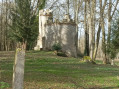
(10) Turn right here. At the next junction, go straight on and immediately turn right onto a track. Pass under a high-voltage power line and, at a junction (marker 95), go straight on and head downhill. Cross the Ru d’Ancoeur, climb back up the other side and you’ll soon reach the Chapel of Notre-Dame de Roiblay.
(11) Continue climbing. At the top, at a T-junction, turn right at the edge of the woodland. You’ll soon reach a track; follow it to the right. Turn left at thefirst fork (marker 93).
(12) At the end of the track, turn right. Pass under a high-voltage power line and cross a track running at right angles. Further on, the track turns into a tarmac road.
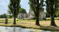
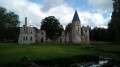
(13) Cross a small road and head straight on along the Route de Chatillon. Ignore two streets on the left, then one on the right. You’ll reach a junction at the foot of Blandy Castle.
(14) Walk round the château and past the church: the route follows a clockwise direction, but you can, of course, go anti-clockwise.
(14) Take Rue Raoul Kourilsky (straight on if you’ve walked round clockwise, turn right if you’ve gone anti-clockwise). Atthe first junction, turn left into Rue Vauchevres.
(15) Take thefirst right, Chemin de l’Aiguillon, which soon turns into a track. Walk for a long stretch heading south-west. Pass under some high-voltage power lines and cross the bridge which spans first the A5 motorway and then the TGV line. At the end of the bridge, go straight on and pass by the foot of a mast.
(16) At the junction, turn right and pass under the high-voltage power lines again; shortly afterwards, you’ll see the Tour d’Aiguillon on your left.
(17) Continue along the path. At the crossroads (elevation 84), go straight on and cross the Bois d’Aiguillon along a gently sloping path. Cross a stream and join a track near a ford on the right.
(18) Follow the track to the left and, at the three-way junction, turn right. At the next junction, turn right.
(19) Cross the D126 and walk alongside a woodland on your right. At the next junction, turn right and cross a stream. Cross a road and continue straight ahead along the path. At the next junction, turn left and walk alongside a woodland on your right. Enter the woodland and, once you have emerged from it, you will come to a T-junction.
(20) Then turn right and walk alongside the grounds of the Château de Vaux-le-Vicomte on your left. Ignore a turning off to the right and cross the Ru d’Ancoeur. Enter Moisenay via Rue du Moulin and ignore a narrow lane on the right. Turn right at the end of the street and you’ll immediately come to a junction.
(21) Turn left onto Rue de Melun. Continue straight on, leaving Moisenay behind and heading north between the fields. At the junction, follow the D215 to the left (caution: fairly busy road). This will take you to the main gate of the Château de Vaux-le-Vicomte.
(22) Carry on straight ahead along the D215. After the car park (marker 79), turn left and follow the park wall on your left. Enter a wood and ignore a path branching off to the right. Turn right onto the track and follow the River Almont on your left.
(23) You’ll come out onto a small road; follow it to the left. Cross the Almont and carry straight on. When the main road bends to the right, carry straight on along Rue Basse-Poignet.
(24) After No. 9, turn right onto a footpath. Shortly afterwards, turn left, then left again to rejoin Rue Basse-Poignet. Follow it to the right and take thefirst right, Rue du Fourneau. At the end, turn right and you’ll reach Maincy church.
(25) Carry on straight ahead. At the junction, turn left into Rue des Trois Moulins. Take thefirst right, Chemin du Fief de Mons.
(26) Take thefirst footpath on the right, between the houses. Turn right, then left, following the footpath. You’ll come to a narrow lane; follow it to the left. Turn left at the next junction and right at the following one. Join a track (elevation 73) and follow it to the left. Carry on straight ahead until you reach a road.
(27) Follow the road to the right. Ignore a dead-end on the left and, at the next junction, turn right onto the Chemin du Coubray Menereaux. Continue along a footpath and cross the Almont again.
(28) Immediately turn left onto Chemin du Bas de Trois Moulins. At the end, turn left into Rue des Trois Moulins and go under the D605 bridge. Then continue straight on at every junction.
(29) At the traffic lights, carry on straight ahead along Rue des Trois Moulins. Stay on this street. At the end, turn left into Rue Bancel to quickly reach Place Saint-Jean and its roundabout.
(30) Cross the square, pass Boulevard Gambetta on your left and take the next left into Rue René Pouteau. At the junction, go straight on. At the next junction, turn left.
(31) Cross the bridge over one arm of the Seine, walk straight across Île Saint-Étienne and cross the second arm of the Seine. As you leave the bridge, take thesecond left onto Boulevard Henri Chapu. Keep going straight on until you reach Place Chapu.
(32) Go round the square on the left to continue straight ahead onto Boulevard Henri Chapu. At the next junction, turn right onto Rue Dajot. Stay on this road, going straight on at every junction until you reach Melun station (E).


 Visorando Member
 Moderate
 Difficult