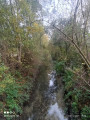
Slag heaps 37 and 56 in Verquin

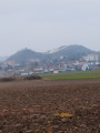
This route will take you past two slag heaps from the old Noeux mines. These are two very unspoilt slag heaps, hardly developed at all, either for tourism or for industrial purposes. So, let the adventure begin.

Details

1103428
Creation:
Last update:
Last review:
  • Walking
    Activity: Walking
  • ↔
    Distance: 2.93 mi
  • ◔
    Average duration: 1h 30 
  • ▲
    Difficulty: Easy

  • ⚐
    Back to start: Yes
  • ↗
    Ascent: + 151 ft
  • ↘
    Descent: - 171 ft

  • ▲
    Highest point: 200 ft
  • ▼
    Lowest point: 89 ft

Description of the walk

Park in the square on Rue Constant Martin in Verquin.

(S/E) Walk north up the street, keeping the church on your left. Leave the ‘sentier des écoles’ on your right. Continue and turn right onto Rue Jean Jaurès, heading for number 86.

(1) Take the small path on the right just at this number , taking care as it is not very visible.
Head to the foot of slag heap no. 37.

(2) Start the climb along the path on the right. Here too, be careful as the path is not very visible. When you reach the top of the slag heap on a plateau, enjoy the view. Head back down the same way.

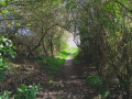
(2) Turn right onto a path that continues through the woods to Rue du 4 Septembre.

(3) Turn left and carry on until you reach the A-road. Walk along the right-hand side of it (watch out for traffic) to reach the path leading into the slag heap site.

(4) Look carefully, as the path isn’t very visible. Prohibitory signs will help you find your way. This slag heap is also very overgrown. Make your way to the foot of the slag heap.

(5) Take the path on the right to reach the top of the slag heap. Head back down via the same path.

(5) When you reach the previous junction, turn right to leave the slag heap grounds and head onto Rue de Courrières.
Follow this street until you reach Rue de Noeux at the end.
Turn right onto this street; it leads onto Rue de l’Égalité, which you should follow to the car park at Place Constant Martin (S/E).

Waypoints

  1. S/E : mi 0 - alt. 125 ft - Car park at Place Constant Martin
  2. 1 : mi 0.33 - alt. 144 ft - No. 86 Rue Jean Jaurès
  3. 2 : mi 0.82 - alt. 200 ft - Climb up slag heap 37
  4. 3 : mi 1.07 - alt. 102 ft - Rue du 4 Septembre
  5. 4 : mi 1.52 - alt. 95 ft - Entrance to the slag heap site 56
  6. 5 : mi 1.68 - alt. 138 ft - Foot of slag heap 56
  7. S/E : mi 2.93 - alt. 121 ft - Car park at Place Constant Martin

Notes

Make sure you follow the map and route carefully, as the path is not signposted and the tracks are not always very visible.
You will be walking along a ‘terril cavalier’, which are old railway tracks built on flat slag heaps to link the mine shafts (fosses) together. Coal was transported along them.

Worth a visit

Railway-on-slope.
Viewpoint at the top of the slag heaps.
Mining town.
Note: for those wishing to take part in the “UNESCO Slope Challenge” (51 slag heaps to climb) or just for fun, you can take a selfie at the top of the slag heap and share it using #defiterril and @defiterril on Instagram or by emailing defiterril@gmail.com

Reviews and comments

4.5 / 5
Based on 2 reviews

Reliability of the description
4.5 / 5
Ease of following the route
4.5 / 5
Route interest
4.5 / 5
ALAIN DUQUESNE
ALAIN DUQUESNE

Overall rating : 4.7 / 5

Date of your route : Feb 05, 2024
Reliability of the description : ★★★★★ Very good
Ease of following the route : ★★★★★ Very good
Route interest : ★★★★☆ Good
Very busy route : Yes

Please note: hunting takes place on Sundays at Slag Heap 57 during the winter months

Machine-translated

capauri
capauri
• Edited:

Overall rating : 4.3 / 5

Date of your route : Aug 09, 2019
Reliability of the description : ★★★★☆ Good
Ease of following the route : ★★★★☆ Good
Route interest : ★★★★★ Very good

A lovely walk, half on road and half off-road. We had a bit of trouble finding our way on the second slag heap, but there were several possible paths, so we eventually managed to reach the plateau. Suitable for a pushchair, but a bit of a workout.

Machine-translated

Other walks in the area

For more walks, use our search engine .

The GPS track and description are the property of this route's author. Please do not copy them without permission.