


Refine your search for walks in Espot
Espot walks


 Route around Estany de Sant-Maurici in Les Encantats
 Visorando Member
 11.38 mi
 +2,946 ft
 -2,946 ft
 7h 50
7h 50
 Difficult
 Departure from Espot (Lleida)
Head towards the Espot Valley, one of the main valleys to the east of the Aigüestortes National Park and Lake Sant Maurici. After passing the small town of Espot and the Riu Gelat campsite, head up the valley where the Rio Escrita flows to reach the end of the road and a large free car park. Lake Sant Maurici is only 3.5 km from the car park. It takes about an hour's leisurely walk through a beautiful forest. You can then climb up to the Renata waterfall, then to the Amitges refuge, and head towards Col de Port de Retara.
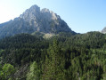
Estany de Monestero from Prat de Pierró
 8.03 mi
+1,729 ft
-1,732 ft
5h 10
8.03 mi
+1,729 ft
-1,732 ft
5h 10
 Moderate
Departure from Espot (Lleida)
Moderate
Departure from Espot (Lleida)
This walk starts from the free car park at Prat de Pierro. Most of the walk is in the shade. There is plenty of water throughout the route. There are numerous picnic spots along the streams or on the banks of the Estany de Monestero.
Mallafré refuge - La Molina car park
 12.12 mi
+1,959 ft
-3,858 ft
7h 15
Difficult
Departure from Espot (Lleida)
12.12 mi
+1,959 ft
-3,858 ft
7h 15
Difficult
Departure from Espot (Lleida)
Fourth and final stage of this loop in the Encantats. No technical difficulties except for the length of the descent once you have passed the first pass. Magnificent view of the Encantats in the morning as you leave the refuge.
Estany di Sant Maurici towards Amitges Refuge
 6.63 mi
+1,804 ft
-1,814 ft
4h 35
Moderate
Departure from Espot (Lleida)
6.63 mi
+1,804 ft
-1,814 ft
4h 35
Moderate
Departure from Espot (Lleida)
Magnificent hiking in the Aigüestortes y Estani de Sant Maurici National Park. You'll come across numerous mountain lakes that are unique to this park.
La de St-Maurice, Refuge d’Amitges and Estany del Port de Ratera
8.54 mi
+2,343 ft
-2,300 ft
6h 00
Moderate
Departure from Espot (Lleida)
It’s a magnificent hike. The walk starts at Lac de St-Maurice. It takes about 1½ hours to reach the refuge. The circular route follows the GR®11. The walk ends with a walk around Lac de St-Maurice. The path is well signposted. You can either complete the full loop or shorten the route by taking other paths.
Amitges - Colomina
11.94 mi
+3,675 ft
-3,547 ft
8h 40
Difficult
Departure from Espot (Lleida)
Long stage between Amitges and Colomina: splendid views of the ridges and valley, crossing summer pastures and forests. Passing by the Estany Llong refuge. The gentle but long descent leads to the Colomina refuge, a peaceful haven after this beautiful day in the mountains.
Saboredo Refuge - Mallafré Refuge
 6.69 mi
+2,011 ft
-3,346 ft
4h 50
Difficult
Departure from Alt Àneu (Lleida)
6.69 mi
+2,011 ft
-3,346 ft
4h 50
Difficult
Departure from Alt Àneu (Lleida)
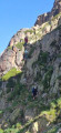
Third and penultimate stage of this loop in the Encantats. Still lots of beautiful lakes and magnificent jagged peaks silhouetted against the sky. Significant elevation gain and sometimes tricky paths with steep slopes, scree and sections with ropes, which fortunately were already in place.
From the Refugi de Saboredo to Banhs de Tredos via the Tuc Gran de Sandrosa
5.49 mi
+1,365 ft
-3,120 ft
3h 45
Difficult
Departure from Alt Àneu (Lleida)
This second stage offers a return route to the Banhs de Tredos via the Sendrosa Pass (Coth deth tuc Gran de Sendrosa).
The ascent of the Tuc Gran de Sendrosa is optional for hikers with sure-footedness. This option, which is well worth the detour for the exceptional view from the summit, involves a 300-metre climb along the rocky ridge and requires using your hands on relatively easy climbing holds (PD), though there are a few exposed sections where a sure footing is essential. The descent is always slightly more technical than the ascent. Not recommended for inexperienced walkers or those prone to vertigo.
This route is well worth the effort for its wild scenery, the flowers and the abundant vegetation in June. The descent from the pass is quite long and a little steep before rejoining the Day 1 trail, just below the Taxis car park.
Estany de Gerber and Refugi Mataró
 7.23 mi
+2,041 ft
-2,034 ft
5h 05
Difficult
Departure from Alt Àneu (Lleida)
7.23 mi
+2,041 ft
-2,034 ft
5h 05
Difficult
Departure from Alt Àneu (Lleida)
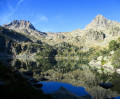
This challenging hike in the Aigues Tortes National Park follows the Vall Gerber upstream, passing by the lake of the same name, through a landscape dominated by mountain pines, rhododendrons and heather. It continues through a more rocky landscape dotted with a multitude of lakes of all sizes, some named and others unnamed. Towards the end of the route, a short detour leads to the Refugi Mataró, a small metal structure offering welcome shelter in this area where thunderstorms can be very violent. A refreshing breath of fresh air in a peaceful, unspoilt natural setting, though you’ll need to be mindful of several sections requiring caution on both the ascent and the descent.
The seven lakes of Colomèrs circular
 4.04 mi
+968 ft
-945 ft
2h 40
Moderate
Departure from Naut Aran (Lleida)
4.04 mi
+968 ft
-945 ft
2h 40
Moderate
Departure from Naut Aran (Lleida)
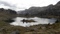
The Colomèrs lake circuit is a massif of mountains arranged in a circle, protecting some fifty lakes ("estanhs") in its bosom. The slow erosion of frost during the Ice Ages has left an inescapable landscape: a high mountain area with high, steep peaks of around 3,000m, such as Creu de Colomèrs, Gran Tuc de Colomèrs and Tuc de Ratera.
Colomèrs
 4.72 mi
+1,270 ft
-1,286 ft
3h 15
Moderate
Departure from Naut Aran (Lleida)
4.72 mi
+1,270 ft
-1,286 ft
3h 15
Moderate
Departure from Naut Aran (Lleida)
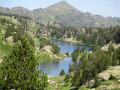
This easy hike takes you past a dozen or so lakes in the Cirque de Colomèrs, which has around thirty in total, some identified and others unnamed. The landscape is magnificent, combining pine undergrowth carpeted with rhododendrons and large areas of rounded rocks dotted with lakes of all sizes fed by crystal-clear torrents. On the way back, a stop at the Colomèrs Refuge allows you to conclude this circular route by enjoying the Estanh Major, into which multiple waterfalls flow. A summary of the Aygues Tortes and San Maurici National Park in all its splendour.
From the car park to the start of the 7 lakes route
3.22 mi
+955 ft
-223 ft
2h 20
Moderate
Departure from Naut Aran (Lleida)
No particular difficulty and a beautiful hike.
There is a taxi service that will take you from our departure point to our arrival point for €5 per person.
It is not possible to drive your car to the arrival point for the start of the lake hike.
Around the Colomèrs lakes from Banh de Tredos
13.16 mi
+4,186 ft
-4,196 ft
2 days
Difficult
Departure from Naut Aran (Lleida)
This route around the Colomèrs lakes allows you to explore part of the magnificent Aigues Tortes (Les Encantats) National Park. Flowers, rhododendrons, torrents and streams, and peaks offering breathtaking views over all the lakes await you. This hike is suitable for those with some experience of mountain walking; less experienced walkers may choose to skip the two peaks on the route (Tuc de Ratera, 2,860 m – not covered on Day 1 – and Tuc Gran de Sendrosa, 2,703 m, on Day 2). The route is classified as difficult due to its length and the steep slopes on Day 1, as well as the summit on Day 2.
The route can be extended by starting with a night at the Colomers mountain hut, which will allow you to complete a longer loop around the lakes of the same name before reaching the Saboredo mountain hut.
From Banhs de Tredos to Refugi Saboredo via Port de Ratera
7.66 mi
+2,822 ft
-1,076 ft
6h 00
Difficult
Departure from Naut Aran (Lleida)
A lovely walk featuring a fairly steep climb to the Port de Ratera, but no other difficulties. Magnificent scenery of lakes, pine trees and rhododendrons (early in the season). A good overview of the Aigues Tortes park and the Encantats.
Ventosa refuge - Saboredo refuge
 8.04 mi
+2,805 ft
-2,526 ft
6h 10
Difficult
Departure from la Vall de Boí (Lleida)
8.04 mi
+2,805 ft
-2,526 ft
6h 10
Difficult
Departure from la Vall de Boí (Lleida)
This is the second stage of this four-stage loop in the Encantats. There are numerous lakes between these two refuges with beautiful ascents and descents. No technical difficulties, but some scree that is not very pleasant.
The Bacivèr Lakes in the Val d’Aran
 4.84 mi
+1,506 ft
-1,499 ft
3h 30
Difficult
Departure from Naut Aran (Lleida)
4.84 mi
+1,506 ft
-1,499 ft
3h 30
Difficult
Departure from Naut Aran (Lleida)
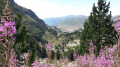
It is a beautiful route in the Val d’Aran, in the Vaqueira mountains, leading to the Naut and Baish de Bacivèr lakes.Although it is a short circular route, it requires a good level of fitness to tackle the first half of the route.Your efforts will be rewarded upon reaching Lake Naut de Bacivèr, the highest point of the walk.