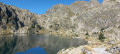
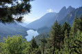
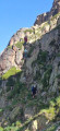
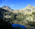
Estany de Monestero from Prat de Pierró

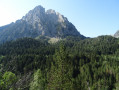
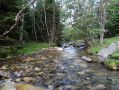
This walk starts from the free car park at Prat de Pierro. Most of the walk is in the shade. There is plenty of water throughout the route. There are numerous picnic spots along the streams or on the banks of the Estany de Monestero.

Details

24419634
Creation:
Last update:
Last review:
  • Walking
    Activity: Walking
  • ↔
    Distance: 8.03 mi
  • ◔
    Average duration: 5h 10 
  • ▲
    Difficulty: Moderate

  • ⚐
    Back to start: Yes
  • ↗
    Ascent: + 1,729 ft
  • ↘
    Descent: - 1,732 ft

  • ▲
    Highest point: 7,159 ft
  • ▼
    Lowest point: 5,427 ft

Photos

Description of the walk

Park at the free car park at Prat de Pierro, 4 km from the centre of Espot. This is the boundary of the Aigüestortes and Estani de Sant Maurici National Park.

(S/E) Set off from the free Prat de Pierro car park and cross the bridge over the Riu Escrita.

(1) Follow the wheelchair-accessible path straight ahead.

(2) Cross the track used by Espot’s 4x4 taxis and continue straight ahead, following the stream.

(3) Turn left towards Estany de Sant Maurici.

(4) Turn left towards Monestero. The path is partly shaded and, further on, crosses the wooden bridge over the Riu del Portarró.

(5) At the Ernest Mallafr Refuge, keep to the right and then, about fifty metres further on, turn left.

(6) Turn left again towards Estany de Monestero. The scenery is varied: woodland, a stretch of meadow near the stream and rocky terrain. Reach Estany de Monestero.

(7) Turn round and follow the same route back as on the way there.

(4) Shortly afterwards, you can take a short detour to have a look at the Hermitage of Sant Maurici through the hole in the door provided for this purpose.

Return to the ascent route to begin the signposted descent towards the car park (S/E).

Waypoints

  1. S/E : mi 0 - alt. 5,430 ft - Prat de Pierro car park
  2. 1 : mi 0.35 - alt. 5,525 ft - Junction
  3. 2 : mi 0.72 - alt. 5,564 ft - Cross the 4x4 track
  4. 3 : mi 1.76 - alt. 5,951 ft - Junction: A/ left – R/ right
  5. 4 : mi 2.08 - alt. 6,175 ft - Junction: A/ left – R/ right
  6. 5 : mi 2.37 - alt. 6,220 ft - Ernest Mallafré Mountain Hut
  7. 6 : mi 2.51 - alt. 6,335 ft - Estany de Monestero Trail
  8. 7 : mi 3.99 - alt. 7,146 ft - Estany de Monestero
  9. S/E : mi 8.03 - alt. 5,427 ft - Prat de Pierro car park

Notes

You must be well equipped: good walking boots.

Remember to take water with you. If you’re not afraid of it, the water in the stream is clear.

Worth a visit

Along the way, you’ll see the Hermitage of Sant Maurici and the Ernest Mallafré Refuge (part of the famous Carros de Foc route).

Reviews and comments

4.8 / 5
Based on 2 reviews

Reliability of the description
5 / 5
Ease of following the route
5 / 5
Route interest
4.5 / 5
MICHEL.SOL
MICHEL.SOL

Overall rating : 4.5 / 5

Date of your route : Aug 08, 2025
Reliability of the description : ★★★★★ Very good
Ease of following the route : Not used / Not applicable
Route interest : ★★★★☆ Good
Very busy route : No

The lake level is very low in this scorching August. We pushed on to the Monestero Pass, which climbs up fine scree that is best descended.

Machine-translated

Cafougnette
Cafougnette

Overall rating : 5 / 5

Date of your route : Aug 19, 2024
Reliability of the description : ★★★★★ Very good
Ease of following the route : ★★★★★ Very good
Route interest : ★★★★★ Very good
Very busy route : No

A really good route, fairly easy to get to and very well described! Lovely scenery all along the walk
The number of walkers drops off sharply as soon as you turn off after Lake San Maurici

Machine-translated

Other walks in the area

For more walks, use our search engine .

The GPS track and description are the property of this route's author. Please do not copy them without permission.