


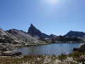
Étape le soir du premier jour au Refuge de la Blanche.
Escapade Queyrassienne

Deux jours dans la vallée du torrent de l'Aygue Blanche permettant, le deuxième jour, de faire le tour de la célèbre Tête des Toillies.
Details
Creation:
Last update:
Last review:
–
–
-
 Activity: Walking
 -
 Distance: 19.43 mi
 -
 Average duration: 2 days
 -
 Difficulty: Difficult
 -
-
 Back to start: Yes
 -
 Ascent: + 6,542 ft
 -
 Descent: - 6,539 ft
 -
-
 Highest point: 9,856 ft
 -
 Lowest point: 6,053 ft
-
 Country:
France
Country:
France
-

-
 City:
Saint-Véran (05350)
City:
Saint-Véran (05350) -
 Start/End: N 44.704036° / E 6.855522°
 -


 Hour-by-hour weather
Photos
Stages of the route
This route needs several days, find the details below:
Notes
Worth a visit
Saint Véran et les villages du Queyras.
Refuge de la Blanche
Other walks in the area
Le Cros - Refuge de la Blanche
 Visorando Member6.63 mi
+2,943 ft
-906 ft
5h 35
Difficult
Visorando Member6.63 mi
+2,943 ft
-906 ft
5h 35
Difficult
 Departure from Saint-Véran (Hautes-Alpes)
This is the first stage of this journey, half in Queyras and half in Ubaye. Follow the right bank of the Aigue Blanche, then continue along the Col de Saint-Véran trail, before enjoying a beautiful descent that leads to the lake and the Refuge de la Blanche.
Horse riding in Queyras and Ubaye
 30.50 mi
+10,669 ft
-10,666 ft
4 days
Difficult
Departure from Saint-Véran (Hautes-Alpes)
30.50 mi
+10,669 ft
-10,666 ft
4 days
Difficult
Departure from Saint-Véran (Hautes-Alpes)
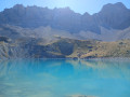
Here is a simple 4-day route that alternates between Queyras and Ubaye, starting from the hamlet of Cros before Saint-Véran. The Queyras valley will be the first stop for a night by Lac de la Blanche at the refuge of the same name. The route through Ubaye will take you over the Col de la Noire before descending to the hamlet of Maljasset. You will return to Queyras on day 3 via the Col Girardin before returning to the starting point via the Col des Estronques on the fourth day.
Crête de la Marcelette from Saint-Véran
 7.01 mi
+3,711 ft
-3,714 ft
6h 25
Difficult
Departure from Saint-Véran (Hautes-Alpes)
7.01 mi
+3,711 ft
-3,714 ft
6h 25
Difficult
Departure from Saint-Véran (Hautes-Alpes)
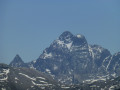
This is a superb hike, partly unmarked on the IGN map, where you will undoubtedly be the only ones to enjoy the 360° panorama throughout the central part of the hike.The ridge is safe for hikers who are not afraid of heights and are used to the mountains. Hiking boots are recommended.About halfway along the ridge, there is a lovely spot for a snack, with a hollow to shelter from the wind.
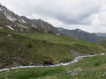
The Refuge de la Blanche, starting from Saint-Véran
 8.69 mi
+1,814 ft
-945 ft
5h 35
8.69 mi
+1,814 ft
-945 ft
5h 35
 Moderate
Departure from Saint-Véran (Hautes-Alpes)
Moderate
Departure from Saint-Véran (Hautes-Alpes)
Via the Grand Canal, now completely disused, a long crossing opposite the Grande Tête des Toillies, ending at the Refuge de la Blanche and then at the observatory car park.
The Bucher Summit
 7.09 mi
+2,156 ft
-2,146 ft
5h 10
Moderate
Departure from Saint-Véran (Hautes-Alpes)
7.09 mi
+2,156 ft
-2,146 ft
5h 10
Moderate
Departure from Saint-Véran (Hautes-Alpes)
In Queyras, at this time of year (late October), the ubiquitous larch forests colour the mountain landscapes with shades ranging from yellow to red, and the snow-capped peaks further enhance this feeling of fulfilment.
The proposed hike takes place in this atmosphere above the highest village in Europe: Saint-Véran.
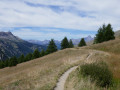
The balcony trail along the Grand Canal in Saint-Véran
 7.65 mi
+1,266 ft
-1,266 ft
4h 35
Moderate
Departure from Saint-Véran (Hautes-Alpes)
7.65 mi
+1,266 ft
-1,266 ft
4h 35
Moderate
Departure from Saint-Véran (Hautes-Alpes)
This hike starts in Saint-Véran, follows the Clausis chapel trail, which it leaves to return via a beautiful balcony path along the course of the old Grand Canal. Without any difficulty, it offers superb views of the Saint-Véran valley, the village and the surrounding peaks throughout the route.
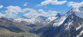
Pic de Cascavelier via the Curlet ridges
 5.42 mi
+2,746 ft
-2,756 ft
4h 55
Difficult
Departure from Saint-Véran (Hautes-Alpes)
5.42 mi
+2,746 ft
-2,756 ft
4h 55
Difficult
Departure from Saint-Véran (Hautes-Alpes)
This beautiful and varied hike follows ridges offering unobstructed views. The route to the summit of Pic de Cascavelier via the rocky ridge is more alpine in character but never dangerous. The exposed path, zigzagging between the rocks, sometimes requires you to use your hands. From the Croix du Curlet, you have a magnificent bird’s-eye view of the village of Saint-Véran and its valley.
Saint Véran – Refuge de la Blanche
 10.15 mi
+4,537 ft
-3,035 ft
8h 35
Difficult
Departure from Saint-Véran (Hautes-Alpes)
10.15 mi
+4,537 ft
-3,035 ft
8h 35
Difficult
Departure from Saint-Véran (Hautes-Alpes)
This serves as an introduction to a cross-border trek between Saint-Véran and Larche. We set off from the mountain pastures for a gentle approach to the border, through a rocky and colourful landscape that can at times be quite disorientating. There are no real difficulties, but a good understanding of how to read the terrain is sometimes necessary to avoid losing your way.
For more walks, use our search engine .
The GPS track and description are the property of this route's author. Please do not copy them without permission.

