Saint-Germain Hermitage – Lanfon Forest – Rochers des Moillats

A lovely circular walk around the Saint-Germain Hermitage and the Rochers des Moillats.

Details

n°2764358
Creation:
Last update:
Last review:
  • Walking
    Activity: Walking
  • ↔
    Distance: 5.28 mi
  • ◔
    Average duration: 3h 55 
  • ▲
    Difficulty: Moderate

  • ⚐
    Back to start: Yes
  • ↗
    Ascent: + 1,670 ft
  • ↘
    Descent: - 1,677 ft

  • ▲
    Highest point: 3,593 ft
  • ▼
    Lowest point: 2,287 ft

Photos

Description of the walk

To reach the Saint-Germain de Talloires Hermitage, take the Route du Col de la Forclaz, then, 300 metres after thesecond tunnel, turn left onto a road. Car park above the hermitage on the Route de Ponnay. (Four to five spaces).

(S/E) From the car park, walk up the road and, before the bend, take an ascending path on the right to reach Ponnay.

(1) Head towards Planfait along a path passing to the right of a secluded chalet; further on, you’ll come out onto the Route de Planfait. Follow this to the left for 200 m and look out for a path on the left.

(2) Follow it alongside the Nant Sec for 300 m.

(3) Please note: where the path crosses the Nant Sec, turn right onto a barely visible track and rejoin the Route de Planfait.

(3) Walk up the road for about 50 metres until you reach another path starting on the left. A little further on, you’ll rejoin the Route de Planfait for the last time.

(4) Cross it to take the path opposite. At a fork in the road at the 1000-metre mark, take the path on the right (signposted ‘Tournette’ and others). Then turn left for 100 metres, then turn right to join theGR® 96.

(5) Follow it to the left as it climbs, then descend steeply back down onto the Route de Planfait.

(6) Follow this road to your right; it’s still theGRP® marked in red and yellow. At the paragliding take-off site, carry on, then, at the end of the path, take the track towards Bluffy (signposted) which winds downwards and joins a crossroads (PF Bois de Lanfon). Head towards Ponnay Moillats.

(7) At a place known as ‘La Combe’, head towards Les Moillats

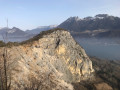
(8) PF Moillats: take the path leading uphill towards Ponnay and the Rochers de Moillats. At the highest point, you’ll walk alongside the rocky ridge of the Moillats. Shortly afterwards, begin the descent, passing a farmhouse before rejoining the ascent route at Ponnay.

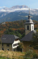
(1) Walk down the road for 60 metres, turn left at the sign for La Pirraz, then immediately turn right onto a path (arrow pointing towards Angon). Further on, the path turns into a track suitable for vehicles and leads out onto the road. Once at La Pirraz, ignore the first road on the right (dead end).

(9) Take the next road on your right straight away. Once on the Route de la Forclaz, after 50 m, follow the access road up to the hermitage, which will take you back to your starting point (S/E).

Waypoints

  1. S/E : mi 0 - alt. 2,395 ft - The Hermitage car park
  2. 1 : mi 0.35 - alt. 2,654 ft - Ponnay
  3. 2 : mi 0.49 - alt. 2,808 ft - Start of the path
  4. 3 : mi 0.66 - alt. 2,949 ft - At the fork, turn right towards the road
  5. 4 : mi 0.8 - alt. 3,077 ft - Cross the road – Chemin de la Forêt de Lanfon
  6. 5 : mi 1.21 - alt. 3,458 ft - GRP junction
  7. 6 : mi 2.16 - alt. 3,143 ft - Route de Planfait
  8. 7 : mi 2.96 - alt. 2,779 ft - La Combe: continue towards Moillats
  9. 8 : mi 3.37 - alt. 2,598 ft - Moillats, on the left as you head uphill
  10. 9 : mi 4.88 - alt. 2,405 ft - Junction: turn right
  11. S/E : mi 5.28 - alt. 2,388 ft - The Hermitage car park

Notes

The hermitage car park: 4–5 spaces.
Unmarked paths from the hermitage to point (5).
Take care at point (3): if you miss the path, you’ll end up straight at the Planfait launch site
Sturdy footwear is recommended.

Worth a visit

Before or after the walk, visit the Saint-Germain hermitage, the small votive grotto and the viewpoint at the Vierge belvedere.

The Planfait paragliding launch site.
The Rochers des Moillats, a climbing site.

Always be cautious and plan ahead when you're outdoors. Visorando and the author of this route cannot be held responsible for any accidents occurring on this route.

The GR® and PR® markings are the intellectual property of the Fédération Française de Randonnée Pédestre.

Reviews and comments

3.6 / 5
Based on 3 reviews

Reliability of the description
3.3 / 5
Ease of following the route
3.3 / 5
Route interest
4 / 5
Lukowiak Michel
Lukowiak Michel

Overall rating : 4.7 / 5

Date of your route : Jun 23, 2023
Reliability of the description : ★★★★★ Very good
Ease of following the route : ★★★★★ Very good
Route interest : ★★★★☆ Good
Very busy route : No

Part of the path has been damaged by forestry machinery. It’s interesting to see the paragliding launch site. We had a picnic at the ‘Vierge à l’Ermitage’ viewpoint. A lovely view of the lake.

Machine-translated

SCOLLET
SCOLLET

Overall rating : 2.7 / 5

Date of your route : May 21, 2023
Reliability of the description : ★★☆☆☆ Disappointing
Ease of following the route : ★★☆☆☆ Disappointing
Route interest : ★★★★☆ Good
Very busy route : No

Hike I did yesterday. The start of the route is very good, but on one section there was forestry work involving timber hauling with heavy machinery, which has completely ruined the paths – they’re very muddy and slippery at the moment. After the take-off site, despite the GPS track, it was impossible to follow the route; the description is very vague. You absolutely must have a map or the GPS track.

Machine-translated

papoufette
papoufette
• Edited:

Overall rating : 3.3 / 5

Date of your route : Jan 07, 2023
Reliability of the description : ★★★☆☆ Average
Ease of following the route : ★★★☆☆ Average
Route interest : ★★★★☆ Good
Very busy route : No

We went on this hike in glorious weather, so the views of the lake, the Dents de Lanfon and La Tournette were stunning! Our only downside was the complete lack of directions between points (6) and (7): after the take-off area, you simply follow the GR trail, but then the route shows you need to cut across to rejoin it further down – and that’s where it gets tricky: there’s no path at all, the slope is steep, and we never managed to find the place called La Combe! In short, a word of advice: just stick to the GR trail to complete the circular route – it’ll be safer. That doesn’t detract from the fact that this is a really lovely walk, perfect for a half-day’s hike in winter.

Machine-translated

Other walks in the area

For more walks, use our search engine .

The GPS track and description are the property of this route's author. Please do not copy them without permission.