Between royal lands and wild waters: the tour of Île d’Or

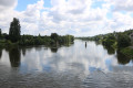
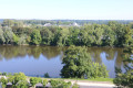
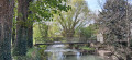
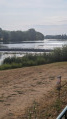
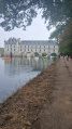
A very pleasant walk along the banks of the Loire, exploring the Île d’Or. During this short walk, there are beautiful views of the Château d’Amboise, and you’ll discover the Chapelle Saint-Jean, a leisure and picnic area, and the site where the ‘Soldiers of the Empire’ hold their historical re-enactments.

Details

44082006
Creation:
Last update:
Last review:
  • Walking
    Activity: Walking
  • ↔
    Distance: 2.78 mi
  • ◔
    Average duration: 1h 20 
  • ▲
    Difficulty: Easy

  • ⚐
    Back to start: Yes
  • ↗
    Ascent: + 26 ft
  • ↘
    Descent: - 26 ft

  • ▲
    Highest point: 207 ft
  • ▼
    Lowest point: 177 ft
  • ⚐ Country: France
  • ⚐ City: Amboise (37530|37400)
  • ⚑
    Start/End: N 47.415278° / E 0.982188°
  • ❏
    IGN map(s): Ref. 1922SB
  • Hour-by-hour weather

Photos

Description of the walk

The car park is situated at the south-western tip of the Île d’Or (near the Centre Ethic Etapes or Youth Hostel).

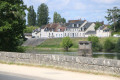
(S/E) Leave the car park heading south. At the crossroads, near the Loire, turn left onto the path which runs alongside the river on the right-hand side, with a second shaded car park on the left. Pass under the D431 road, which crosses the Maréchal Leclerc Bridge. Continue straight ahead onto Quai François Tissard. Shortly after passing under the Maréchal Leclerc Bridge, there is a beautiful view of Amboise Castle on the right-hand side, across the Loire.

(1) Just after La Lézardière, located at number 8 Quai François Tissard, take the stone staircase on the right, through a small opening in the wall. The steps lead to the path that runs alongside the Loire. Head to the left, keeping the Loire on your right. Further on, the path runs alongside the Île d’Or d’Amboise campsite on your left. Continue along the path until it joins the Allée de la Chapelle Saint-Jean.

(2) Turn right to visit the Chapelle Saint-Jean, about two hundred metres away. Walk round it to see, amongst other things, the stained-glass windows, then return to the banks of the Loire.

(2) Continue along the path that follows the road, heading north-east. Carry on like this until you reach the tip of the Île d’Or. This fairly narrow area features a fitness trail.

(3) Carry on along the path that runs alongside the second branch of the Loire, which starts with an area of sandbanks that is partly wooded. Further on, the path runs close to the Loire on the right-hand side. The path runs alongside the Stade Boulogne, situated north-east of the Chapelle Saint-Jean (football pitch and running tracks). Immediately afterwards, the path runs alongside some tennis courts. The path veers slightly away from the Loire and runs alongside a grassy area on the left-hand side, where a historical re-enactment by‘Les Soldats de l’Empire’ regularly takes place in late September.

(4) Just after a left-hand bend, the path joins the Allée de la Loire. Turn right to follow the section of this avenue that runs alongside the Loire on your right. Further on, you’ll see a bandstand on the right. Next, pass the canoe and kayak club, and turn immediately left. When you reach the junction with the Allée de la Chapelle Saint-Jean, turn right and continue to a roundabout.

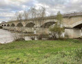
(5) Cross the roundabout carefully, then take the Quai du Maréchal Foch by taking the first exit on the right. Use the pavement on the right-hand side of the road. There is a lovely view of the bridge carrying the D431 road. Carefully cross the junction with the D431, using the three pedestrian crossings in turn, and continue towards the south-western tip of the Île d’Or. A little further on, you will find the car park on the left, just past the Centre Éthic Étapes. (S/E

Waypoints

  1. S/E : mi 0 - alt. 180 ft - Car park at the south-western tip of the - L'Ile d'Or
  2. 1 : mi 0.14 - alt. 200 ft - 8 Quai François Tissard x stairs on the right - La Loire
  3. 2 : mi 0.78 - alt. 190 ft - Chemin x Allée de la Chapelle Saint Jean
  4. 3 : mi 1.46 - alt. 194 ft - North-eastern tip of Île d’Or
  5. 4 : mi 2.17 - alt. 203 ft - Chemin x Allée de la Loire
  6. 5 : mi 2.51 - alt. 197 ft - Allée de la Loire x Roundabout
  7. S/E : mi 2.78 - alt. 180 ft - Park. South-western tip of the Île d’Or. Near the - Château d'Amboise

Notes

This walk, which takes place over varied terrain, requires suitable footwear.

This route is only partially signposted but does not present any real difficulties. Consequently, it is advisable to follow the directions in this description and on the map provided by Visorando, whilst also paying attention to the surrounding landscape. Distance markers from the starting point, and even the GPS coordinates of waypoints (including the start), can also help hikers find their way.

Hike completed by the author on 11 June 2024.

Worth a visit

L’Île d’Or
The Île d’Or was formed where the Loire splits into two branches.
This strip of land, 2 km long and 400 m at its widest point, faces the town and the castle. The island has been inhabited for a very long time. Traces of bridges dating back to the 7th century have been discovered. The first settlements developed around the Rue de l’Entrepont, a street that still exists today!
Originally, it was called Île Saint-Jean. But today it is more commonly known as Île d’Or. The name Île Saint-Jean comes from the small chapel of the same name, which was built at the end of the 12th century.
In 503, the island was chosen by Clovis, King of the Franks, and Alaric II, King of the Visigoths, to sign a peace treaty. The island’s name is said to derive from this meeting, during which a banquet was served on sumptuous gold tableware.

The Chapel of Saint John.

Reviews and comments

4.5 / 5
Based on 2 reviews

Reliability of the description
5 / 5
Ease of following the route
5 / 5
Route interest
3.5 / 5
marie-paule denis
marie-paule denis

Overall rating : 4.3 / 5

Date of your route : Jul 03, 2026
Reliability of the description : ★★★★★ Very good
Ease of following the route : ★★★★★ Very good
Route interest : ★★★☆☆ Average
Very busy route : No

This route is easy to follow: the Île d’Or is small, so you can’t get lost there! You can enjoy a lovely view of Amboise.
As the chapel was undergoing renovation, we didn’t go to see it.

Machine-translated

FD RANDO
FD RANDO

Overall rating : 4.7 / 5

Date of your route : Sep 01, 2025
Reliability of the description : ★★★★★ Very good
Ease of following the route : ★★★★★ Very good
Route interest : ★★★★☆ Good
Very busy route : Yes

A peaceful stroll in the sunshine. A great way to start the holiday.
The chapel had a problem with its roof and there was a risk of falling stones. It was closed.
Beautiful views.

Machine-translated

Other walks in the area

For more walks, use our search engine .

The GPS track and description are the property of this route's author. Please do not copy them without permission.