Country:
 City:
City:


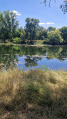
The entire walk takes place within the town of Bléré and the starting point is the car park under the chestnut trees on Quai de Bellevue, facing the River Cher next to the foundry: 47.3303, 0.9894 (N 47°19’49.1664” E 0°59’21.6672”) 28c Quai Bellevue, 37150 Bléré.
(S/E) With your back to the car park, turn left and head due west along the River Cher until you reach the corner by the Château de Fontenay.
(1)Turn left and continue until you reach the ‘give way’ sign. Please note: you’ll be coming onto the very busy Route de Tours (D976) and there’s a tricky section here. You must be extra careful! You’ll need to cross this road and, whilst walking carefully along the roadside to the right for a few dozen metres on the embankment, watch out for oncoming traffic. This tricky section is very short. Then turn left onto the first road.
(2)Enter the Vallée de Fontenay; a few metres further on, take the first path on the right through the woodland; it is signposted. You will then come to a path through a clearing across the fields and reach the road at the sign marking the former demarcation line from the Second World War.
(3) Turn right into the hamlet and carry on straight ahead until you reach the sign for “Le Petit Moulin”.
(4) Continue to the right towards “le Haut Village”, pass through this typical hamlet of Bléré and arrive at a crossroads (another sign marking the former demarcation line. Bléré, steeped in history, was a key transit point for the Free French during the Second World War).
(5) Turn lefttowards “Les Houches” and arrive at the entrance to the Grandes Fontaines protected area, where dogs must be kept on a lead.
(6) Turn left and, after the barrier, follow the red markings on a wooden post indicating that you should turn left at the end of the green wire fence to take a small, shaded, signposted path that will lead you to the remains of the Roman aqueduct. Then follow the path running alongside the stream; this section is signposted.
(7) At this junction, continue to the left, following both the red markings and the stream. Then turn left through the Grandes Fontaines and follow the red markings closely until you reach the exit, marked by a wooden gate.
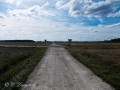
(8) Turn left and take the tarmac farm track if possible: cars are not allowed to use it. You’ll reach the bridge over the ring road.
(9) Turn right at the Stop sign and cross the bridge: take care – there are few cars but no pavement for crossing the bridge. Continue straight on along Rue des Canaux, turn right towards the hamlet of La Touche and walk through it.
(10) At the end of the hamlet, turn left and walk alongside the vineyards until you reach the Stop sign. Cross carefully and start the climb up Rue de la Croix de Beauchêne.
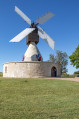
(11) Ignore Rue du Chemin Blanc on your right and head straight ahead (the path was under construction at the time of the walk). Walk past the blocks of flats, then continue straight on until you reach Rue des Loches, from where you’ll see the Moulin des Airgemonts.
(12)Turn right towards the mill; if it’s open, take a break to visit it.After the mill, take the first left onto Rue du Réflessoir. At the roundabout after the secondary school, turn left onto Rue de Gimont and head towards the town hall.
(13) Opposite the town hall, turn rightonto RueButtement; pass the Chapelle Jehan de Seigné on your right and , keeping a bakery on your right-hand side, head uphill, then turn left opposite the Chenonceaux Inter-municipal Community.
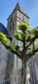
(14) Turn right onto Venelle Dominique Dunois and continue to Place Saint-Julien. Turn left, then right, and discover the listed Saint-Christophe Church. Head to the magnificentPlace Charles Bidault and continue to the end of Rue du Pont. Turn left into the Quai de Bellevue car park, where you’ll see the chestnut trees from the car park at the start of the walk (S/E).
 Visorando Member

 Easy
Easy