Country:
 City:
City:


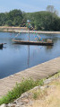
The starting point is the car park beneath the chestnut trees on Quai de Bellevue, facing the River Cher next to the foundry in Bléré.
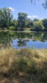
(S/E) Set off facing the bridge, follow the River Cher to your left, heading due east, passing a footbridge on your left whilst staying on this bank. You are now on the GR®41, which you should follow towards Chenonceaux along the Route du Cher cycle route until you reach the Pont de Civray – a small, narrow bridge that has been fully restored and adapted for pedestrians, cyclists and cars.
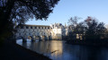
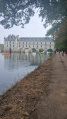
(1) At the Pont de Civray, carry on straight ahead, passing on the left under the bridge and continuing to follow the Cher. Carry on straight ahead, ignoring the path on the right, and admire the Civray needle dam, as well as the diversion of the Cher. Carry on straight ahead to the next bridge, before which you’ll have the pleasure of discovering the Château de Chenonceau, which spans the Cher.
(2) Carry on straight ahead along the river.
(3) Cross the bridge over the Cher. On the other side, turn left and follow the river again. Then turn right and walk alongside the grounds of the Château de Chenonceau until you reach a tarmac road.
(4) Take this road, keeping to the left, and, after passing a car park reserved for motorhomes, you’ll reach the car park at the château’s main entrance.
(5) Enter the car parks at the château entrance and then turn right. Cross the railway line and continue straight on along the main road leading to the château. Carry on until you reach the road where you see the signs for Bléré, Montrichard and Loches; turn left, staying on the hard shoulder of the D40 and following the vineyards.
(6) Turn left after passing the Total petrol station and follow the ‘Cher à vélo’ route. Cross the railway bridge and turn right, continuing to follow the ‘Cher à vélo’ route alongside the railway line until you reach a junction.
(7) Turn left, heading due south, and continue to follow signs for Bléré and Amboise on the Chemin des Festivités. When you reach the River Cher, turn right and follow the river to the Pont de Civray. After passing the needle-gate weir, go under the bridge as on the way there and, 500 m further on, turn right onto a dirt track.
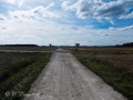
(8) Turn left onto it immediately and carry on straight ahead along this track until you reach the Ruisseau de Mesvres.
(9) Turn left to rejoin the banks of the Cher. If you look up, you’ll see the Bléré Bridge in the distance. Continue to the right towards this bridge , following the Cher.
(10) Turn left and cross the bridge to reach the Quai de Bellevue car park on your right (S/E).

 Visorando Member

 Easy
Easy