Circular route around Lamérac

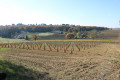
A walk in Lamérac, suitable for everyone, passing through a variety of landscapes, including vineyards, walnut groves, woodland and fields.

Details

28831
Creation:
Last update:
Last review:
  • Walking
    Activity: Walking
  • ↔
    Distance: 6.13 mi
  • ◔
    Average duration: 3h 00 
  • ▲
    Difficulty: Easy

  • ⚐
    Back to start: Yes
  • ↗
    Ascent: + 243 ft
  • ↘
    Descent: - 253 ft

  • ▲
    Highest point: 364 ft
  • ▼
    Lowest point: 220 ft

Description of the walk

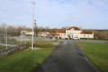
Park in the car park by the old town hall, near the village hall.

(S/E) From the car park, take the road that passes in front of the church until you reach the crossroads by the wayside cross.

(1) Turn left. Follow the road, then the path for 800 metres until you reach a field.

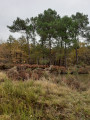
(2) Before reaching the field, take the path on the left which leads into the woods. At the entrance to a village called “Les Tortues”, take the small road on the left, then the wider one on the right.

(3) After about 200m, take the path on the left between the vineyard and the woods. You’ll reach a road at the hamlet of La Dague. Please note: when you reach the hamlet, you’ll need to cross a fairly busy road to continue straight on.

(4) As you come out of the woods, take the path on the right just before the first house. Go round the village of La Verrie, then take the road on the right to the village of “Chez Michelet”. Cross the small road and continue straight on along a white path, which then becomes a dirt track. As you come out of the woods between the vineyards, turn left and then, further on, left again to reach the village of “Chez Janneau”.
Please note that the path isn’t very visible; to reach the village, you’ll need to follow the vineyard headlands and go “by sight”.

(5) Turn right and cross the village, then follow the road to the entrance to Phélipaud.

(6) Just before the road bends to the right, take the path on the left. Cross the fields, turn right towards the woods and then towards the walnut trees.

(7) When you reach a road, turn left, follow it for 50 metres, then take the path on the right before the poplars. Head up towards the woods, passing between the walnut trees for about 400 metres, and just at the edge of the forest, follow the path on the right along the edge until you reach the road.

(8) Take the road on the left for 15 metres, then the path on the right. When you reach a path cut between two embankments, turn left. Walk past the houses in Le Pont.

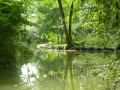
(9). Walk past a stately home and take the white track on the right opposite a pond. Follow this track for one kilometre until you reach the wayside cross.

(1) Turn left and walk past the church again before reaching the car park (S/E).

Waypoints

  1. S/E : mi 0 - alt. 266 ft - Car park at the former town hall in Lamérac
  2. 1 : mi 0.21 - alt. 266 ft - Calvary crossroads
  3. 2 : mi 0.53 - alt. 308 ft - Path through the woods before the field
  4. 3 : mi 1.18 - alt. 361 ft - Path on the left between the vineyard and the woods
  5. 4 : mi 1.62 - alt. 322 ft - Path on the right between the woods and the house
  6. 5 : mi 2.81 - alt. 325 ft - Turn right towards Chez Janneau
  7. 6 : mi 3.09 - alt. 289 ft - On the left, opposite the bend in the road
  8. 7 : mi 3.65 - alt. 253 ft - Road on the left
  9. 8 : mi 4.59 - alt. 240 ft - Turn left for 15 metres, then right
  10. 9 : mi 4.98 - alt. 220 ft - Turn right opposite a pond
  11. S/E : mi 6.13 - alt. 266 ft - Car park at the former town hall in Lamérac

Notes

Wear waterproof footwear in wet weather.

Worth a visit

At the entrance to the village of Chez Janneau, the first house has walls made of Campanian (Cretaceous) rudists.

Reviews and comments

4.1 / 5
Based on 3 reviews

Reliability of the description
4.3 / 5
Ease of following the route
4.3 / 5
Route interest
3.7 / 5
cognac
cognac

Overall rating : 3.3 / 5

Date of your route : May 08, 2023
Reliability of the description : ★★★★☆ Good
Ease of following the route : ★★★☆☆ Average
Route interest : ★★★☆☆ Average
Very busy route : Yes

I followed this route in part, adding the route through the woods of St Maigrin

Machine-translated

blablapattes
blablapattes

Overall rating : 4.7 / 5

Date of your route : Feb 03, 2020
Reliability of the description : ★★★★★ Very good
Ease of following the route : ★★★★★ Very good
Route interest : ★★★★☆ Good

A lovely walk, thank you.

Machine-translated

Kascendres
Kascendres

Overall rating : 4.3 / 5

Date of your route : Mar 18, 2018
Reliability of the description : ★★★★☆ Good
Ease of following the route : ★★★★★ Very good
Route interest : ★★★★☆ Good

The route through the vineyards and walnut groves is a bit tricky, but we didn’t find it particularly difficult to follow the very clear signposting along the way.

Machine-translated

Other walks in the area

For more walks, use our search engine .

The GPS track and description are the property of this route's author. Please do not copy them without permission.