Country:
 City:


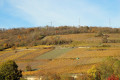
The route starts at Mutzig station and can be reached by train on the Strasbourg–Saâles–Saint-Dié line, getting off at Mutzig.
(S/E) From the station, head towards the town centre along Avenue du Général De Gaulle, crossing the River Bruche and its canal.
(1) Turn right onto Rue des Jardiniers and follow the cycle path for about 800 metres.
(2) Follow the path on the right, which runs along the top of the embankment, past the sports facilities. When you reach the road, continue to the right.
(3) At the Maison Associative, turn right onto the cycle path and follow it to the Bruche dam.
(4) Leave the cycle path and take the path on the right which runs alongside the River Bruche. At the bridge, turn right and cross the river and the railway line.
(5) Just after the level crossing, turn right and follow the road to the village via the Chemin de Dorlisheim.
(6) At the church, carry on straight ahead along Rue des Deux Églises until you reach Grand’Rue.
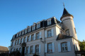
(7) Turn left onto this street and continue to the castle.
(8) Enter on the right and walk through the park. On leaving, head right into Rue des Remparts.
(9) At the roundabout, turn right into Rue de Rosheim, cross the Grand’rue at the pedestrian crossing and continue along Rue du Lavoir until you reach the junction with Rue des Prés.
(10) At the junction, turn left and, after 50 m, turn right into Rue des Étangs until you reach a fork in the road.
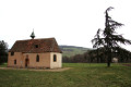
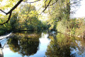
(11) Turn left towards the SNCF bridge, then left again immediately after the bridge. Walk alongside the pond and past the Chapelle Saint-Jacques.
(12) Just before the housing estate, turn left onto the path leading to the car park at Mutzig station (S/E).
 Tourist office

 Moderate

 Visorando Member