


 Country:
 City:
City:


The walk starts from the car park, which has a waste sorting point, next to a restaurant, at the entrance to Oyré when approaching from Châtellerault.
No signposting
(S/E) Leave the car park, turn right at the corner of the restaurant and head uphill towards the church.
(1) Turn left onto the D21 towards Leugny. Ignore a dead-end on the left and continue gently uphill.
Yellow signposting
(2) At the junction, take the first road on the left – the only one without a sign – and head downhill.
No markings
(3) At the Stop sign, turn right. Enter Les Fravalières, cross Rue des Fravalières on the right-hand side and carry on straight ahead. Further on, ignore a road on the left leading to La Soleillerie; head uphill, pass through the hamlet of Le Pin and arrive at a Fork in the road near Château de la Groie.
Yellow signposting (on one side only, in the opposite direction to the walk)
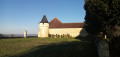
(4) Turn right onto Rue de la Groie, leaving the château on your left, then take the hairpin bend to the right and head uphill. After a shaded stretch, you’ll reach a junction at the foot of a medium-voltage pylon.
No signposting
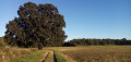
(5) Turn left onto a path, passing a pond on your right. Walk past a beautiful solitary oak tree, turn left with the path and you’ll soon reach a junction.
(6) Then turn right onto a grassy path and walk alongside a fenced woodland on your left. Continue straight on between a tree-lined hedge on your left and a pine woodland on your right.
Blue markings
(7) At the end of the path, turn left onto a gravel track. Keep going straight on, ignoring all side paths to the left. You’ll reach a junction with a small road (with a metal cross opposite).
Blue + Red and White markings
(8) Take the first left and follow theGR®655along a track.
Blue markings
(9) At the fork in the road shortly afterwards, veer right onto a grassy path and leave theGR®. Further on, the path descends and becomes a hollow. After a right-hand bend, you’ll reach a three-way junction. Turn left here (no arrow or marker here) and walk between the fields.
Blue + Red and White + Yellow and Blue markings
(10) You’ll come out onto a small road; follow it to the right. After about 150 m, take the first track on the left. Walk alongside a hedge on your right, then the wall of a property.
(11) At the Stop sign, turn left and walk alongside a horse paddock on your right. Cross a stream, walk slightly uphill and ignore the turn-off to the Moulin de Saint-Ustre on the left.
Blue + Yellow and Blue markings
At the junction (elevation 60), take a farm track on the left.
No markings
(12) When the track turns right, carry on straight ahead along a grassy path.
Dark green markings
You’ll come out onto a small road (Rue de Pothumé) and follow it to the left. At the next junction, turn right into Rue de la Renarderie.
(13) At number 190, turn left onto a field track and head slightly uphill. You’ll reach a junction just before the top of the hill.
No signposting
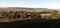
(14) Then turn left and head due east (on the left, a lovely view of Château de la Groie). At the next junction (elevation 76), go straight on along a grassy path. Further on, continue along a track.
(15) You’ll come out onto a small road; follow it to the left for about a hundred metres. When the road bends to the left, turn right onto a grassy track.
(16) You’ll come out onto the D75 near the Oyré exit sign; follow it to the left and you’ll soon find a good pavement on the left-hand side. Ignore a road coming from the right and walk past the cemetery on your left. At the Stop sign, turn left and then immediately right to cross at the pedestrian crossing. Cross a footbridge over a stream opposite, then take another footbridge on the right to return to the starting car park (S/E).

 Tourist office
 Easy
Easy 
