Circular route around Valençay Castle

As you follow the path, you’ll walk along the banks of the Vienne, then pass through the woods of La Rabellerie, La Pagerie and Valençay, before skirting the magnificent Maisonneuve Park to rejoin the Vienne.

Details

3216974
Creation:
Last update:
Last review:
  • Walking
    Activity: Walking
  • ↔
    Distance: 8.46 mi
  • ◔
    Average duration: 4h 15 
  • ▲
    Difficulty: Moderate

  • ⚐
    Back to start: Yes
  • ↗
    Ascent: + 463 ft
  • ↘
    Descent: - 482 ft

  • ▲
    Highest point: 469 ft
  • ▼
    Lowest point: 144 ft
  • ⚐ Country: France
  • ⚐ City: Antran (86100)
  • ⚑
    Start/End: N 46.852616° / E 0.543498°
  • ❏
    IGN map(s): Ref. 1825SB
  • Hour-by-hour weather

Description of the walk

Park in the large car park situated between the Town Hall and Antran Church.

(S/E) Head towards the church, then go round it on the right. Cross a meadow on the left – there’s a playground there – and head for the banks of the Vienne.

(1) Turn left and walk along the river on your right. Stay on the sandy path as close to the river as possible and, after about 500 m, turn left onto Rue de Touraine.

(2) Follow this street to the right. After about a hundred metres, take a path on the left and walk past the houses on your left. The path turns left between two houses and leads onto Rue du Lavoir.

(3) Follow this street to the right. At the end, turn right into Rue d’Alsace. In a right-hand bend, you’ll see a washhouse on the left. Continue along the road to the Green Cross roundabout.

(4) Go round the roundabout on the right and follow the D1 straight ahead to cross a blue bridge. At the fork in the road (crossroads), keep right on the D1. At the next fork in the road, turn left onto a small road.

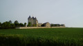
(5) Note the view of Valençay Castle on your left and carry on along the road, which further on becomes a semi-tarmac track. Pass a farm and you’ll soon come out onto the D75.

(6) First turn left then right to cross the road and follow a small road towards Château de la Taupanne. At the end, at a place called Les Deniaux, turn left and take a grassy track. You’ll rejoin the tarmac at a place called Pichon.

(7) When the road bends to the left, turn sharply right onto a dirt track that climbs between the Maisonneuve estate on the left and an old hazelnut grove on the right. Head north for about 500 m, then turn west-north-west onto a stony path through the Bois de la Pagerie.

(8) At the junction near a reservoir, turn left for a lovely descent. You’ll rejoin the tarmac at a place called La Bertinière and continue downhill to the D43. Cross this road and follow it to the left for about fifty metres.

(9) Take thefirst track on the right. Follow this grassy track north-westwards, climbing alongside a high-voltage power line as you make your way up the grassy track. Further on, walk alongside a woodland on your left for about 300 metres.

(10) Then turn left into the woodland and follow a wide, stony path southwards, still climbing. Reach a flat area and ignore a path on the left, then one on the right.

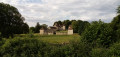
(11) At the next junction, turn right onto a lovely downhill path. Leave the woodland and continue downhill. You’ll come out onto the D75; follow it to the left. Pass through the hamlet of La Moralière (with its beautiful mansion) and continue to the next junction, at the hamlet of Le Moulin du Chapt.

(12) Then turn right, cross the leat of the old mill and follow a small road lined with poplars. At the cross, turn left onto a field track. You’ll come out onto a small road; follow it to the right for about a hundred metres until you reach a triangular junction.

(13) First turn right then left to head due east towards the stadium at the Green Cross roundabout. Pass the stadium and arrive at the roundabout.

(4) Take thesecond right onto Rue de la Fontaine des Poulpes, which continues as Rue d’Alsace. Then turn left onto Rue du Lavoir.

(3) Turn left, then follow the path to the right which runs behind the houses. At the end, turn right onto Rue de Touraine.

(2) Just before a street on the right, take a path on the left. Head towards the banks of the Vienne and follow the river on your left.

(1) When you reach the bank of a small tributary, turn right. Then turn right again to return to the church, then left to get back to the car park (S/E).

Waypoints

  1. S/E : mi 0 - alt. 164 ft - Town hall car park - Église Saint-Hilaire
  2. 1 : mi 0.09 - alt. 151 ft - Bord de Vienne
  3. 2 : mi 0.46 - alt. 157 ft - Rue de Touraine
  4. 3 : mi 0.68 - alt. 164 ft - Rue du Lavoir
  5. 4 : mi 1.19 - alt. 184 ft - Green Cross
  6. 5 : mi 1.57 - alt. 180 ft - Viewpoint overlooking the - Château de Valençay (Antran)
  7. 6 : mi 2.35 - alt. 184 ft - D75 road
  8. 7 : mi 3.02 - alt. 243 ft - Start of the trail
  9. 8 : mi 3.65 - alt. 443 ft - Reservoir – Junction
  10. 9 : mi 4.07 - alt. 279 ft - Start of the trail
  11. 10 : mi 4.68 - alt. 410 ft - Junction
  12. 11 : mi 5.32 - alt. 449 ft - Junction
  13. 12 : mi 6.14 - alt. 236 ft - The Moulin du Chapt
  14. 13 : mi 6.81 - alt. 194 ft - T-junction
  15. S/E : mi 8.46 - alt. 164 ft - Town hall car park - Église Saint-Hilaire

Notes

Toilets next to the Town Hall.

Bar opposite the Town Hall.

Worth a visit

Heritage:
- General: a village with numerous archaeological remains.
- Church (12th century, remodelled in the 19th century).
- The River Vienne (runs alongside the town).
- Fontaine des Poulpes.
- Numerous unobstructed views of the countryside.
- Village cross.
- Large farmhouses.
- Château de la Taupanne.
- Several woods crossed: Valençay Wood, Rose Wood (if taking the alternative route, also: Peu Wood; Pagerie Wood; La Rabellerie; Salut Wood).
- Chapt Mill.
- Pond.

Reviews and comments

4.3 / 5
Based on 2 reviews

Reliability of the description
4.5 / 5
Ease of following the route
4 / 5
Route interest
4.5 / 5
nicole.l
nicole.l

Overall rating : 5 / 5

Date of your route : Mar 20, 2025
Reliability of the description : ★★★★★ Very good
Ease of following the route : ★★★★★ Very good
Route interest : ★★★★★ Very good
Very busy route : No

A lovely route, with a very pleasant start and finish on the banks of the Vienne. Paths through the woods and a few sections along quiet country lanes.

Machine-translated

Grand Châtellerault
Grand Châtellerault

I would like to respond to Paquito 65. We have passed on your comment regarding points 7 and 8 to the local council for the maintenance of the path. Furthermore, the Grand Châtellerault Urban Community has installed two directional signs between points 7 and 8, indicating the direction, the name of the route and the distance to be covered, in order to guide walkers along the correct path.

Machine-translated

PAQUITO 85
PAQUITO 85

Overall rating : 3.7 / 5

Date of your route : Jul 10, 2021
Reliability of the description : ★★★★☆ Good
Ease of following the route : ★★★☆☆ Average
Route interest : ★★★★☆ Good
Very busy route : No

A really lovely route, with a mix of small roads and woodland. A few lovely climbs through the woods.

Please note: the forest path must have been altered by a mountain bike race (between points 7 and 8). The finish at point 8 is no longer in quite the same place, and we ended up cycling a few kilometres before getting back on track.

Machine-translated

Other walks in the area

For more walks, use our search engine .

The GPS track and description are the property of this route's author. Please do not copy them without permission.