The Hellet Forest from Bailleul-Neuville

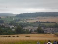
This walk crosses the Hellet Forest via the Bois de Bailleul and the Bois du Vaubert. It offers a beautiful view over the Eaulne valley and the village of Bailleul-Neuville.

Details

n°8089799
Creation:
Last update:
–
Last review:
  • Walking
    Activity: Walking
  • ↔
    Distance: 6.65 mi
  • ◔
    Average duration: 3h 25 
  • ▲
    Difficulty: Moderate

  • ⚐
    Back to start: Yes
  • ↗
    Ascent: + 413 ft
  • ↘
    Descent: - 397 ft

  • ▲
    Highest point: 705 ft
  • ▼
    Lowest point: 308 ft

Photos

Description of the walk

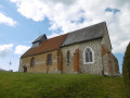
Start from the car park at Bailleul-Neuville church, Rue du Presbytère.

(S/E) Opposite the church, turn right onto Rue du Presbytère and follow it to the junction with Rue du Mont Fiacre (D117). Turn left and continue along the D117 until you reach a Fork in the road at the edge of the village, near the wayside cross.

(1) At the fork in the road, carry on along the D117 to your left. Follow this road straight ahead up to the hamlet of La Queue du Hellet (Baillolet).

(2) Walk through the hamlet. Before the last houses, take the path on the right marked ‘Route No. 13’.

(3) Continue along this Val Pâteux forest track until it ends at the junction with the D56.

(4) Cross the D56 and take the path opposite. Follow this path to a Fork in the road, then continue to the right until you reach the junction with the D56.

(5) Turn left onto the D56 and continue along this road until you reach the crossroads. Take the road on your right until you reach the entrance to the Bois de Vaubert.

(6) Turn right onto the forest track. Continue straight ahead along this track until it joins a tarmac road.

(7) Cross the road and take the path opposite. Continue along this path at the edge of the woods until you reach a crossroads at the edge of the Bois du Vaubert, where you’ll be treated to a stunning view of the Eaulne Valley.

(8) Turn right onto the dirt track until you reach the junction with the Voie Communale du Vaubert. Turn left onto the road leading down to the village of Bailleul-Neuville. Continue along this road until you reach the junction with the D117.

(9) Turn right onto Rue Mont de Fiacre. Follow this street carefully.Take the first street on your left, Rue du Presbytère. Follow this street and you’ll return to your starting point at the church car park (S/E).

Waypoints

  1. S/E : mi 0 - alt. 308 ft - Car park at the - Église Saint-Vaast (Bailleul-Neuville)
  2. 1 : mi 0.56 - alt. 348 ft - Fourche au Calvaire
  3. 2 : mi 1.38 - alt. 430 ft - La Queue du Hellet hamlet
  4. 3 : mi 1.64 - alt. 482 ft - Route marker no. 13
  5. 4 : mi 2.7 - alt. 699 ft - Rue D56
  6. 5 : mi 3.45 - alt. 699 ft - Rue D56
  7. 6 : mi 4.19 - alt. 663 ft - Entrance to the Bois du Vaubert
  8. 7 : mi 5.35 - alt. 581 ft - Path along the edge of the woods
  9. 8 : mi 5.74 - alt. 466 ft - Bois du Vaubert walk
  10. 9 : mi 6.42 - alt. 341 ft - Turn right onto Rue du Mont de Fiacre
  11. S/E : mi 6.65 - alt. 308 ft - Car park at the - Église Saint-Vaast (Bailleul-Neuville)

Notes

Avoid visiting during the hunting season, or check the ONF website for the hunting calendar.

Worth a visit

Mesnieres-en-Bray, a village awarded 4 flowers for its floral displays, featuring its Renaissance castle, Saint-Amador Hill and the Avenue Verte.
Discover Neufchâtel-en-Bray and its heritage through the 16 information panels installed throughout the town.

Reviews and comments

4.7 / 5
Based on 1 review

Reliability of the description
5 / 5
Ease of following the route
5 / 5
Route interest
4 / 5
papy diouf
papy diouf

Overall rating : 4.7 / 5

Date of your route : Apr 29, 2022
Reliability of the description : ★★★★★ Very good
Ease of following the route : ★★★★★ Very good
Route interest : ★★★★☆ Good
Very busy route : No

A lovely route for the sections through the woods, but too much tarmac at the start and in the middle of the walk. It’s a shame – there must be a way to avoid these roads.

Machine-translated

Other walks in the area

For more walks, use our search engine .

The GPS track and description are the property of this route's author. Please do not copy them without permission.