Between the Saintois and the Moselle

A walk through the rolling countryside and woods on the edge of the Saintois region, passing through the villages of Benney, Crévechamps and Saint-Remimont.

Author’s note, 2 January 2020: Access to this private woodland is permitted subject to certain conditions. See practical information below

Details

529378
Creation:
Last update:
Last review:
  • Walking
    Activity: Walking
  • ↔
    Distance: 11.69 mi
  • ◔
    Average duration: 5h 50 
  • ▲
    Difficulty: Moderate

  • ⚐
    Back to start: Yes
  • ↗
    Ascent: + 512 ft
  • ↘
    Descent: - 492 ft

  • ▲
    Highest point: 1,099 ft
  • ▼
    Lowest point: 791 ft
  • ⚐ Country: France
  • ⚐ City: Benney (54740)
  • ⚑
    Start/End: N 48.512486° / E 6.220131°
  • ❏
    IGN map(s): Ref. 3416O
  • Hour-by-hour weather

Description of the walk

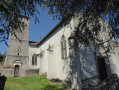
The walk starts at Benney Church, where there is parking available.
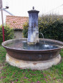
(S/E) Walk past the left-hand side of the church, then across the Place de la Fontaine and onto the D61. Continue along this road towards the north-east.

(1) At the bend on leaving the village, carry straight on, passing to the right of the water tower. Follow this road as it crosses over the motorway until you reach a small pond.

(2) Turn right, passing to the left of a mobile phone mast. Continue along the track, keeping the Bennay Forest on your left. Ignore the side tracks on either side and reach the entrance to the village of Crévéchamps via Rue du Bois

(3) Turn right and cross the village along the Grande Rue, passing in front of the church.

(4) On leaving the village, at a wide bend, turn right onto a quiet sunken track. The climb is a bit steep before you reach the D62.

(5) Carry on to the left, walking alongside the D62 – a road with little traffic – and continue until you reach a wide track on the left.

(6) Take this path. Turn 90° to the left and then to the right, towards a small copse; contrary to the IGN map, the path does exist.

(7) At the entrance to the woods, go under the fence, turn immediately right and continue along the edge of the woodland. Pass a path on your right and reach a T-junction.

(8) Take the field path on the right, then turn left and join a small road at the entrance to Saint-Remimont.

(9) Turn right and enter the village.

(10) Turn right onto the D62, cross the village and, at a wide right-hand bend, turn left.

(11) Just before the Town Hall, turn left between two houses, follow the path along the edge of the fields, heading south, then turn left towards the D62.

(12) Walk along the D62 to the right until you reach the next junction.

(13) At the junction of the road and a field track under the EDF power line, turn right and go under the motorway (in heavy rain, you’re guaranteed to get your feet wet).

(14) Turn right into the forest. Make an S-bend and then carry on straight ahead.

(15) As you come out of the woodland, turn right, follow the motorway and then veer slightly to the left.

(16) At the farm, take the road on the left reserved for residents and head towards the church (S/E).

Waypoints

  1. S/E : mi 0 - alt. 974 ft - Benney Church
  2. 1 : mi 0.22 - alt. 1,033 ft - Turn, go straight on
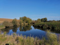
  3. 2 : mi 1.09 - alt. 1,070 ft - Lake; turn right towards a mobile phone mast
  4. 3 : mi 2.81 - alt. 794 ft - At the entrance to Crévéchamps, turn right
  5. 4 : mi 3.03 - alt. 797 ft - Leaving Crévéchamps, turn right
  6. 5 : mi 3.24 - alt. 906 ft - Junction with the D62, turn left
  7. 6 : mi 3.73 - alt. 1,073 ft - Junction with a field path; turn left
  8. 7 : mi 4.4 - alt. 1,086 ft - Entrance to the woods, on the right
  9. 8 : mi 4.9 - alt. 1,083 ft - Crossroads of field paths, turn right
  10. 9 : mi 5.43 - alt. 1,066 ft - Junction with a small road; turn right
  11. 10 : mi 5.74 - alt. 1,040 ft - Junction with the D62, on the right
  12. 11 : mi 5.99 - alt. 1,040 ft - Path on the left between two houses
  13. 12 : mi 6.9 - alt. 1,040 ft - Turn right onto the D62
  14. 13 : mi 7.46 - alt. 1,089 ft - Crossing: EDF high-voltage power line, on the right
  15. 14 : mi 8.31 - alt. 1,017 ft - Enter the forest on the right
  16. 15 : mi 10.35 - alt. 1,007 ft - Leaving the forest, turn right
  17. 16 : mi 11.41 - alt. 1,063 ft - Farm, on the left
  18. S/E : mi 11.69 - alt. 974 ft - Benney Church

Notes

A good pair of walking shoes.

Note from the author of the walk on 2 January 2020:

I spoke to him on the phone and he has authorised access to the forest OUTSIDE THE
HUNTING SEASON; I have included this clarification in the walk description.

Worth a visit

The scenery from the various high points.
The beautiful forests at the start and finish.

Reviews and comments

3.7 / 5
Based on 4 reviews

Reliability of the description
3.8 / 5
Ease of following the route
4.3 / 5
Route interest
3 / 5
LAURENT FRANCOIS
LAURENT FRANCOIS
• Edited:

Hello
Following a telephone conversation with the landowner, he has given permission for walkers to visit outside the hunting season, and I would like to thank him for this permission
The author, Laurent.

Machine-translated

vincentm5194
vincentm5194

Overall rating : 4.3 / 5

Date of your route : Aug 19, 2019
Reliability of the description : ★★★★★ Very good
Ease of following the route : ★★★★★ Very good
Route interest : ★★★☆☆ Average

A rather pleasant walk, but the route passes through private property clearly marked by gates with ‘No Entry’ signs. It would have been fair to point this out, particularly regarding the Bois d’Ormes, which you walk through for several kilometres.

Machine-translated

ardlli
ardlli

Overall rating : 4 / 5

Date of your route : Apr 06, 2018
Reliability of the description : ★★★★☆ Good
Ease of following the route : ★★★★☆ Good
Route interest : ★★★★☆ Good

Setting off from Crévéchamps, then St Remimont
I followed the motorway from St Remimont on the way back to keep the trip to half a day
But I had to go under a wire with a ‘private property’ sign at number 7
Is this little woodland really private property? It seems so, but it’s a bit of a nuisance having that sign there!
Kind regards
ardlli

Machine-translated

fanfan
fanfan

Good evening
Regarding point 14, can we really say that walkers are, as a matter of principle, allowed in private forests? This may not be the case everywhere. Here, the signposted route goes round the forest, and faced with this ‘private property, no trespassing’ sign, I remain sceptical.
Trail markers are required to seek permission before marking a path....
Well, let’s not get into a row – in any case, it’s always possible to have a chat with the landowners if you come across them. Do bear in mind, however, that there are hunting seasons in this sort of area.
Kind regards
Fanfan

Machine-translated

LAURENT FRANCOIS
LAURENT FRANCOIS

No luck with the fog
Regarding point 7, it’s a fence prohibiting motor vehicles; no problem for pedestrians
As for the passage under the motorway (turn right then left), that’s correct, but you simply have to follow the path – there’s no other way round it; I didn’t want to overload the description.
As for point 14, it’s also a fence to keep out motor vehicles, but in principle walkers are allowed in private woods.

Machine-translated

fanfan
fanfan

Overall rating : 4.5 / 5

Date of your route : Nov 17, 2017
Reliability of the description : ★★★★☆ Good
Ease of following the route : ★★★★★ Very good
Route interest : Not used / Not applicable

We went on a hike with a group of 20 hikers; in thick as fog, we couldn’t see a thing of the surroundings!! What a shame!!
Personally, I followed the route on the map and had no problems at all. EVERYTHING’S FINE
I’d just like to note:
At point 7: passing under the fence is fine, but isn’t the land private? If so, do we have permission to cross?
At point 13, the passage under the motorway isn’t a direct continuation of the path; turn right, go under the motorway (footbath confirmed), then turn left to rejoin the path on the right.
At point 14: Gate and ‘Private property – no entry’ signs; we went through anyway, but were we allowed to?

Machine-translated

gazok54
gazok54 ★

Thank you, brunox54
Please feel free to send us any suggestions on how to improve the description.

Machine-translated

brunox54
brunox54

Overall rating : 2.3 / 5

Date of your route : Oct 19, 2017
Reliability of the description : ★★☆☆☆ Disappointing
Ease of following the route : ★★★☆☆ Average
Route interest : ★★☆☆☆ Disappointing

The directions were unclear right from the start! I ended up cutting the walk short after getting lost because there were no clear directions from number 6 onwards!
I certainly won’t be doing that again.
On a positive note, though, I saw a squirrel cross the path in front of me – a path that was barely passable – and two does passed behind me!

Machine-translated

Other walks in the area

For more walks, use our search engine .

The GPS track and description are the property of this route's author. Please do not copy them without permission.