Country:
 City:
City:


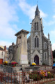
Park near the Church of Saint-Étienne in Éguzon or the Town Hall. Follow the yellow signposts.
(S/E) Follow the D36 (Rue de la Gare) towards Parnac for 600 m, then turn left onto the Route du Faisceau. Pass the water tower and the hamlet of Red Cross.
(1) At the junction (stone cross), follow the small road to the left for 400 m, then turn left again onto a track leading to a telecoms mast. Take the D45 to the left for 100 m, then turn right onto a path.
(2) Follow the small road on the left towards Chavenières and carry on to the next junction. Turn right onto the track for 100 m, then turn left to reach the hamlet of Crocq. Carry on straight ahead to the next junction.
(3) Please note: there may be a diversion – see information. Carry on straight ahead through the hamlet of Séjallas and head down to the D913. Follow it carefully to the left for 40 m, then take a track on the right down to a reservoir on the Clavière. Cross it and follow the track which climbs back up towards the Château de la Clavière. Pass a track on the right, then turn left.
(4) Turn right and head uphill to La Feyte. Cross the D36d with care and continue along the track opposite.
(5) Take the path on the left, cross a small road and carry on straight ahead across the north-eastern plateau. Pass the path leading to a water tower and an aerial on your left, then turn right at a copse to head down towards Chambon. The path leads to a car park: continue along the access road.
(6) Take the Route de la Chapelle on the right and begin the descent (the chapel is on your left), leaving the Chemin des Prés des Gouttes on your right. Follow theD36M to the left, towards Éguzon. At the Stop sign, follow the D36 to the left for 100 m, then turn down a small street on the right. Continue along the Chemin du Pradet until you reach a hiking information sign.
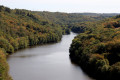
(7) Head down to the right onto the grassy path to the left of the sign. The path then runs along the edge of Lac de Chambon.
(8) After passing a hut, when you reach a jetty overlooking the dam, take the path leading uphill to the left. It emerges near a house onto the D45c; follow this to the left to cross through Fressignes. Pass the Chemin des Jarnasses on your left, then, at a small clearing, take the tarmac ‘Chemin de l’Écluse’ on your right (with a well and a lodge on your right-hand side). Pass two paths on your right and then on your left to reach the end of the tarmac section between two houses.
(9) Carry on straight ahead along the grassy track which descends to La Clavière. Cross the footbridge, then head back up to Éguzonnet.
(10) Turn left onto the Chemin de la Fontaine. Just before the bend to the left, turn onto a grassy path leading uphill to the right (you can take a look at the fountain, which is at the end of the path opposite, in the bend).
At the end of the track, head up to the left to join the D45, which you should follow carefully to the left. Pass the road leading to Les Jarriges on your right and take the next one (Chemin de la Garenne). Pass a grassy track on your right and carry on straight ahead.
(11) At the next junction, take the farm track on the left. When you reach the campsite gates, continue to the left.
At the Stop sign, turn right onto the D45 and follow it back to the starting point (S/E).
 Visorando Member

 Easy
Easy