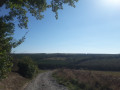
Between the Grand Duchy of Luxembourg and Belgium, starting from Surré

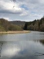
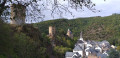
Start from a village with a traditional church dating from 1822 and pass from one village to the next as you follow the course of a small river, the Surbich.

Details

n°46438519
Creation:
Last update:
Last review:
  • Walking
    Activity: Walking
  • ↔
    Distance: 6.35 mi
  • ◔
    Average duration: 3h 40 
  • ▲
    Difficulty: Moderate

  • ⚐
    Back to start: Yes
  • ↗
    Ascent: + 817 ft
  • ↘
    Descent: - 814 ft

  • ▲
    Highest point: 1,614 ft
  • ▼
    Lowest point: 1,204 ft

Photos

Description of the walk

Park in the church square in the village of Surré in the Grand Duchy of Luxembourg, where there is a free car park with four spaces.

(S/E) With your back to the church, follow the road westwards and take the first road leading uphill to the right, Rue du Bois. Walk for about 1 km until you reach a Fork in the road where a road joins from the left.

(1) Keep to the right. Stay on the road as it enters the forest and continue until you reach a three-way junction after about 800 metres.

(2) Turn right towards Bastogne, walk for about 800 metres and you’ll reach another three-way junction at the corner of a field on your left.

(3) Leave the road and continue along theGR®15, taking the path on the left. Shortly afterwards, look out for the beehives in the clearing, then carry on until you reach an old cast-iron Belgian-Luxembourg border marker.

(4) Continue along the path overlooking the Surbich valley for about 1.7 km until you reach thefirst path on the right, at the southernmost point of the walk, where you leave theGR®15.

(5) Take the hairpin bend to the right and head down towards the bridge over the Surbich. Cross the bridge and ignore the path on the left; instead, take the steep path on the right for a short distance. Continue climbing to the right through the fir forest for about 400 m, then descend along the hillside towards the Moulin de Honville and the small river.

(6) Cross the river over two concrete slabs and leave the mill on your left. Follow the path uphill, which generally follows the crest of the ridge, for about 700 m, then enter the forest.

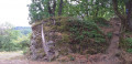
(7) Continue along the path, skirting a clearing, then look out for an old, dilapidated shed in the meadow on the left, before coming out onto a road (Route de Bouillon).

(8) Follow it to the right until you reach the edge of the forest.

(9) Carry on to the first forest track on the left.

(10) Follow it for about 1 km. The track ends with a steep downhill slope and comes out onto a road near an old ruined building.

(11) Take this road to the right and follow it to the left-hand bend just after a small stream.

(12) Leave the road and take the path up to the right, which leads to Rue du Cimetière, clearly signposted by a lovely sign.

(13) Follow this street to the right to return to the church (S/E).

Waypoints

  1. S/E : mi 0 - alt. 1,230 ft - Place de l’Église
  2. 1 : mi 0.74 - alt. 1,486 ft - Fork in the road
  3. 2 : mi 0.9 - alt. 1,535 ft - Fork in the road heading towards Bastogne
  4. 3 : mi 1.36 - alt. 1,568 ft - The path starts on the left
  5. 4 : mi 1.8 - alt. 1,467 ft - Border marker
  6. 5 : mi 2.65 - alt. 1,260 ft - Southernmost point of the walk (end of the GR°°®°°15)
  7. 6 : mi 3.31 - alt. 1,286 ft - Bridges crossing the Surbich
  8. 7 : mi 4.13 - alt. 1,447 ft - Hangar
  9. 8 : mi 4.43 - alt. 1,473 ft - Return via the road
  10. 9 : mi 4.6 - alt. 1,499 ft - Entering the forest
  11. 10 : mi 4.8 - alt. 1,526 ft - Junction in the forest
  12. 11 : mi 5.43 - alt. 1,293 ft - Ruined house
  13. 12 : mi 5.86 - alt. 1,230 ft - Path on the right
  14. 13 : mi 6.15 - alt. 1,207 ft - Rue du Cimetière
  15. S/E : mi 6.35 - alt. 1,230 ft - Place de l’Église

Notes

Some sections of the route include steep slopes requiring a good level of fitness, but nothing more.

Worth a visit

Always be cautious and plan ahead when you're outdoors. Visorando and the author of this route cannot be held responsible for any accidents occurring on this route.

The GR® and PR® markings are the intellectual property of the Fédération Française de Randonnée Pédestre.

Reviews and comments

4.7 / 5
Based on 1 review

Reliability of the description
5 / 5
Ease of following the route
5 / 5
Route interest
4 / 5
Jean Mathias
Jean Mathias

Thank you for your review. It is interesting and surprising to learn that the walk was very popular.

Machine-translated

Eric280562
Eric280562

Overall rating : 4.7 / 5

Date of your route : Nov 03, 2025
Reliability of the description : ★★★★★ Very good
Ease of following the route : ★★★★★ Very good
Route interest : ★★★★☆ Good
Very busy route : Yes

Pleasant route without any major difficulties

Machine-translated

Other walks in the area

For more walks, use our search engine .

The GPS track and description are the property of this route's author. Please do not copy them without permission.