Country:

 City:
City:


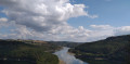
Car park near the Misère bridge between the villages of Boulaide and Arsdorf.
Blue double-page open trail markers
(S) Head towards the bridge and, just before you reach it, turn right onto the dirt track. Walk uphill between two pastures. Turn left, ignoring the path opposite. Enter the forest and walk until you reach the gate of a property on your left.
(1) Turn left and head down the path running alongside the fence. Before the dam, turn right and, at the Fork in the road, keep to the right. Cross the jetty. The path turns right and climbs gently. At the meadow, turn left; the path climbs in switchbacks then follows the contour line until it rejoins another path.
(2) Continue to the left and head downhill. Further on, climb the switchbacks.
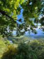
(3) Pass a viewpoint. Further on, ignore the path on your right and carry on straight ahead to another viewpoint.
(4) Follow the path to the right after the bench. Head downhill and keep to your left until you reach the wide path.
(5) Turn left. At the Fork in the road, continue to the right. The path turns right. Ignore the path on your left (not shown on the map) where there is a ‘No Entry’ sign. Walk to the stream.
(6) Turn left and wade across this stream (dry in September 2020). Head left. Go downhill and then uphill again. Pass another viewpoint overlooking the lake and head down to the wide path.
(7) Continue left along this wide path, which turns right a little further on.
(8) Take the path on the right and walk for about 250 m until you reach a path on your left.
(9) Turn left. Cross the ford (dry in September 2020) and head uphill. Ignore the path on your left leading down to the lake; take the hairpin bend to the right and continue uphill. The path becomes a wide grassy track at a junction.
(10) Carry on straight for 800 m. A wide track joins from your left; carry on. At the next track, with concrete slabs, turn right and head uphill. Go round the barrier. At the road with the car parks, turn left. Go round the next barrier and carry on straight until you reach the path on your right (not shown on the map).
(11) Turn right, follow the path down and then back up to the viewpoint. Climb up to it and enjoy the view over the lake. Retrace your steps. Return to the path you took on the way there and, at the Fork in the road, take the path on the left. At the road, continue to the left for just under 700 m until you reach a hairpin bend on your left.
(12) Turn left, then immediately right, and head downhill. At the forest track, turn right. Go round the barrier. Keep to the right and cross the car park. After passing the public toilet block, take the path on your right under the fir trees. When you reach the road, continue to the right until you come to a path leading down to your left after the car park. Follow the different markings to avoid the tarmac.
Blue Flag 1 markings
(13) Head down to the left and walk along the lake. At the next car park, keep to your left. Walk down towards the solar-powered boat jetty and, at the bottom, go up the stairs. At the top, turn right and walk along the railing. At the beach, head back up towards the toilets, then turn off towards the car park. Turn left and continue along the path that starts at the bend. Keep to the right until you reach a Fork in the road.
No signposting
(14) Follow the path on the right up to the road.
Blue double-page open sign
Turn left and cross the road bridge. At the end of the bridge, turn right and head towards the car park. Take the dirt track starting at the car park entrance; this is the Lultzhausen Sculpture Trail. At the road, continue to the left. In the bend, you’ll find thefirst sculpture, ‘L’Ange du Lac’. The road turns into a dirt track. Walk to the junction.
(15) Take the path on the right. As you climb, you’ll come across the other sculptures and enjoy a view of the village of Bonnal. Carry on uphill and, when you reach the road, take a sharp left-hand bend. The road turns into a stony track. Discover the final sculptures and enter the forest. At the Fork in the road, turn left, then at the next fork, turn right. Walk down the rocky, steep path to a junction with a wide forest track.
(16) Continue along the path opposite. When you reach the road, head slightly to the right and cross the bridge to the path on your right. The signposting changes so that you do not end up on tarmac.
White arrow on a blue background
(17) Turn right onto the path. Ignore thefirst path leading down to your right and take the wide path further up, still on your right. Walk uphill for 1 km, ignoring the paths on either side (whether marked on the map or not), until you reach the junction with a tree bearing a large fluorescent yellow exclamation mark on its trunk.
(18) Turn left and walk for 800 m until you reach a path on your left. The signposting ends here.
No signposting
(19) Take a sharp left-hand bend and head downhill. Before reaching the road, turn right onto the grassy track which becomes a footpath. Climb the log steps and, once back on a forest track, continue straight ahead. Walk past the power station and stay on the track until you reach the road.
E2 signposting
Turn left and head down the road. Turn left onto thefirst path and continue downhill until you reach the path in front of the house on your right.
(20) Turn right onto the ascending path. Signposting ends here.
No signposting
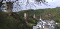
At the bench, continue to the left. Walk downhill and, at the next path on your right, head uphill. Discover the statue of the MutterGottes (Black Madonna) and, in the background, the castle ruins. To the left, you can head towards the tower. Return to the statue and, with your back to it, walk down the path. Turn left and go down the steps to the entrance to Esch-sur-Sûre (E).



 Visorando Member
 Difficult
 Very difficult