Chaumont and the La Strange Valley

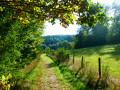
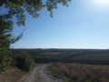
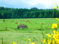
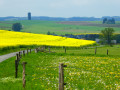
The Ardennes aren’t just made up of coniferous forests… There are also valleys, pastures, hay meadows, copses and farmland… Come and discover this other side of the Ardennes with this circular route through open countryside.

Details

10726072
Creation:
Last update:
Last review:
  • Walking
    Activity: Walking
  • ↔
    Distance: 6.85 mi
  • ◔
    Average duration: 3h 45 
  • ▲
    Difficulty: Moderate

  • ⚐
    Back to start: Yes
  • ↗
    Ascent: + 676 ft
  • ↘
    Descent: - 666 ft

  • ▲
    Highest point: 1,706 ft
  • ▼
    Lowest point: 1,378 ft

Photos

Description of the walk

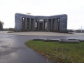
Start from the car park near the Canon de la Place Général A. Irzyk in Chaumont.

Blue vertical rectangle signposts

(S/E) The car park is on your left; head straight ahead down the dead-end road. The road turns into a stony track after the farm. Walk along the farm track for just over 600 m.

(1) Cross the tributary of the Grandru and walk until the surface changes and you reach the path on your right.

(2) Turn right. Then, at the T-junction, turn left. Where the path surface changes, carry on straight ahead. At the junction, ignore the hairpin bend to the left.

Unmarked

(3) Take the dirt track (not on OSM) on the left, before the house. Pass under the high-voltage power lines. Stay on this main track for about 700 m until you reach the junction with the RAVeL.

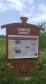
(4) Carry on to the left for 500 m. Look out for a faint path on the right through the tall grass. This leads to the fish pass on the River Strange. If you’re standing in front of the information board about the River Strange fish pass, you’re too far away to see it. You’ll need to retrace your steps slightly.

(5) Then rejoin the RAVeL and carry on to the sign for Chaumont station. Cross the road with care.

(6) Take the dirt track on the left before continuing along the RAVeL. Join the RAVeL again further on and carry on to the left until you reach the next junction.

(7) At the Sainlez stop, turn left and leave the RAVeL for good. Wade across the tributary of the Strange and carry on. Further on, cross over the Ruisseau du Harjê. The path turns sharply left; head uphill.

(8) Walk past the hunting lodge and carry on straight ahead. The path becomes a road. Ignore the path on your right and carry on straight ahead. Ignore the next path on your right 1 km further on. At the junction on the left, the road becomes a stony track.

Green Cross signposting

(9) At the solitary oak tree, turn left. Stay on this track until you reach the crossroads. Carry on straight ahead. At the next junction, continue straight ahead again until you reach the crossroads at the edge of a fir forest.

Blue Vertical Rectangle signpost

(10) Turn right and head downhill to the road. Continue to the right. Cross the Ruisseau Grandru. Walk along the road with care.

(11) At the multi-way junction, head left. Cross the Ruisseau de Chaumont and return to your car park (S/E).


Waypoints

  1. S/E : mi 0 - alt. 1,463 ft - Place Général Irzyk
  2. 1 : mi 0.52 - alt. 1,467 ft - Grandru Stream
  3. 2 : mi 0.82 - alt. 1,555 ft - Change in surface
  4. 3 : mi 1.48 - alt. 1,401 ft - Dirt track
  5. 4 : mi 1.97 - alt. 1,394 ft - Ravel on the left
  6. 5 : mi 2.24 - alt. 1,381 ft - Fish ladder
  7. 6 : mi 2.34 - alt. 1,394 ft - Dirt track after Chaumont station
  8. 7 : mi 2.68 - alt. 1,411 ft - Sainlez stop
  9. 8 : mi 3.5 - alt. 1,578 ft - Hunting lodge
  10. 9 : mi 4.61 - alt. 1,637 ft - Isolated tree
  11. 10 : mi 6.09 - alt. 1,526 ft - Sapinière crossroads
  12. 11 : mi 6.77 - alt. 1,463 ft - Multiple junctions
  13. S/E : mi 6.85 - alt. 1,463 ft - Place Général Irzyk

Notes

From October to December, please note the hunting dates
No drinking water available along the route.
The route is mainly in open country along wide paths, so please remember to protect yourself.

Worth a visit

Along the way
Information boards about the old railway line, now a RAVeL cycle path.
The Grandru, Hardjê and Chaumont streams.
The fish ladder.
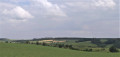
The La Strange valley.

Reviews and comments

4.6 / 5
Based on 3 reviews

Reliability of the description
4.3 / 5
Ease of following the route
4.7 / 5
Route interest
4.7 / 5
fanfan1969
fanfan1969

Overall rating : 5 / 5

Date of your route : Feb 22, 2024
Reliability of the description : ★★★★★ Very good
Ease of following the route : ★★★★★ Very good
Route interest : ★★★★★ Very good
Very busy route : No

A lovely walk – not too difficult and with some stunning scenery!

Machine-translated

lazzerini
lazzerini

Good evening, Vervoort,

it must have been magnificent with the frost.

Machine-translated

vervoort
vervoort

Overall rating : 4.7 / 5

Date of your route : Dec 12, 2022
Reliability of the description : ★★★★☆ Good
Ease of following the route : ★★★★★ Very good
Route interest : ★★★★★ Very good
Very busy route : No

A winter walk offering stunning views, history and nature in a lovely circular route, with sightings of beavers

Machine-translated

Manu57120
Manu57120

Overall rating : 4 / 5

Date of your route : Dec 12, 2021
Reliability of the description : ★★★★☆ Good
Ease of following the route : ★★★★☆ Good
Route interest : ★★★★☆ Good
Very busy route : No

A pleasant walk

Machine-translated

Other walks in the area

For more walks, use our search engine .

The GPS track and description are the property of this route's author. Please do not copy them without permission.