Country:
 City:


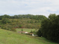


Start from the Saint-Jean-de-Thurac picnic area between the D 813 and the side canal.
(S/E) Walk to the far end of the picnic area, then turn left and cross the D 813. Turn right and follow the left-hand side of the road for 200 m.
(1) Turn left onto Chemin de Noble, marked in blue. Continue along a grassy track until you reach a Lareyronne house; go round it on the right, then turn left and follow the blue or red and green signposts. Continue until you reach a small road; turn right onto it – you’ll see the dovecote opposite.
Carry on along this road, the Route de la Plaine, until you come to a tarmac road on the left called Chemin de Merle.
(2) Walk up this very steep road and, at the top, continue to the left; then, just before the house at No. 205, turn right onto a small grassy path running alongside a barbed-wire fence. Cross the meadow through the open gate. Continue to follow the blue, red and green markings until you reach a road; follow this to the left as far as the ‘Give Way’ sign.
(3) Turn right onto the road, Chemin de la Tour Chappe, for 100 m, then take the small road leading down to the right, Chemin de Lapointe. Pass through the hamlet of Lapointe, then, on the left, continue along the stony then grassy path that runs alongside the Ruisseau de Barrère.
__Caution! This area can be wet and slippery in winter when it rains.
Carry on until you reach the red ‘private property’ sign.
(4) Turn left to follow the path which climbs along the edge of the woodland on the left-hand side and, further on, on the right-hand side. Follow this path to the top of the hill, then continue along the road opposite.
(5) At the first house on the right, turn sharply left onto a grassy track, following the power line until you reach a road, which you should take to the left.
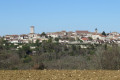
View of the village of Saint-Romain-le-Noble on the right.
Follow this road to the farm at a place called La Mondine; at the letterbox, take the small path on the right. On emerging from the woods, continue along the tarmac road opposite, then turn right onto the Route des Tulipes for 300 metres.
(6) After the second house on the left, cross the road and take a grassy path which climbs to the left at the bottom of the valley towards a wood and a cliff. Continue along this path to the top of the hill and carry on along a small road, the Chemin de Moreau.
(7) At the junction, turn right, then immediately left onto the grassy path until you reach the Route de la Tour.
(8) Follow it to the left for 50 metres and, at the ‘Private Road’ sign, take the grassy path leading down to the right. Follow this to a cluster of houses in the hamlet of Pelleran. Continue to the right along Chemin de Joinique and head for the Saint-Jean-de-Thurac picnic area (S/E).


 Visorando Member

 Association / Club / Walk leader
 Easy