Through woods and vineyards from Montendre-Marcillac Aerodrome

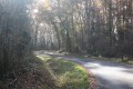
A pleasant route along forest tracks and small roads. Suitable even in very wet weather.

Details

n°4466002
Creation:
Last update:
Last review:
  • Walking
    Activity: Walking
  • ↔
    Distance: 4.95 mi
  • ◔
    Average duration: 2h 25 
  • ▲
    Difficulty: Easy

  • ⚐
    Back to start: Yes
  • ↗
    Ascent: + 135 ft
  • ↘
    Descent: - 138 ft

  • ▲
    Highest point: 256 ft
  • ▼
    Lowest point: 108 ft
  • ⚐ Country: France
  • ⚐ City: Marcillac (33860)
  • ⚑
    Start/End: N 45.276021° / W 0.458461°
  • ❏
    IGN map(s): Ref. 1534SB
  • Hour-by-hour weather

Description of the walk

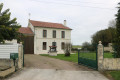
The starting point is in the car park at Montendre-Marcillac Aerodrome.

(S/E) Set off along the small road you have just taken to reach the car park.

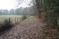
(1) At the junction at the end of the small road, go straight on along the forest track. Follow this track to the end.

(2) When you reach a road where you’ll see glass and cardboard recycling bins on your right, turn right between a woodland on the right and a vineyard on the left. Follow this road, passing forest tracks and a small road on your left, and continue to the end until you come out onto a main road (D23).

(3) Turn left, and almost immediately, cross the road carefully to take the first road on the right towards Les Charrons and Chandas.

(4) On the descent after the last houses, turn right onto a grassy track. (There is a road opposite leading to the village of Chandas.) Follow this track, which becomes a forest track.

(5) When you reach the tarmac road, go straight on, ignoring a small road on your right signposted ‘private road’ (Les Bernards). 200 metres further on, follow the road to the right, ignoring several roads or forest tracks on the left.

(6) Join the D23 and cross it carefully. Continue straight ahead and follow the road through the village of Petit Gablezac.

(1) Take the first road on the left, which will take you back to the aerodrome car park (S/E).

Waypoints

  1. S/E : mi 0 - alt. 154 ft - Airfield car park
  2. 1 : mi 0.17 - alt. 164 ft - Junction at the end of the circular loop
  3. 2 : mi 1.53 - alt. 213 ft - Containers
  4. 3 : mi 2.42 - alt. 249 ft - D23 road
  5. 4 : mi 2.83 - alt. 210 ft - Grassy track
  6. 5 : mi 3.62 - alt. 121 ft - Route
  7. 6 : mi 4.41 - alt. 125 ft - D23 road
  8. S/E : mi 4.95 - alt. 154 ft - Airfield car park

Reviews and comments

5 / 5
Based on 1 review

Reliability of the description
5 / 5
Ease of following the route
5 / 5
Route interest
5 / 5
ARNAUDIN
ARNAUDIN

Overall rating : 5 / 5

Date of your route : Oct 13, 2021
Reliability of the description : ★★★★★ Very good
Ease of following the route : ★★★★★ Very good
Route interest : ★★★★★ Very good
Very busy route : No

A very well-marked route, pleasant, very well maintained, ideal in any weather, with clear, concise and precise instructions.
I highly recommend this walk and would like to thank the route planner
Kind regards

Machine-translated

Other walks in the area

For more walks, use our search engine .

The GPS track and description are the property of this route's author. Please do not copy them without permission.