Country:

 City:
City:


Start on the D 519 from the small car park at a place called Le Contant, just before the roundabout on the road to Grenoble.
(S/E) Opposite the car park, cross the road to Grenoble with care and walk past the Damien Vivier nurseries.
(1) Just after the bend, turn right; the path climbs and passes under a power line.
(2) As you come out of the woods, turn right and continue up towards the houses to the north, passing under the power line once more.
(3) Turn left onto Route des Bruyères behind the farm, follow the path alongside the forest until you reach the junction in the Gourras neighbourhood.
(4) Turn right and head up Chemin du Loup almost to the plateau, about fifty metres before the edge of the woods. Turn left onto the path, enter the woods, go straight on to the T-junction and turn right. Continue to the edge of the woods.
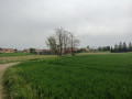
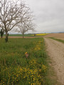
(5) Carry on straight ahead along the Chemin de la Vigne Gauthier, pass between the fields, then follow the edge of the woodland until you reach the road, the Chemin des Terres.
(6) Turn right onto this road and follow it for approximately 350 metres. At the Y-junction, turn sharp right onto Impasse du Pré Terraillat, heading south, and continue along the track, which becomes a dirt track.
At the corner of Le Bosquet (elevation 356), turn left across the fields until you reach the road, Chemin du Loup.
(7) Turn left and, immediately afterwards, turn right onto the path which continues across the fields. It then turns right along the edge of the woodland, then left along the forest edge, and then right again. Carry on to Route des Bruyères. Turn right onto this road and continue towards the Les Bruyères neighbourhood; at the junction, turn right and rejoin the route you took on the way there.
(3) Just before the farm, turn left onto the path leading downhill and follow the route in the opposite direction to return to the car park on the D519 (S/E).

 Visorando Member

 Moderate