Passing through Les Casses in Frangy-en-Bresse

In the north-east of the Burgundian Bresse region, Frangy-en-Bresse stretches from east to west for around 10 km. It shares a natural border with the Jura via the River Seille. A Natura 2000-designated wetland, situated between the rivers Seille and Seillette and created to protect wildlife, is particularly rich in bird species and flora. Along the trail, you’ll pass through the commune’s many hamlets and discover fortified houses and traditional Bresse farmhouses.

Details

n°8090600
Creation:
Last update:
Last review:
  • Walking
    Activity: Walking
  • ↔
    Distance: 6.02 mi
  • ◔
    Average duration: 2h 55 
  • ▲
    Difficulty: Easy

  • ⚐
    Back to start: Yes
  • ↗
    Ascent: + 138 ft
  • ↘
    Descent: - 135 ft

  • ▲
    Highest point: 663 ft
  • ▼
    Lowest point: 597 ft

Photos

Description of the walk

The start is near the town hall and the school, where there is free parking.

A ‘Balades Vertes’ sign lists the three marked routes in Frangy-en-Bresse, including the ‘En passant par les Casses’ route, marked FRA2.

(S/E) From the Place de la Mairie, walk past the school and follow Rue du Bourg.

(1) Note the church on your right and turn left into Traverse du Bourg.

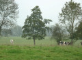
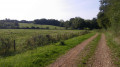
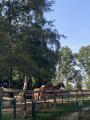
(2) Turn left and continue until you reachthe first dirt track on the left, at the hamlet of Curtil Guillet. You are now on a dirt track that winds through meadows where cows are often seen grazing. Pass over Le Teuil and continue until you reach the junction with the Chemin du Haut de Beauvoir.

(3) Turn right onto the Chemin du Haut de Beauvoir.

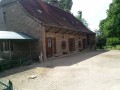
(4) At the next junction, turn left onto the Route de Clémencey. Continue along this road for 2.5 km until you reach the Route de Saint-Germain-du-Bois (D87). The countryside you pass through alternates between meadows and farmland, dotted with a few pretty Bresse farmhouses.

(5) Turn right onto the Route de Saint-Germain-du-Bois (watch out for traffic). Continue for 300 metres.

(6) Take the Chemin de terre de Curtil Pavot until the next junction on the left. You’ll have a lovely view of the Seille on your right.

(7) At the hamlet of Les Vernes, turn left and continue along the track to the BioGretener farm, which has been based in Frangy-en-Bresse for many years.

(8) Turn right onto the Chemin de l’Abergement and continue along this track until you reach the Route de Saint-Germain-du-Bois (D87).

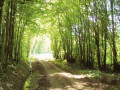
(9) Cross the road (watch out for traffic) and follow the path opposite. Continue along this path through cultivated fields and meadows until you reach the next tarmac road.

(10) Turn left, continue for 100 metres and turn right onto Chemin du Haut de Beauvoir.

(3) Take the path on the right, which will take you back to the hamlet of Curtil Guillet via the reverse route of the outward journey. Continue to the Traverse du Bourg.

(2) Turn right onto the Traverse du Bourg until you reach Rue du Bourg.

(1) Turn right, walk past the school and head towards the Place de la Mairie (S/E).

Waypoints

  1. S/E : mi 0 - alt. 650 ft - Town Hall Square - Seille (Affluent de la Saône)
  2. 1 : mi 0.13 - alt. 663 ft - Crossing the village - Église Saint-Denis (Frangy-en-Bresse)
  3. 2 : mi 0.34 - alt. 633 ft - Junction
  4. 3 : mi 0.8 - alt. 653 ft - Haut de Beauvoir
  5. 4 : mi 1 - alt. 614 ft - Triangular junction
  6. 5 : mi 2.53 - alt. 600 ft - D87 road
  7. 6 : mi 2.72 - alt. 617 ft - Chemin de Curtil Pavot
  8. 7 : mi 3.12 - alt. 600 ft - Les Vernes
  9. 8 : mi 3.49 - alt. 646 ft - BioGretene Farm
  10. 9 : mi 4.05 - alt. 640 ft - D87 road
  11. 10 : mi 4.81 - alt. 653 ft - Road junction
  12. S/E : mi 6.02 - alt. 650 ft - Town Hall Square

Notes

Trainers or light walking shoes are sufficient.
The trail is signposted with directional signs (FRA2) and yellow arrow markings.

Worth a visit

The trail winds through farmland; depending on the season, you’ll see fields of yellow rapeseed, wheat fields or even maize fields. You’ll also be near Clémencey, close to the River Seille, which offers a lovely view. Two other routes have been created in the commune: the 18.5 km ‘From Fields to Forests’ route (marked FRA3) and the 9.5 km ‘From Clémencey to L’Abergement’ route (marked FRA1).

Reviews and comments

4.7 / 5
Based on 1 review

Reliability of the description
5 / 5
Ease of following the route
5 / 5
Route interest
4 / 5
OT Bresse Bourguignonne
• Edited:

Hello,
thank you for sharing your experience.
In summer, it might be best to go in the morning or late in the day. Give it a go!

Have a lovely day

Bresse Bourguignonne Tourist Office
Mélise

Machine-translated

jpclerc
jpclerc
• Edited:

Overall rating : 4.7 / 5

Date of your route : Feb 08, 2025
Reliability of the description : ★★★★★ Very good
Ease of following the route : ★★★★★ Very good
Route interest : ★★★★☆ Good
Very busy route : No

A pleasant and easy route
A very open route, perfect for getting some fresh air in this cool season.
Well worth a visit in summer when the sun’s out!?

Machine-translated

Other walks in the area

For more walks, use our search engine .

The GPS track and description are the property of this route's author. Please do not copy them without permission.