Moulin de l’Étang de Chavenne

A pleasant and peaceful walking and mountain-biking route, following roads and paths to reach the Moulin de Chavenne and its pond.

Details

4100041
Creation:
Last update:
Last review:
  • Walking
    Activity: Walking
  • ↔
    Distance: 5.45 mi
  • ◔
    Average duration: 2h 40 
  • ▲
    Difficulty: Easy

  • ⚐
    Back to start: Yes
  • ↗
    Ascent: + 141 ft
  • ↘
    Descent: - 112 ft

  • ▲
    Highest point: 702 ft
  • ▼
    Lowest point: 617 ft

Photos

Description of the walk

Park at Place de la Mairie in La Chapelle-Saint-Sauveur.

Yellow signposts

(S/E) Take Rue de l’Église and head towards the Croix de Masse junction.

(1) Go straight on along Rue des Pernards for about 150 metres.

(2) At the crossroads with a cross, follow Rue du Château straight ahead until the first junction (cross).

(3) Continue straight on along the road (Rue du Bois d’Avaux), which bends to the right for 350 m.

(4) Before reaching the Bois des Vaux, turn left onto the track and carry on straight ahead, keeping in the same direction.

(5) At the crossroads, turn right towards Chavenne, then turn left onto Chemin des Duchaux. Keep to the right at the next junction.

(6) Turn right at a 90° angle, then right again at the edge of a woodland to reach the Étang and the Moulin de Chavenne.

(7) Turn right and walk for about 200 metres. Take the small path on the left opposite an abandoned farm. Walk past the fish farm and continue along Rue du Bois d’Avaux until you reach a three-way junction.

(8) Turn slightly left to join Rue des Pernards. Turn right, walk past a pond on your right-hand side and continue to the junction you passed on the way out.

(2) Turn left and then carry on straight ahead, following the same route as on the way there, until you reach Place de la Mairie (S/E).

Waypoints

  1. S/E : mi 0 - alt. 669 ft - Place de la Mairie
  2. 1 : mi 0.41 - alt. 699 ft - Croix de Masse, straight on
  3. 2 : mi 0.51 - alt. 696 ft - Junction of Rue des Pernards and Rue du Château
  4. 3 : mi 0.88 - alt. 673 ft - Croix, straight on along Rue du Bois d’Avaux
  5. 4 : mi 1.07 - alt. 659 ft - Path on the left
  6. 5 : mi 1.93 - alt. 666 ft - Route de Chavenne, on the right
  7. 6 : mi 2.44 - alt. 679 ft - Crossroads, on the right
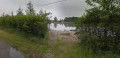
  8. 7 : mi 3.06 - alt. 623 ft - Chavenne Pond and Mill
  9. 8 : mi 4 - alt. 653 ft - Three-way junction, on the left
  10. S/E : mi 5.45 - alt. 669 ft - Place de la Mairie

Worth a visit

Moulin de l’Étang de Chavenne restaurant.
Signposted in the village; swimming open in summer from 15 June to early September.

Reviews and comments

4.6 / 5
Based on 3 reviews

Reliability of the description
5 / 5
Ease of following the route
5 / 5
Route interest
3.7 / 5
Les noux'
Les noux'

Overall rating : 4.3 / 5

Date of your route : Feb 18, 2025
Reliability of the description : ★★★★★ Very good
Ease of following the route : ★★★★★ Very good
Route interest : ★★★☆☆ Average
Very busy route : No

A route of little interest, apart from the fact that it’s accessible to everyone...
all in all, quite pleasant given the bright sunshine......
The ponds were barely visible, if at all......

Machine-translated

pdls
pdls

Overall rating : 4.7 / 5

Date of your route : Oct 09, 2023
Reliability of the description : ★★★★★ Very good
Ease of following the route : ★★★★★ Very good
Route interest : ★★★★☆ Good
Very busy route : No

A perfect route, provided it isn’t too hot, as there are quite a few sections that are completely exposed. The pond in the middle of the route is, unfortunately, almost invisible, hidden by hedges and very off-putting signage. It cannot be used as a destination.
The fact that the route forms a circular pattern is very pleasant.

Machine-translated

daniel et brigitte
daniel et brigitte
• Edited:

Overall rating : 4.7 / 5

Date of your route : Mar 28, 2021
Reliability of the description : ★★★★★ Very good
Ease of following the route : ★★★★★ Very good
Route interest : ★★★★☆ Good
Very busy route : No

No problems at all – clearly signposted and lovely weather

Machine-translated

Other walks in the area

For more walks, use our search engine .

The GPS track and description are the property of this route's author. Please do not copy them without permission.