Country:
 City:
City:


The route starts near Place de la Libération (large car park), by the arcades. A signpost indicates the route, and you’ll find directional studs on the ground, supplemented by enamelled plaques fixed directly to the buildings.
(S) Facing the signpost, take the pedestrian crossing and cross the Grande Rue, then walk past the Auberge de l’Europe – the town’s iconic café-restaurant – and enter the arcades.
The Maison du Bailli (No. 1 on the themed map): a building in Gothic and Renaissance styles. Continue past the patisserie, where you can sample the corniotte, the town’s speciality. This choux pastry on a shortcrust base is available every day of the year in Louhans’ bakeries and patisseries. Turn right onto Rue de l’Église and head towards the church.
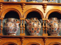
Saint-Pierre Church (No. 2 on the themed map): comprising two buildings, the oldest of which dates back to the 14th century, this church features a polychrome glazed roof. The church is open to the public during the day; you need to walk under the bell tower and enter through the small door on the right. Please note that from spring to late autumn, a colony of swallows nests above the door, so don’t linger!
Walk alongside the church, with the square and round towers on your right, and continue straight on for a few metres until you reach Rue des Cuisines, where you can see the different types of half-timbered architecture.
(1) Turn right into Rue de l’Hôtel de Ville; you’ll find yourself opposite the old Town Hall.
Town Hall (No. 3 on the themed map): an 18th-century building. Take a look to your right to get a full view of the church’s superb roof.
Walk under the archway and then cross the street to reach the front of the town hall. Behind you stands the bandstand. Continue on and turn left into Rue du Capitaine Vic. Carry on until you reach the 17th-century Hôtel-Dieu.
(2) Hôtel-Dieu (No. 4 on the themed map): this former hospital cared for patients until 1977. The wisteria adorning the railings is a magnificent sight in spring when it is in full bloom.
Turn left at the junction of Rue du Capitaine Vic and Rue Edgar Guigot, walking alongside the Hôtel-Dieu to the Museum of Deaf History and Culture.
Museum of Deaf History and Culture (No. 5 on the themed map): this museum traces the history and culture of the deaf community. It also highlights Ferdinand Berthier, a native of Louhans, who worked tirelessly for the recognition of deaf people. His bust is situated opposite the museum.
Continue up Rue Edgar Guigot, passing the Saint Paul Tower (No. 6 on the themed map), a defensive remnant of the town. You will reach Place Saint-Jean.
(E) Continue straight on, leaving the Grande Rue on your left. Turn left into Rue des Dôdanes and continue to the Printing Museum/Museum of Fine Arts.
Printing Museum/Museum of Fine Arts (No. 7 on the themed map): on the ground floor is the former workshop of the newspaper *L’Indépendant*, complete with printing presses and rotary presses. Upstairs, in the Museum of Fine Arts, you’ll find a collection of works by local artists.
Continue along Rue des Dôdanes until you reach the Saint Pierre Tower, the town’ssecond defensive tower.
Saint Pierre Tower (No. 8 on the themed map). Built of brick, there were originally four defensive towers. Today, only two remain.
Carry on a little further to the corner of Rue de la Grenette and the Salle de la Grenette.
Salle de la Grenette (No. 9 on the themed map): a former grain market where, amongst other events, the ‘Concours des Glorieuses’ takes place – a competition for fine poultry slaughtered in mid-December.
Carry on up Rue de la Grenette until you reach the Grande Rue – that is, the street with the arcades (No. 10 on the themed map). You are now in the town centre, with 200 metres to your right and 200 metres to your left. This is one of the longest arcaded streets in France. There are numerous shops lining this street. So do feel free to ‘explore the arcades’, that is, to stroll around and browse.
Cross the Grande Rue towards Rue de l’Hôtel de Ville and turn left under the arcades. Continue on to the theatre.
Theatre (No. 11 on the themed map): this is one of the last Art Deco-style theatres. It has been listed on the supplementary list of Historic Monuments since the year 2000.
Carry on for a few metres to the Loggia (on the other side of the arcades), a unique building beneath the arcades.
Continue along the arcades until you reach Place Saint-Jean, near the Tourist Office (E).


 Tourist office
 Moderate