


Refine your search for walks in Église Saint-Martin (Villarceaux)
Église Saint-Martin (Villarceaux) walks


 Around Omerville
 Visorando Member
 5.38 mi
 +692 ft
 -689 ft
 3h 05
3h 05
 Easy
Easy
 Departure from Omerville (Val-d'Oise)
A route starting from the picturesque village of Omerville, offering the chance to explore this part of the Aubette de Magny valley.
Grand tour of Île-de-France in 34 stages on the GR®11
 528.35 mi
+22,037 ft
-22,156 ft
34 days
528.35 mi
+22,037 ft
-22,156 ft
34 days
 Difficult
Departure from Paris
Difficult
Departure from Paris
This marked GR® route around the Île-de-France region (with a few forays into neighbouring departments and regions) complements its "little brother", the GR®1, by forming a circular route around Paris, generally with a slightly larger radius.
It follows the same overall pattern: first, a radial section starting from Paris (more precisely from the Pont d'Austerlitz, near the former confluence of the Bièvre and the Seine), going up the entire Bièvre valley, then continuing to Villiers-Saint-Frédéric, in the Yvelines. From there, it is a circular route that loops around the Île-de-France region, close to its borders with neighbouring regions.
The route passes through beautiful regions, often untouched by intensive urbanisation, regional nature parks and other protected natural areas, and takes in some architectural wonders.
From Genainville to Chars in the heart of the French Vexin region.
18.42 mi
+988 ft
-1,040 ft
9h 20
 Very difficult
Departure from Genainville (Val-d'Oise)
Very difficult
Departure from Genainville (Val-d'Oise)
Seventh stage of the Grand Tour of Île-de-France on the GR®11, starting from the village of Genainville, in the heart of the French Vexin, and heading towards Chars station further east. This stage goes hand in hand with the previous Mantes-Genainville stage, with a night in Genainville or the surrounding area necessary to walk between Mantes and Chars stations. This beautiful stage continues the crossing of the equally magnificent French Vexin Regional Nature Park, heading generally eastwards. It joins andthen climbs up the Aubette de Magny valley, crosses a series of agricultural plateaus between Oise and Val d'Oise before descending into the Viosne valley to reach Chars.
Walks near Église Saint-Martin (Villarceaux)
Villages and landscapes of the French Vexin region along the Aubette
 11.42 mi
+535 ft
-636 ft
5h 45
11.42 mi
+535 ft
-636 ft
5h 45
 Moderate
Departure from Cléry-en-Vexin (Val-d'Oise)
Moderate
Departure from Cléry-en-Vexin (Val-d'Oise)
The walk takes you through a string of pretty villages, each with its own church boasting distinctive architecture and, for the most part, also home to a castle, the most remarkable of which are those at Guiry-en-Vexin, Théméricourt and Viry. There are also several museums along the route: the Archaeological Museum, the Tools Museum, the Harvest Museum and the Maison du Parc.It is also an opportunity to admire the open landscapes of this very hilly French Vexin region, where fields, meadows and forests intermingle. The calcareous meadows are particularly striking in spring due to the abundance of flowers found there.
From Bonnières to Vernon via Giverny
 9.22 mi
+144 ft
-141 ft
4h 20
Moderate
Departure from Bonnières-sur-Seine (Yvelines)
9.22 mi
+144 ft
-141 ft
4h 20
Moderate
Departure from Bonnières-sur-Seine (Yvelines)
Follow in the footsteps of Claude Monet, considered one of the founders of Impressionism, on a hike from station to station along the Seine and its hillsides. Beautiful views punctuate the route. Halfway along the route, there are several possible visits in Giverny, where the painter lived and worked from 1883 until his death in 1926. At the end of the hike, the collegiate church of Vernon is worth a detour.
From Chars to Bornel via the Rosne hills
 21.42 mi
+1,191 ft
-1,257 ft
10h 55
Very difficult
Departure from Chars (Val-d'Oise)
21.42 mi
+1,191 ft
-1,257 ft
10h 55
Very difficult
Departure from Chars (Val-d'Oise)
This is the eighth stage of the Grand Tour de l'Île-de-France on the GR®11, starting from Chars station in the Val d'Oise and heading towards Bornel-Belle-Église station in the Oise, through the north-eastern part of the French Vexin and the borders of the Pays de Thelle. This stage is unique in that it runs along the border between the Val d'Oise and Oise departments, with roughly 50% of the route on each side. The proposed itinerary passes through the Buttes de Rosne, the highest natural point in Île-de-France, although it deviates slightly from the GR® for this.
From Chars to Santeuil via the Buttes de Rosne
 14.60 mi
+801 ft
-830 ft
7h 25
Moderate
Departure from Chars (Val-d'Oise)
14.60 mi
+801 ft
-830 ft
7h 25
Moderate
Departure from Chars (Val-d'Oise)
The Buttes de Rosne are the highest natural points in the Île-de-France region. Situated in the Vexin, this easily accessible area can be comfortably explored on foot with the family over half a day or a full day. This route starts in Chars and returns via Santeuil, offering a variety of landscapes along the way. The first part of the route takes you mainly through fields. The second part is more wooded.
From Mantes-la-Jolie to Bonnières via the Moisson circular route
 16.53 mi
+394 ft
-436 ft
7h 55
Difficult
Departure from Mantes-la-Jolie (Yvelines)
16.53 mi
+394 ft
-436 ft
7h 55
Difficult
Departure from Mantes-la-Jolie (Yvelines)
A long walk from station to station with many different facets! The route follows the Seine, and crossing it halfway along via the Vétheuil ferry makes for a pleasant break. It also runs alongside the Moisson nature reserve, offering superb heathland scenery. There is also some beautiful architectural heritage to be seen.
N.B. The ferry across the Seine operates seasonally: this walk can only be undertaken at weekends, from April to October (see practical information).
From Rosny-sur-Seine to Bonnières-sur-Seine through the woods
 14.79 mi
+794 ft
-837 ft
7h 30
Difficult
Departure from Rosny-sur-Seine (Yvelines)
14.79 mi
+794 ft
-837 ft
7h 30
Difficult
Departure from Rosny-sur-Seine (Yvelines)
A walk from station to station through the Rosny-sur-Seine Regional Forest, the Bois Boutilliers, the Vallée des Prés and the Houssaye, during which you’ll also discover some beautiful views and heritage sites.
From Mantes to La-Roche-Guyon, between the Seine and the hillsides
 13.59 mi
+1,355 ft
-1,411 ft
7h 25
Difficult
Departure from Mantes-la-Ville (Yvelines)
13.59 mi
+1,355 ft
-1,411 ft
7h 25
Difficult
Departure from Mantes-la-Ville (Yvelines)
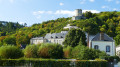
A linear walk between Mantes and La-Roche-Guyon, offering varied scenery ranging from the banks of the Seine to the Seine hillsides. It passes through beautiful villages in the Vexin region, culminating in Vétheuil and its church painted by Claude Monet, as well as La-Roche-Guyon and its château, which served as the setting for Edgar P. Jacobs in a Blake and Mortimer adventure, *Le Piège diabolique*.N.B.: the return journey to Mantes station is by bus, which runs from Monday to Friday.
From Mantes-la-Jolie to Genainville through the French Vexin
 13.56 mi
+725 ft
-564 ft
6h 50
Difficult
Departure from Mantes-la-Ville (Yvelines)
13.56 mi
+725 ft
-564 ft
6h 50
Difficult
Departure from Mantes-la-Ville (Yvelines)
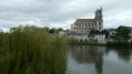
Sixth stage of the Grand Tour de l'Île-de-France on the GR® 11, linking Mantes-Station railway station in the Yvelines to the village of Genainville in the Val d'Oise, in the heart of the French Vexin. This stage is the first part of a two-day route, the aim of which is to connect Mantes-Station railway station to Chars railway station, further north-east in the Val d'Oise.The stage begins in Mantes-la-Jolie in the Seine valley and heads north through the south-western part of the Vexin Français Regional Nature Park, quickly passing from one of the lowest points in the region (crossing the Seine, at ~18 m) to one of the highest points (the beech forest at Villiers-en-Arthies, at 205 m).The French Vexin, with its unspoilt agricultural and wooded landscapes, is a magnificent region where it is very pleasant to hike.
Vexinois route between Chaumont-en-Vexin and Gisors
8.73 mi
+374 ft
-466 ft
4h 20
Moderate
Departure from Chaumont-en-Vexin (Oise)
Crossed by numerous waterways, the town of Chaumont-en-Vexin has been awarded the Petite Cité de Caractère label. Along the route, you can discover the rolling landscapes of the Vexin and the Troesne valley, with two megaliths along the way: the Dolmen des Trois-Pierres in Trie-Château and the Pierre Droite de Delincourt.