Country:

 City:
City:


This walk starts at Chaumont-en-Vexin station (train J from Saint-Lazare station). You will need to leave a car at the end point, Gisors station, or take the train back in the opposite direction to Saint-Lazare station.
This walk is not signposted. Please follow the route description carefully.
(S) With your back to the station, cross the footbridge then turn right onto Rue de la Laiterie until you reach the three-way junction. Turn left onto Rue de la Pissotte. This road winds upwards in a spiral.
(1) Keep well to the right at the next junction and walk along the edge of the woods for about 500 metres.
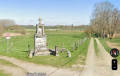
(2) At the Fork in the road, stay on the road to the right and ignore the path leading off to the left towards La Pierre Droite, through the fields. Then leave the road and turn right, continuing along the edge of the woods until you reach the crossroads.
(3) Enter the Bois de Gomerfontaine on the right via a road, then, at the Fork in the road, continue straight on through the woodland, following the railway line.
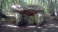
(4) Turn left and you’ll reach the Dolmen des Trois Pierres.
(5) Walk alongside the railway line for a short while and pass a sewage treatment plant.
(6) Turn right onto the Chemin des Groux, then go through the tunnel under the D981 and carry on straight ahead. You’ll come to a road; follow it to the right.
(7) Go through the tunnel under the railway line and continue along Rue de la Gare de Trie Château.
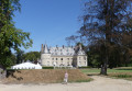
(8) Turn left onto Rue Nationale. On your right, you can see Trie Castle. Continue for about 300 metres and turn right onto Rue de la Forêt.
(9) At the junction, turn left onto the Sentier Rural. At the end, turn left onto Route de Villers and rejoin Rue Nationale.
(10) Follow it to the right, then a little further on, take Rue Marchandin on your right and walk alongside the shopping centre. Continue along Rue de la Folie, pass the water tower, then turn right.
(11) As you come out of the bridge under the railway lines, take the path on the left and head towards La Troësnes.
(12) Head right, crossing three bridges over the river, then take a footpath which leads to Rue Paul Elliard.
(13) Turn right, cross a bridge and arrive at Rue de la Troësnes.
(14) Turn left onto this street, continue along Rue du Bouloir on the right and cross Rue François Cadenne. 200 metres further on, enter the Frédéric Passy Environmental Park on the right.
(15) Walk halfway round the park on the left-hand side, cross a small bridge, then continue round the park on the right-hand side until you reach Rue de Saint-Ouen.
(16) Turn left onto this street, then turn right onto Rue de l’Hospice and emerge onto Rue des Annonciades.
(17) Turn left, walk past Gisors Town Hall, then turn right onto Rue de Paris, cross the Epte and turn left onto Rue du Colonel O’Diette. Continue to the next junction.
(18) Turn right onto Rue de Preslay, then, at Place de Blanmont, take the steps on the right to enter the castle gardens.
(19) Cross the garden, then take the small bridge to reach Rue Jean Jaurès on the opposite side.
(20) At the roundabout, turn left onto Rue Walter Bruder, then right onto Avenue de Verdun. Turn left onto Rue de Dieppe and then right onto Avenue de la Gare, which leads to Gisors station (E).


 Visorando Member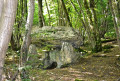
 Easy
Easy