Country:

 City:


Park in the car park next to the War Memorial, on the corner of Rue Charles de Gaulle and Rue des Fontaines in Omerville.
(S/E) With your back to the monument and facing the fire hydrant, turn right (Rue Charles de Gaulle) towards the village centre. When you reach Place Saint-Martin, walk along its left-hand side, passing a Templar cross, then turn left and immediately right into Rue Bizet. Pass under a portico and then turn right. Take thefirst path on the left, which will soon lead you to a crossroads.
(1) Take thesecond road opposite, which forms part of theGR®11(marked in white and red), and head down to the pumping station before reaching a four-way junction (D86). Cross with care and continue straight ahead towards Louvière, slightly uphill. Ignore a road on the left and reach the large crossroads at Louvière, with a central reservation and a stone pillar.
(2) Walk a few more metres and leave theGR® to turn left onto thePR® path, marked in yellow. Follow a gentle climb to the edge of a wood and walk along its edge until you reach the corner of the field.
(3) Turn left into the woodland, still on thePR®, and keep to the right at the edge of the woodland, continuing straight on to reach Rue de Saint-Gervais.
(4) Cross the road and take the path opposite, slightly to the right. Then turn left and join a small road leading to the hamlet of Vaumion. Take thefirst left, Chemin des Vignes, then, just after number 6, take the path leading uphill to the right and continue to a four-way junction.
(5) Take the path on the left downhill and you’ll soon rejoin thePR®. Continue along the path opposite, then, when you reach the road, keep right. Cross the Aubette via the bridge, then head slightly uphill to reach the D86. Turn right onto it, taking care, and head towards the castle, then on to a crossroads opposite the church.
(6) Cross the road and walk up Rue du Cimetière. At the top, turn left onto Rue Haute, then turn right immediately. After passing the last houses, at a Fork in the road, keep to the right. At thefirst crossroads, carry on straight ahead until you reach another four-way junction.
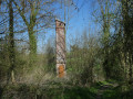
(7) Turn 90° to the left and head down towards a wood. Follow the edge of the wood until you reach the water ram.
(8) Head back up the path and, at the end, turn right. At thefirst house, at No. 2, ignore the tarmac and take the path on the right. At the end, head left and you’ll come to a small road. Take this to the left and enter the village. When the road bends to the right, go up the steps opposite.
(9) At the top, take Rue des Courtins on the left. After 50 m, head up the grassy path on the right which runs above the road. You’ll reach a junction; turn right onto Rue des Groues, then left onto Rue des Jardins. Continue along the path leading to the church, then turn right onto the cross street (Rue de l’Église) and head towards the church. Opposite the porch, take Rue du Presbytère, then turn left onto Rue des Fontaines, which leads back to the War Memorial car park (S/E).


 Association / Club / Walk leader
 Moderate

 Visorando Member


 Very difficult