


Refine your search for walks in Église de la Nativité de Notre-Dame (Champdray)
Église de la Nativité de Notre-Dame (Champdray) walks


 La Colline au Loup (Laleu Colline) via the Spiémont geodesic chimney
 Visorando Member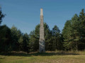
 5.90 mi
 +843 ft
 -856 ft
 3h 25
3h 25
 Easy
Easy
 Departure from Champdray (Vosges)
The hike begins at the Spiémont geodesic chimney with its orientation table, then takes you to discover "sacrificial stones" with magnificent cup marks that are said to have been used in ancient rituals. The route then heads to Laleu Colline (Colline au Loup), a small hill with a rocky summit which offers panoramic views of the Middle Vosges from its footbridge. On the way back, the route passes through the Bouyère peat bog before reaching the village of Champdray.
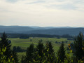
Geodetic chimney of Spiémont
 1.99 mi
+315 ft
-331 ft
1h 10
Easy
Departure from Champdray (Vosges)
1.99 mi
+315 ft
-331 ft
1h 10
Easy
Departure from Champdray (Vosges)
This walk provides quick access to a beautiful viewpoint at the summit of Spiémont, where you can enjoy a panoramic view of the Vosges and the Vologne valley. The presence of a geodesic chimney and an orientation table complete the hike.
Walks near Église de la Nativité de Notre-Dame (Champdray)
Gérardmer - Les Champis
7.48 mi
+2,480 ft
-915 ft
5h 35
 Moderate
Departure from Xonrupt-Longemer (Vosges)
Moderate
Departure from Xonrupt-Longemer (Vosges)
First stage of the Gérardmer Mini-Trek. On this first day, you will discover the aerial landscapes of Le Poli and the heights of Lispach, as well as the isolated stubble fields above the Vologne Valley. This stage allows you to make steady progress towards the Chalet des Champis, where you will spend the night. It is also an opportunity to spend a night in an unguarded cabin that has (almost) everything to please: isolated and at least a 30-minute walk from any built-up area, in the middle of the thatched cottages, accessible to all and all year round...It is a must-see in the area.
Southern route of the Epinal fortress
 11.88 mi
+1,161 ft
-928 ft
6h 30
Moderate
Departure from Arches (Vosges) (Vosges)
11.88 mi
+1,161 ft
-928 ft
6h 30
Moderate
Departure from Arches (Vosges) (Vosges)
4th stage of the tour of the Épinal stronghold via the Forts, taking you from Arches via the Réduit du Bois d’Arches, the Bois d’Arches intermediate depot, Fort du Bambois, the Étang du Bult intermediate depot, Fort des Friches and finishing at Fort du RoulonThis is a linear walk, so please leave a car at the Morevoid pond after Roulon on the road to Uzemain. Make your way to the starting point in Arches via Nayemont, Uriménil, Dounoux and Hadol.
From Lake Longemer to Lake Blanchemer
 11.03 mi
+2,979 ft
-2,169 ft
7h 40
11.03 mi
+2,979 ft
-2,169 ft
7h 40
 Difficult
Departure from Xonrupt-Longemer (Vosges)
Difficult
Departure from Xonrupt-Longemer (Vosges)
The first stage of a two-day bivouac hike with an overnight stay at Lac de Blanchemer, passing by Lac du Lispach, which is reminiscent of a Canadian landscape, and the Machais peat bog.
Difficulty and beautiful views sum up this first stage.
Remiremont - Méloménil
 19.59 mi
+1,608 ft
-1,883 ft
10 hrs
19.59 mi
+1,608 ft
-1,883 ft
10 hrs
 Very difficult
Departure from Remiremont (Vosges)
Very difficult
Departure from Remiremont (Vosges)
The path leaves the Moselle valley and heads towards the Canal des Vosges. This mainly wooded walk is enhanced by traditional Lorraine farmhouses.
Gérardmer – Honneck – Sotré
 12.06 mi
+1,220 ft
-2,782 ft
6h 35
Difficult
Departure from La Bresse (Vosges)
12.06 mi
+1,220 ft
-2,782 ft
6h 35
Difficult
Departure from La Bresse (Vosges)
This second stage of the Gérardmer Mini-Trek links the Chalet des Champis to Petit Xonrupt, passing through some of the most beautiful landscapes of the Hautes-Vosges. After a descent into the Vologne valley, the route climbs back up to the heights of La Bresse-Hohneck, before reaching Lac de la Lande, the Schmargult farmhouse inn and the famous Route des Crêtes. The walk continues with a long descent past the Sotré mountain refuge, Lake Retournemer and the shores of Lake Longemer, before reaching the centre of Xonrupt-Longemer. A varied stage combining forests, high-altitude scree slopes, glacial lakes and remarkable panoramic views.
From the Cabane des Champis to Lac de Blanchemer
 8.77 mi
+1,627 ft
-2,201 ft
5h 25
Moderate
Departure from La Bresse (Vosges)
8.77 mi
+1,627 ft
-2,201 ft
5h 25
Moderate
Departure from La Bresse (Vosges)
Starting from Les Champis, the route passes through the Marécage Rouge Feigne, the Col de Thiaville (alt. 1,112 m), the Hohneck (alt. 1,363 m) and the Col du Wormspel (alt. 1,277 m) before descending towards Lac de Blanchemer.
From the Chalet de Rouge Mousse to the Cabane des Champis
 6.55 mi
+1,732 ft
-968 ft
4h 30
Moderate
Departure from La Bresse (Vosges)
6.55 mi
+1,732 ft
-968 ft
4h 30
Moderate
Departure from La Bresse (Vosges)
Starting from the Chalet de Rouge Mousse, the route takes you to Lac des Corbeaux, then via the GR®533 to La Roche Beauty (viewpoint), and on to Mont Moyenmont (alt. 969 m) to reach La Chaume des Champis and its hut.