From Vagney to La Bresse via Sapois, Rochesson and Gérardmer

An 8-hour walk in the mid-mountain range, starting from Vagney (Cremanvillers), passing through Sapois, Rochesson, Gérardmer (Les Bas-Rupts) and the Col de Grosse Pierre, finishing at La Bresse.

Details

76940
Creation:
Last update:
Last review:
  • Walking
    Activity: Walking
  • ↔
    Distance: 14.65 mi
  • ◔
    Average duration: 9h 25 
  • ▲
    Difficulty: Difficult

  • ⚐
    Back to start: No
  • ↗
    Ascent: + 3,058 ft
  • ↘
    Descent: - 2,300 ft

  • ▲
    Highest point: 3,435 ft
  • ▼
    Lowest point: 1,325 ft
  • ⚐ Country: France
  • ⚐
  • ⚐ City: Vagney (88120)
  • ⚑
    Start: N 48.020987° / E 6.710737°
  • ⚑
    End: N 48.002254° / E 6.873064°
  • ❏
    IGN map(s): Ref. 3519OT, 3618OT, 3618OTR, 3619OT, 3619OTR
  • Hour-by-hour weather

Photos

Description of the walk

Take an SNCF coach from La Bresse (on the Place du Champtel) at 7.20 am, which will take you to Vagney (Crémanvillers); the walk starts at 8.00 am.

(S/E) At the junction in Crémanvillers (100 metres from the bus stop on the way back towards Vagney Centre), take the Route du Haut du Tôt for 100 metres, then turn right onto a small road.

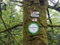
(1) After 150 m you’ll come to a footpath (marked with Red Cross symbols). Follow it for about one kilometre, cross the road and continue to follow the Red Cross symbols.

(2) Pass through the Breux housing estate and continue along the Chemin des Savoyards (signposted), following the Ruisseau du Bouchot to Sapois.

(3) At the entrance to the village, take a path leading uphill to the left. After 150 m, you’ll reach a small road; go down it to the right and, after 200 m at the crossroads, take the road to the left. 100 m further up, a path (marked with a Blue Cross) branches off to the right; follow it to Cens-la-Ville.

(4) Cross the Col de Sapois road and head up towards the Croix de la Houblivière, following a path (marked with yellow Saltires).

(5) Take the path that starts inside the bend (small wooden steps, marked with Yellow Circles and Red Circles). This path follows the ridge above Rochesson to Les Cinq Sentes (Club Vosgien shelter).

(6) Then take the path (Red Circles) towards the Roche des Ducs (quite technical and rocky; proceed with caution).

(7) At the Roche des Ducs, continue to follow the path (marked with Red Circles) towards the Roche Jean des Houx.

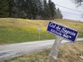
(8) Continue along the signposted path towards the Col de Sapois.

(9). Once you reach the road leading to the pass, follow it for 500 m to the right, then turn right onto the wide Chemin de l’Urson (marked with Green Circles). Follow this for about 3 km, until you reach the Col du Haut de la Côte and the “Chalet Fleuri” hotel.

(10) Take the road towards “Le Xetté” opposite, and just after the hotel, follow the path branching off to the right. After 200 m, join the small Rein du Beau road, which you follow to the right as far as Les Bas Rupts. Pass under the ski jump and past the “La Drosera” inn, then follow the road towards Les Hauts Rupts for 1 km (towards La Croix Claudé, marked with Red Circles).

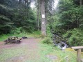
(11) At Les Hauts Rupts, at the junction of four roads, take the one on the right and continue for 750 m, passing the Pierre Marie Louise; then take the path on the left (after a picnic area) towards La Croix Claudé (still marked with Red Circles).

(12) At the Chalet de la Croix Claudé, continue towards La Bresse (signposted). Keep following the red circles. Once you reach the ridge, the signposting changes (red triangles and circles) and the path descends towards La Gesse and the Col de Grosse Pierre.

(13) At the pass, cross the road and the large car park, and follow the green circles. Then take the La Bresse-Centre path (signposted and marked with blue saltires).

(14) Pass La Roche and continue along the path marked with blue saltires, which will take you back to La Bresse-Centre.

(15) Cross the Moselotte and head for the swimming pool car park.

Waypoints

  1. S : mi 0 - alt. 1,325 ft - Near the - Moselotte (rivière)
  2. 1 : mi 0.14 - alt. 1,342 ft - Red Cross trail
  3. 2 : mi 1 - alt. 1,407 ft - Les Breux. Close to the - Bouchot (rivière)
  4. 3 : mi 1.69 - alt. 1,440 ft - Take the path leading uphill to the left
  5. 4 : mi 2.85 - alt. 1,519 ft - Head up towards the Croix de la Houblivière
  6. 5 : mi 3.21 - alt. 1,683 ft - Path with small wooden steps
  7. 6 : mi 4.12 - alt. 2,162 ft - Cinq Sentes
  8. 7 : mi 4.92 - alt. 2,789 ft - Roche des Ducs
  9. 8 : mi 6.31 - alt. 2,635 ft - Roche Jean des Houx
  10. 9 : mi 6.88 - alt. 2,740 ft - Col de Sapois (830m)
  11. 10 : mi 8.78 - alt. 2,621 ft - Col du Haut de la Côte (799m)
  12. 11 : mi 10.03 - alt. 2,920 ft - Crossroads where four paths meet
  13. 12 : mi 11.15 - alt. 3,386 ft - Croix Claudé
  14. 13 : mi 12.14 - alt. 3,130 ft - Col de Grosse Pierre (945m)
  15. 14 : mi 13.06 - alt. 2,723 ft - La Roche
  16. 15 : mi 14.56 - alt. 2,070 ft - La Bresse Centre - Moselotte (rivière)
  17. E : mi 14.65 - alt. 2,060 ft - Car park by the swimming pool

Notes

A fairly long hike, but without any major difficulties (apart from the climb up to the Roche des Ducs).
Sturdy, high-top walking boots and walking poles are strongly recommended.
Make sure you bring enough drink for the day, as whilst the trails and paths are sometimes damp, there are few sources of drinking water along the route.
There is a Club Vosgien shelter at Les Cinq Sentes above Rochesson and a lovely public chalet at La Croix Claudé.
Food and drink are available at the Bas-Rupts Cross-Country Ski Centre and at the Col de Grosse Pierre.
You may wish to take the IGN map 3618OT.

Worth a visit

Stop for a break at the Club Vosgien shelter at Les Cinq Sentes and at the Chalet de la Croix Claudé.
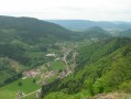
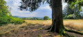
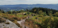
Magnificent panoramic views from the summit of the Roche des Ducs (850m), towering 300m above the village and the Rochesson valley.
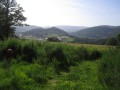
From the Col de Grosse Pierre, there are lovely views over the Bresse and its valleys.

Reviews and comments

4.5 / 5
Based on 2 reviews

Reliability of the description
4.5 / 5
Ease of following the route
4.5 / 5
Route interest
4.5 / 5
Mary et Bernie
Mary et Bernie

Overall rating : 4.3 / 5

Date of your route : Aug 21, 2021
Reliability of the description : ★★★★☆ Good
Ease of following the route : ★★★★☆ Good
Route interest : ★★★★★ Very good
Very busy route : No

A superb, long and enjoyable walk with a few technical sections leading up to the Roche des Ducs.
We arrived by bus from Remiremont. As indicated, get off at the Crémanvillers stop, retrace your steps towards the crossroads (about 150 metres) and follow the signs for Haut Tôt.

Machine-translated

bryer
bryer

Yes, of course, that was a mistake on my part.

Machine-translated

Bressaud
Bressaud

You’re talking about the Piquante Pierre – I think you mean the Roche des Ducs??

Machine-translated

bryer
bryer

Overall rating : 4.7 / 5

Date of your route : Sep 28, 2014
Reliability of the description : ★★★★★ Very good
Ease of following the route : ★★★★★ Very good
Route interest : ★★★★☆ Good

A lovely walk.
The climb up La Piquante Pierre was a bit tricky, though there were handholds to help with the more challenging sections.
The descent to La Bresse was very pleasant.
We caught the bus at 5.30 pm from La Bresse to get back to Crémanvillers and our car.
What’s more, it was a sunny day, which meant we were able to enjoy it to the full.

Machine-translated

Other walks in the area

For more walks, use our search engine .

The GPS track and description are the property of this route's author. Please do not copy them without permission.