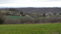
Circular route from the Bois de la Limone to Assieu

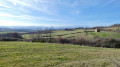
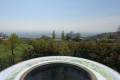
A walk along small tarmac roads offering sweeping views of the Pilat massif and, in places, the Vercors massif. The forest paths can be a little muddy in wet weather.

Details

44656422
Creation:
Last update:
Last review:
  • Walking
    Activity: Walking
  • ↔
    Distance: 3.98 mi
  • ◔
    Average duration: 2h 10 
  • ▲
    Difficulty: Easy

  • ⚐
    Back to start: Yes
  • ↗
    Ascent: + 397 ft
  • ↘
    Descent: - 390 ft

  • ▲
    Highest point: 1,220 ft
  • ▼
    Lowest point: 869 ft

Photos

Description of the walk

Use the signposted car park behind the church.

(S/E) Leave the car park and take Rue des Jeux on the right. At the junction, turn left onto Rue Taramas. Follow this street up to the junction with Rue de Chiney, which you take on the left.

(1) Take the street on the left, called Rue des Bûcherons, which continues to climb steadily before levelling out, and the view opens up.

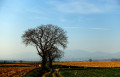
(2) Carry on straight along the road until you reach a large building at a place called Le Canard. The road turns at a right angle round this building. Continue along the road until the next right-hand bend at a right angle. A large tree marks the junction with stony footpaths.

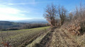
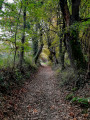
(3) Leave the tarmac and take the path opposite, which continues from the road. Follow the main path as it winds through the Bois de la Limone until you reach the junction with aGR® trail.

(4) Turn right onto it for a few metres, then leave it to follow the path on the left which joins the little road to Le Vaux.

(5) Take this on the left, then, a few metres further on, leave it again to take the path that continues it round a bend. Continue straight on through the forest until you reach a four-way junction with large trees, where you rejoin the GR®.

(6) Turn right and follow it until you rejoin the Route du Vaux, which you follow to the left for 100 metres. Leave theGR® and head down this road towards Assieu. Pass Les Vanaux and arrive at an iron footbridge.

(7) Turn left onto Rue Montarzin, following it as it curves to the right. Pass the Impasse du Sentier, then turn left onto Rue des Jeux, which leads back to the church and the car park (S/E).

Waypoints

  1. S/E : mi 0 - alt. 876 ft - Car park behind the church
  2. 1 : mi 0.25 - alt. 938 ft - Junction with Route des Bûcherons
  3. 2 : mi 0.91 - alt. 1,138 ft - Junction, go straight on
  4. 3 : mi 1.64 - alt. 1,030 ft - Leaving the road
  5. 4 : mi 2.28 - alt. 1,158 ft - GR°°®°° junction
  6. 5 : mi 2.57 - alt. 1,204 ft - Arrival by road
  7. 6 : mi 2.81 - alt. 1,220 ft - Four-way junction
  8. 7 : mi 3.77 - alt. 892 ft - Iron footbridge
  9. S/E : mi 3.98 - alt. 876 ft - Car park behind the church

Always be cautious and plan ahead when you're outdoors. Visorando and the author of this route cannot be held responsible for any accidents occurring on this route.

The GR® and PR® markings are the intellectual property of the Fédération Française de Randonnée Pédestre.

Reviews and comments

4.1 / 5
Based on 3 reviews

Reliability of the description
4.3 / 5
Ease of following the route
4.7 / 5
Route interest
3.3 / 5
User 26292680

Overall rating : 4 / 5

Date of your route : Jan 05, 2026
Reliability of the description : ★★★★☆ Good
Ease of following the route : ★★★★★ Very good
Route interest : ★★★☆☆ Average
Very busy route : No

Route to do in winter.

Machine-translated

Darbon
Darbon
• Edited:

Overall rating : 4.7 / 5

Date of your route : May 10, 2024
Reliability of the description : ★★★★★ Very good
Ease of following the route : ★★★★★ Very good
Route interest : ★★★★☆ Good
Very busy route : No

Thank you for suggesting this walk: the lovely weather meant we could see, to the west, the plain leading down to the Rhône valley with its crops; to the east, the Belledonne mountain range; and to the south, the fortified site of Surieu, with its church, former vicarage and keep.
The paths through La Limone wood were muddy, but that’s to be expected after this spell of rain… We headed straight to point 6 from point 4, as the path was a succession of puddles…
A very enjoyable walk for my ‘Marche Douce’ group.
Thanks to the author for the detailed description.

Machine-translated

nono 12620
nono 12620

Overall rating : 3.7 / 5

Date of your route : Feb 21, 2024
Reliability of the description : ★★★★☆ Good
Ease of following the route : ★★★★☆ Good
Route interest : ★★★☆☆ Average
Very busy route : No

I think it’s a shame that the route follows the road far too often, when there are plenty of footpaths that can be reached quite quickly from the church car park.

The walk through the forest is very pleasant.

Machine-translated

Other walks in the area

For more walks, use our search engine .

The GPS track and description are the property of this route's author. Please do not copy them without permission.