


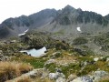
Water point at the “Campana de Cloutou” refuge.
A hut above the “Grésiolle” dam.
You will be in the high mountains. You must be properly equipped.
Don’t forget a sheet for the refuge, toiletries and warm clothes for the evening (2,235 m).
Walking poles may be useful on the descents; take 2 litres of water, and clothing to protect against rain and the cold.
A map, route description, .gpx track and a compass are essential for the second day.
Weekend at the Campana de Cloutou mountain hut


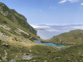
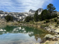
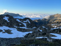
A two-day hike offering the chance to admire numerous mountain lakes and explore three valleys.
The first day does not present any major difficulties but involves a significant elevation gain.
On the second day, the walk takes place off the marked trail, using cairns as landmarks: this should only be undertaken in good weather.
Details
Creation:
Last update:
Last review:
-
 Activity: Walking
 -
 Distance: 15.05 mi
 -
 Average duration: 2 days
 -
 Difficulty: Difficult
 -
-
 Back to start: Yes
 -
 Ascent: + 5,443 ft
 -
 Descent: - 5,423 ft
 -
-
 Highest point: 8,258 ft
 -
 Lowest point: 3,963 ft
-
 Country:
France
Country:
France
-
 Areas: Pyrenees, Massif de l'Arbizon
 -
 City:
Campan (65710)
City:
Campan (65710) -
 Start/End: N 42.926959° / E 0.202349°
 -


 Hour-by-hour weather
Photos
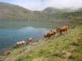
Stages of the route
This route needs several days, find the details below:
Notes
Worth a visit
Artigues, 65710 Campan: Lodges
“Refuge de Campana de Cloutou”: Campana Mountain Hut
Artigues: Artigues
Reviews and comments
4.7 / 5
Based on 5 reviews
Reliability of the description
4.5 / 5
4.5 / 5
Ease of following the route
4.7 / 5
4.7 / 5
Route interest
4.8 / 5
4.8 / 5

lemarcheur65

Hello User 12306033
You wrote:
All in all, a lovely walk between Lac de l’Oule and Campana de Cloutou via the Bastan refuge. And back via Pic de Bastan and Lac de Bastan. A bit of a let-down at Campana, where the lake had completely run dry. The same went for Lac de l’Oule, which was almost empty
The circular route I’m suggesting doesn’t go via Lac de l’Oule or the Bastan mountain hut!
So!
Machine-translated

User 12306033
Overall rating : 5 / 5
Date of your route : Aug 31, 2026
Reliability of the description : ★★★★★ Very good
Ease of following the route : ★★★★★ Very good
Route interest : ★★★★★ Very good
Very busy route : No
All in all, a lovely walk between Lac de l’Oule and Campana de Cloutou via the Bastan mountain hut. We returned via Pic de Bastan and Lac de Bastan. A slight disappointment at Campana, where the lake had completely run dry. The same went for Lac de l’Oule, which was almost empty....
I’d recommend this relatively easy and varied route. 1,000 metres of elevation gain
Machine-translated
lemarcheur65
Hello User 30182429
It says so in the introduction:
The first day does not present any major difficulties but involves a significant elevation gain.
On the second day, the walk takes place off the marked trail, using cairns as landmarks: this should only be undertaken in good weather.
Then, in the practical information section:
A map, route description, .gpx track and a compass are essential for the second day.
So!
Machine-translated
User 30182429
Overall rating : 4 / 5
Date of your route : Aug 17, 2026
Reliability of the description : ★★★★☆ Good
Ease of following the route : Not used / Not applicable
Route interest : ★★★★☆ Good
Very busy route : No
The second leg of the return journey (downhill) between the refuge and Artigue is very difficult, as it is steep in places. On certain sections of the return walk, you have to hop from one large boulder to another, which is quite tiring. This hike is therefore only recommended for experienced and fit walkers.
The welcome at the refuge is very warm. The refuge is very well maintained. The food is plentiful.
I highly recommend the refuge and its hosts.
Machine-translated
EmilieDanot
Overall rating : 4.3 / 5
Date of your route : Jun 28, 2021
Reliability of the description : ★★★★☆ Good
Ease of following the route : ★★★★☆ Good
Route interest : ★★★★★ Very good
Very busy route : No
The first part is easy, on the GR 10
After that, it gets tricky, as soon as you have to leave the GR10,
A GPX track is essential; most of the cairns must have been destroyed – there are a few here and there, but they’re rare, and without the track, finding your way back is unlikely!
For those who’re well-equipped, it’s a lovely walk, and once you’ve left the GR, you’re all on your own!
Perfect for me!
Machine-translated
Cocorando65
Overall rating : 5 / 5
Date of your route : Apr 21, 2019
Reliability of the description : Not used / Not applicable
Ease of following the route : Not used / Not applicable
Route interest : ★★★★★ Very good
There’s a slight discrepancy between the points on the map and the description, but otherwise it’s a lovely walk
You’ll need snowshoes for this at the moment 
Machine-translated
Yuiko
Overall rating : 5 / 5
Date of your route : Sep 16, 2018
Reliability of the description : ★★★★★ Very good
Ease of following the route : ★★★★★ Very good
Route interest : ★★★★★ Very good
We did this route over two days.
A hike with very little tree cover but very scenic, with beautiful, varied landscapes.
On the first day, there was quite a bit of elevation gain, but the path was well signposted, and there were plenty of flat sections between the climbs. We reached the refuge in 3 hours and 45 minutes. We topped up our water supplies with 2 litres per person as we were almost out. The Col de Bastanet is about 1 hour and 15 minutes away. We decided to set up camp by the Lac de la Hourquette.
A magnificent view of the sunset over the Pic du Midi.
On the second day, we headed back down to the refuge to top up our water supplies: 2 litres per person plus 1 litre as a reserve. The route is marked by small cairns, which are then flagged in orange amongst the scree. The descent is fairly straightforward in stages before reaching a valley that leads down to Lac de Montarrouye. Once past the ‘Les Portes’ junction, it gets tricky; we found ourselves in high pastures (watch out for sheep – they might charge at you if you get too close to the lambs… 😅). It’s difficult to make out the path (no cairns or markings), so you’ll need the GPX track or a map and compass. There isn’t really a proper path.
All in all, a very beautiful hike, but be warned: the descent is long… 7 hours from the refuge, including breaks (1 hour 15 minutes maximum).
Machine-translated
Other walks in the area
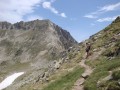
From Artigues to the Campana de Cloutou refuge
 Visorando Member
 7.46 mi
+4,469 ft
-1,148 ft
7h 20
Difficult
7.46 mi
+4,469 ft
-1,148 ft
7h 20
Difficult
 Departure from Campan (Hautes-Pyrénées)
Ascent to the Hourquette de Caderolles, the Col de Bastanet and overnight stay at the Campana de Cloutou refuge.
This first stage is classified as difficult because there is a lot of elevation gain.
A waterfall in Artigues
1.48 mi
+394 ft
-364 ft
1h 00
 Easy
Departure from Campan (Hautes-Pyrénées)
Easy
Departure from Campan (Hautes-Pyrénées)
Come and enjoy a refreshing break along the Adour du Gripp for a lovely walk accompanied by the gurgling of the stream. Follow the Adour downstream and then head back upstream with the fish.
From the village of Artigues to Tournaboup
8.91 mi
+3,907 ft
-3,077 ft
7h 30
Difficult
Departure from Campan (Hautes-Pyrénées)
Third day of a three-day circular route. After a restful night in Artigues, set off having filled your water bottle and packed a packed lunch. To round off this circular route on a high note, take this path between the Col du Tourmalet and the Pic du Midi de Bigorre. A very pleasant walk, with the Pic du Midi towering above you. Return by heading down towards the Tournaboup car park.
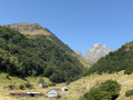
Waterfall and Val d'Arizes from Artigues
 3.00 mi
+1,286 ft
-1,289 ft
2h 30
3.00 mi
+1,286 ft
-1,289 ft
2h 30
 Moderate
Departure from Campan (Hautes-Pyrénées)
Moderate
Departure from Campan (Hautes-Pyrénées)
An easy hike in the hills above the village of Artigues, at the foot of the Pic du Midi de Bigorre.
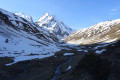
Cabane d'Arizes
 4.22 mi
+1,470 ft
-1,470 ft
3h 15
Moderate
Departure from Campan (Hautes-Pyrénées)
4.22 mi
+1,470 ft
-1,470 ft
3h 15
Moderate
Departure from Campan (Hautes-Pyrénées)
This beautiful round-trip hike, with a challenging start near the stunning Arizes waterfall, will take you to the foot of the Pic du Midi de Bigorre via a magnificent valley along the Ruisseau d'Arizes.
Pic de Portarras via the Campana du Cloutou refuge
 11.48 mi
+4,403 ft
-4,400 ft
9h 05
Difficult
Departure from Campan (Hautes-Pyrénées)
11.48 mi
+4,403 ft
-4,400 ft
9h 05
Difficult
Departure from Campan (Hautes-Pyrénées)
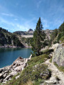
Between the mountain pastures of the upper Campan valley, where cows and sheep graze, and the towering peaks of Bastan and Portarras, this hike runs alongside a dozen or so bodies of water of all sizes and colours, ranging from forest green to deep blue.
This hike (difficult+) requires a minimum of preparation: steep slopes, significant elevation gain, rocky terrain, scree, high mountains.
In the summer pastures around Tuco
 4.97 mi
+591 ft
-607 ft
2h 50
Easy
Departure from Campan (Hautes-Pyrénées)
4.97 mi
+591 ft
-607 ft
2h 50
Easy
Departure from Campan (Hautes-Pyrénées)
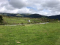
This hike forms a loop around Tuco and in the Gaoube valley. It offers beautiful views of several surrounding valleys. A beautifully restored hamlet has tables and benches for a very pleasant picnic stop. An ideal complement after a few days of hiking in the high mountains!
For more walks, use our search engine .
The GPS track and description are the property of this route's author. Please do not copy them without permission.

