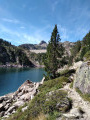
A waterfall in Artigues

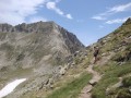
Come and enjoy a refreshing break along the Adour du Gripp for a lovely walk accompanied by the gurgling of the stream. Follow the Adour downstream and then head back upstream with the fish.

Details

103816463
Creation:
Last update:
Last review:
  • Walking
    Activity: Walking
  • ↔
    Distance: 1.48 mi
  • ◔
    Average duration: 1h 00 
  • ▲
    Difficulty: Easy

  • ⚐
    Back to start: Yes
  • ↗
    Ascent: + 394 ft
  • ↘
    Descent: - 364 ft

  • ▲
    Highest point: 3,970 ft
  • ▼
    Lowest point: 3,570 ft

Description of the walk

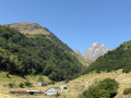
The start is at the Lodge Auberge des Cascades (parking available).

(S/E) With your back to the car park, head back towards the Route du Tourmalet, walking alongside the campsite. At the end of the campsite, turn right onto a road

(1) Follow this road as it descends through the forest to the bridge over the Adour de Gripp.

(2) Cross the bridge and head into the picnic area on the right. Set off along the river upstream. At the far end of the picnic area, find the start of the path that follows the course of the river. Pass by an unnamed waterfall.

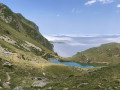
(3) Continue until you reach another picnic area by the reservoir of the Artigues power station.

(4) Turn right, cross the river to rejoin the road and follow it to the right back to the starting point (S/E).

Waypoints

  1. S/E : mi 0 - alt. 3,934 ft - Auberge des Cascades lodge - Station de ski
  2. 1 : mi 0.21 - alt. 3,914 ft - There is a fork in the path at the end of the campsite
  3. 2 : mi 0.66 - alt. 3,576 ft - Bridge over the - Adour du Tourmalet ou Adour de Gripp (ruisseau)
  4. 3 : mi 1.01 - alt. 3,852 ft - Waterfall
  5. 4 : mi 1.28 - alt. 3,947 ft - Reservoir
  6. S/E : mi 1.48 - alt. 3,934 ft - Auberge des Cascades lodge - Station de ski

Notes

This short family walk requires no special equipment or fitness level.

The first half is downhill along a quiet road; the second half follows a path that has been fitted with steps and handrails by the Association des Sentiers de Campan.

However, the path along the river between (2) and (4) is quite steep and puts quite a strain on the knees with its many steps.

At the bridge, in the picnic area (2), there is a drinking fountain

Worth a visit

This route takes you past a waterfall on the River Adour. At least two other waterfalls can be seen in the same area, on the GR®10 access path which passes by the reservoir’s picnic area (4).

  • the Garet Waterfall, by following the GR®10 access route on the south side towards the Campane de Cloutou refuge.
  • the Anzes Waterfall, by following the GR®10 access route on the western side towards the Col de Sencours.

Always be cautious and plan ahead when you're outdoors. Visorando and the author of this route cannot be held responsible for any accidents occurring on this route.

The GR® and PR® markings are the intellectual property of the Fédération Française de Randonnée Pédestre.

Other walks in the area

For more walks, use our search engine .

The GPS track and description are the property of this route's author. Please do not copy them without permission.