Country:

 City:
City:


No signposting
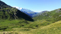
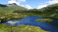
(S) From the hilltop overlooking Lac de Pormenaz, take the path on the right heading north. After a few ascents and descents, cross a stream in a hollow.
(1) At the junction, ignore the path on the left which descends towards Les Argentières and head up the path on the right towards the Moëde-Anterne mountain hut. At the Laouchet crossroads, continue straight ahead along the ridge.
Red and white markings
(2) At the junction 150 metres before the Moëde-Anterne refuge, ignore the track leading up opposite to the refuge and turn right onto the Chemin rural de Moëde. At a left-hand bend, ignore a path branching off to the right leading to Laouchet and continue down the track towards the Chalets de Moëde (north-west). Ignore a path on the left which climbs up to the refuge. At the junction, leave the track and turn right onto the Chemin de Sixt à Chamonix. Cross the Ruisseau de la Forclaz and reach a junction below the Chalets de Moëde.
(3) Ignore a path branching off to the right which descends towards the Torrent de Moëde; carry on straight ahead and cross the Nant des Sangles (wetland). In the Fonds de Moëde, follow the left bank of the Torrent de Moëde to reach the foot of the Tête de Jeubon (elevation 1686).
(4) Head north-north-east, cross a scree slope and, via two hairpin bends, descend to the Pont d’Arlevé.
(5) Cross the Diosaz via the bridge and head up the opposite slope along the Chemin de Chamonix to Sixt. After two hairpin bends, ignore a path branching off to the left towards the Chalets de Balme and continue along the southern slope. Cross the Torrents d’Arlevé and du Lac Cornu to reach the ruins of the Chalets d’Arlevé.
(6) Cross the Torrent de Sous l’Aiguille. At a hairpin bend, ignore a path branching off to the right and turn left. After a second hairpin bend, continue climbing along the hillside until you reach the Torrent de la Ravine.
(7) Climb a scree slope via switchbacks alongside the torrent. Ignore a path branching off to the right which crosses the torrent and reach the junction with theGR®® Tour du Mont Blanc at the Col du Brévent.
(8) Turn right and climb the northern slope of the Brévent. Using a series of ladders and handrails, reach the Brèche du Brévent.
(9) Take the ski run to the right and reach the summit of the Brévent.
(10) On the northern slope, turn right and descend through the scree via the Grand Balcon (the summit ridge linking the Brévent to the Tête de Bel-Lachat). After a few hairpin bends, the slope levels out and you look out over the Lac du Brévent.
(11) Ignore a path branching off to the right which descends towards the lake; continue along the ridge and reach the Tête de Bel-Lachat.
(12) Ignore a path branching off to the left and continue straight ahead along the track. At a hairpin bend in the path, ignore a path branching off to the right and turn left. After a bend, descend through a scree slope (south-south-west). Ignore a path branching off to the right towards the Aiguillette des Houches. Descend to the left and, after two bends, reach the Refuge de Bel-Lachat.
(13) Turn right onto the path towards Les Houches (west). Ignore several paths branching off to the right, descend via numerous hairpin bends (south-southeast) and reach the Ravin des Vouillourds.
(14) Cross the ravine, continue the descent via hairpin bends (south), then along the hillside. After further hairpin bends, head south-west and enter the forest. Use the handrails, then reach the Torrent de Lapaz.
(15) Cross the torrent and head downwards south-south-west. Ignore a path branching off to the left which descends alongside the Merlet Wildlife Park and head south-west. Ignore a path branching off to the right which climbs towards the Auguillette des Houches; continue the descent straight ahead and reach a junction.
(16) Continue straight ahead along the fence of the Merlet Wildlife Park. Ignore two path junctions on the right and, at a junction, turn left onto the Chemin de Merlet. You will come out onto a road.
(17) Then take the road to the right and, 50 metres past the coach park, turn left onto the Chemin de Coupeau in Merlet. Ignore a path on the left leading down towards the Arve and continue along the path on the hillside (west). At a junction just before you reach the road, leave the track, head down to the left and, via a series of hairpin bends, reach the statue of Christ the King.
(18) Ignore a path branching off to the left; carry on straight ahead towards Les Houches railway station (west) until you reach a junction. First turn left then right to join the Route de Coupeau, which you follow down to the left. After a hairpin bend, you’ll reach a junction (elevation 1115). Head down to the right along the Chemin du Senet. You’ll come out onto the road again; follow it to the right for about a hundred metres.
(19) Turn left onto the track. At a fork in the road, turn right and rejoin the road. First turn right then left, take a footpath and rejoin the road again, turning right. Cross the railway line and, after a right-hand bend, you will reach Les Houches SNCF station (E).
 Visorando Member
 Difficult
  Moderate