A wild circular walk in the Monges massif

If you’d like to discover the wide open spaces, the magnificent views and the joys of the Basses-Alpes – unspoilt nature, the great outdoors, peace and tranquillity – this lovely circular walk will delight you.

Details

27495009
Creation:
Last update:
Last review:
  • Walking
    Activity: Walking
  • ↔
    Distance: 7.99 mi
  • ◔
    Average duration: 5h 55 
  • ▲
    Difficulty: Difficult

  • ⚐
    Back to start: Yes
  • ↗
    Ascent: + 2,579 ft
  • ↘
    Descent: - 2,605 ft

  • ▲
    Highest point: 6,932 ft
  • ▼
    Lowest point: 4,544 ft

Description of the walk

The access road is rudimentary and very narrow but passable by car. In places, it can be quite daunting (Clue de Feissal). Park at the side of the forest road, before the valley/stream, shortly after the turn-off to the hamlet of Feissal.

(S/E) On the approach road, head back the way you came (west). After a few dozen metres, turn right onto a path climbing towards the hamlet of Feissal (GR®6, marked in red and white).

(1) Walk through the hamlet of Feissal and continue north-west along the signposted path. Climb through the mountain pastures. The path turns west and reaches the Croix de la Jatte, a sort of small pass.

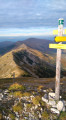
(2) Continue the ascent along the hillside, heading west-north-west, still following theGR®6. This will take you to the Crête de Pierre-Mont.

(3) Follow the ridge to the right, leave theGR® and follow the yellow markings. Climb steadily, heading east then east-north-east. Further on, head north and pass the foot of an unnamed hillock on the right (elevation 1922). Reach the foot of a rocky ridge.

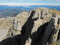
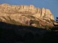
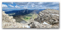
(4) Continue north-east and skirt the overhanging rocky outcrop on the left. Climb to the summit of Les Monges (beautiful panoramic view).

(5) Descend on the other side towards the east to quickly reach an unnamed pass. Then turn right and head off-track. Make your way eastwards then south-eastwards along the edge of a steep slope descending to the left (take care). Choose the route that suits you best, as the route is only indicative here. After this section at a roughly constant altitude, the path begins to descend.

(6) Descend steeply in switchbacks, heading roughly east-southeast. Find the best route according to your own judgement. Reach the Croix de Veyre.

(7) Turn right onto a well-marked path, heading south-west then due south; the path is unmarked until it joins theGR®6.

(8) Follow it south then south-west (red and white markings). This is a vibrant landscape of woodland edges and pastures, with a few crossings over black (or grey) marl known locally as ‘robines’, which is constantly eroding. Reach the hamlet of Les Bastides.

(9) Continue south-west along the signposted path, which widens. Walk through pastures, fording a few streams, and shortly afterwards you’ll reach a crossroads.

(10) Ignore a path branching off to the right and continue westwards to the starting point (S/E).

Waypoints

  1. S/E : mi 0 - alt. 4,606 ft - Parking by the roadside
  2. 1 : mi 0.19 - alt. 4,656 ft - Feissal
  3. 2 : mi 0.79 - alt. 5,125 ft - La Croix de la Jatte
  4. 3 : mi 1.73 - alt. 4,865 ft - Crête de Pierre-Mont
  5. 4 : mi 3.68 - alt. 6,345 ft - Rocky outcrop
  6. 5 : mi 4.43 - alt. 6,932 ft - Les Monges (2114m)
  7. 6 : mi 5.08 - alt. 6,755 ft - Start of the winding descent
  8. 7 : mi 5.41 - alt. 6,188 ft - La Croix de Veyre
  9. 8 : mi 5.94 - alt. 5,581 ft - Junction with the GR®6
  10. 9 : mi 6.99 - alt. 4,633 ft - The Bastides
  11. 10 : mi 7.35 - alt. 4,557 ft - Junction, after the - Vançon (rivière)
  12. S/E : mi 7.99 - alt. 4,606 ft - Car park on Route de Feissal

Notes

From the summit of Les Monges until you reach La Croix de Veyre (7), the route is mainly unmarked and off-trail. Following the route using the Visorando app can be very helpful.

Worth a visit

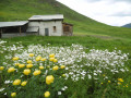
The landscapes are wild and magnificent. On the Monges ridge, the view is magnificent; then, after the Croix de Veyre (7), the landscape changes completely to one of forests and pastures.

Always be cautious and plan ahead when you're outdoors. Visorando and the author of this route cannot be held responsible for any accidents occurring on this route.

The GR® and PR® markings are the intellectual property of the Fédération Française de Randonnée Pédestre.

Reviews and comments

4.5 / 5
Based on 2 reviews

Reliability of the description
4.5 / 5
Ease of following the route
4.5 / 5
Route interest
4.5 / 5
fredgege47
fredgege47

Hello
I’m planning to go on this hike with a group of 25 people. How many vehicles can we park at the start?
Thank you

Machine-translated

Lagalere
Lagalere

Overall rating : 4 / 5

Date of your route : Aug 29, 2023
Reliability of the description : ★★★★☆ Good
Ease of following the route : ★★★★☆ Good
Route interest : ★★★★☆ Good
Very busy route : Yes

The route appears to be well-used along the initial section shared by mountain bikers and walkers; the signposting is clear and the route is easy to follow by sight along the section from the summit of Les Monges to the Col de la Croix de Veyre, where the route is marked with posts set at regular intervals.

Machine-translated

abeauville
abeauville

Overall rating : 5 / 5

Date of your route : May 07, 2023
Reliability of the description : ★★★★★ Very good
Ease of following the route : ★★★★★ Very good
Route interest : ★★★★★ Very good
Very busy route : No

A lovely circular walk. The ascent is a classic route and quite busy, but we didn’t see a soul on the descent, which is absolutely stunning. It’s worth noting that the path indicated in (5) and (6) is now signposted and marked with cairns, and is relatively well-defined, so I wouldn’t describe this walk as ‘difficult’.

Machine-translated

Other walks in the area

For more walks, use our search engine .

The GPS track and description are the property of this route's author. Please do not copy them without permission.