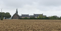
From Le Diable to the Rance Valley via Guenroc

A small village with unexpected treasures, perched high above the Rance Valley. Don’t miss a visit to the church with its devil, its Christ the King, and the view over the Rophemel Dam, which marks the end of the Rance Valley.

Details

31183178
Creation:
Last update:
Last review:
  • Walking
    Activity: Walking
  • ↔
    Distance: 5.62 mi
  • ◔
    Average duration: 3h 00 
  • ▲
    Difficulty: Moderate

  • ⚐
    Back to start: Yes
  • ↗
    Ascent: + 505 ft
  • ↘
    Descent: - 502 ft

  • ▲
    Highest point: 318 ft
  • ▼
    Lowest point: 151 ft
  • ⚐ Country: France
  • ⚐ City: Guenroc (22350)
  • ⚑
    Start/End: N 48.31832° / W 2.076251°
  • ❏
    IGN map(s): Ref. 1117SB
  • Hour-by-hour weather

Photos

Description of the walk

Start in front of Guenroc Church.

(S/E) Head south through the village and, at the Fork in the road, turn left onto Rue du Presbytère. Walk down to thesecond junction.

(1) Turn right towards Launay Manor and follow this road to the viewpoint overlooking the Rophémel Dam.

(2) Take in the view and turn right onto the path that runs alongside the lake. The path is quite steep and can be slippery in wet weather. Follow the path to the road, opposite the Château de Beaumont en Guitté.

(3) Turn right onto the road, ignore the road on the right and continue for about a hundred metres until you reach a cross.

(4) Leave the road, turn onto the path on the right and join the Route de Baumelin. Follow it to the left until you reach the La Rosais junction.

(5) Turn left onto the path that runs alongside the farm on the right, then at the next junction, turn right to join the Guitté–Guenroc road.

(6) Cross it and follow the path opposite until you reach the D90.

(7) Take the road on the right to reach the village and the church (S/E).

Waypoints

  1. S/E : mi 0 - alt. 295 ft - Église Saint-Gervais et Saint-Protais (Guenroc)
  2. 1 : mi 0.27 - alt. 240 ft - Turn-off towards Launay Manor
  3. 2 : mi 0.95 - alt. 203 ft - Barrage de Rophemel
  4. 3 : mi 3.71 - alt. 180 ft - Guitté–Guenroc route - Rance (fleuve)
  5. 4 : mi 4.05 - alt. 282 ft - Junction (cross)
  6. 5 : mi 4.59 - alt. 315 ft - La Rosais
  7. 6 : mi 4.81 - alt. 302 ft - Crossing the road
  8. 7 : mi 5.23 - alt. 295 ft - D90 road
  9. S/E : mi 5.62 - alt. 292 ft - Église Saint-Gervais et Saint-Protais (Guenroc)

Notes

Public toilets are available in the courtyard behind the village hall.
The section along the Rance Valley is steep and can be slippery in wet weather. This is the only challenging part of the route.

Worth a visit

Visit Guenroc Church.
Admire Beaumont Castle, which overlooks the Rance Valley.
Climb up onto the rocks near the White Cross to admire the view.

Reviews and comments

4.8 / 5
Based on 2 reviews

Reliability of the description
5 / 5
Ease of following the route
4.5 / 5
Route interest
5 / 5
trio35
trio35

Overall rating : 4.7 / 5

Date of your route : Apr 25, 2026
Reliability of the description : ★★★★★ Very good
Ease of following the route : ★★★★☆ Good
Route interest : ★★★★★ Very good
Very busy route : No

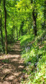
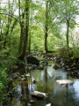
This lovely walk was a real treat. It starts in a quaint village featuring a striking large white quartz rock that you can climb to take in the surrounding area. Two-thirds of the route winds through woodland along a narrow path by the water’s edge, offering superb views of the Rance river below. The final stretch through the countryside, whilst less interesting, completes the circular route.
Note: we did this walk in dry weather, so we had no problems, but it must indeed be a bit tricky in wet weather. There is also a fair bit of elevation gain. Not recommended for those who aren’t sure-footed or for young children.
There are several good spots for a picnic.

Machine-translated

famillecaro
famillecaro

Overall rating : 5 / 5

Date of your route : Apr 12, 2023
Reliability of the description : ★★★★★ Very good
Ease of following the route : ★★★★★ Very good
Route interest : ★★★★★ Very good
Very busy route : No

We only did part of the walk, from Guenroc (a very pretty village with lovely houses and beautiful chimneys, and a stunning church – featuring a remarkable statue of St Michael slaying the dragon) to the town of Bourdais, then we made our way back to the village by road; this section presented no difficulties.

Machine-translated

Other walks in the area

For more walks, use our search engine .

The GPS track and description are the property of this route's author. Please do not copy them without permission.