The Vallon de l’Osier, starting from Quédillac

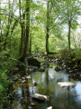
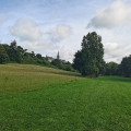
A pleasant walk around Quédillac, signposted with specific yellow and blue signs. It runs alongside Quédillac Pond and takes you along paths through unspoilt countryside. Please note that some sections may be difficult to navigate if it has rained heavily recently.

Details

n°18766798
Creation:
Last update:
Last review:
  • Walking
    Activity: Walking
  • ↔
    Distance: 3.70 mi
  • ◔
    Average duration: 1h 45 
  • ▲
    Difficulty: Easy

  • ⚐
    Back to start: Yes
  • ↗
    Ascent: + 66 ft
  • ↘
    Descent: - 66 ft

  • ▲
    Highest point: 292 ft
  • ▼
    Lowest point: 213 ft
  • ⚐ Country: France
  • ⚐ City: Quédillac (35290)
  • ⚑
    Start/End: N 48.250047° / W 2.142681°
  • ❏
    IGN map(s): Ref. 1017SB, 1018SB, 1117SB, 1118SB
  • Hour-by-hour weather

Description of the walk

Park near Quédillac church.

(S/E) With your back to the church steps, head towards the railway line along Rue de la Gare. 

(1) Just past the station, turn right and then immediately left to go round the Salle Polyvalente. Take the first right, then the second left, and continue to the junction where there is a cross. 

(2) Turn right towards the pond, then walk along its left-hand side once you’ve passed the chapel. 

(3) Turn left towards the hamlet of La Villée. Go up the hill, ignore two driveways to houses on the right and head for the Maladrie crossroads. 

(4) Carry on straight ahead. Once you reach the right-hand bend, leave the road and take a path on the left. You’ll come to a crossroads; carry on straight ahead. 

(5) Take a path on the left at the corner of the property. Further on, turn left onto the path and head up towards La Gérardais. 

(6) Turn right onto the tarmac road, continue along the track and join the D220 near the swimming pool and sports centre. 

(7) Turn left and walk carefully along the road for about fifty metres, then turn left to go round the football stadium and return to the D220. 

(8) Turn left and walk along the D220 with the same caution towards the railway line. 

(1) Continue straight ahead, cross the level crossing and head back up to the car park next to the church (S/E). 

Waypoints

  1. S/E : mi 0 - alt. 259 ft - Église Saint-Pierre (Quédillac)
  2. 1 : mi 0.17 - alt. 240 ft - Gare de Quédillac
  3. 2 : mi 0.58 - alt. 226 ft - Junction, cross
  4. 3 : mi 1.04 - alt. 213 ft - Étang de la Villée
  5. 4 : mi 1.4 - alt. 256 ft - La Maladrie
  6. 5 : mi 1.91 - alt. 276 ft - Path on the left
  7. 6 : mi 2.57 - alt. 262 ft - La Gérardais
  8. 7 : mi 2.99 - alt. 272 ft - D220 road
  9. 8 : mi 3.21 - alt. 262 ft - D220 road
  10. S/E : mi 3.7 - alt. 243 ft - Church - Église Saint-Pierre (Quédillac)

Notes

This route is accessible by public transport, starting from Quédillac station (1) (TER line).

Reviews and comments

4 / 5
Based on 2 reviews

Reliability of the description
5 / 5
Ease of following the route
4.5 / 5
Route interest
2.5 / 5
RIKITAV
RIKITAV
• Edited:

Overall rating : 4.7 / 5

Date of your route : Aug 14, 2026
Reliability of the description : ★★★★★ Very good
Ease of following the route : ★★★★★ Very good
Route interest : ★★★★☆ Good
Very busy route : No

A pleasant, easy walk through the countryside, which would be well worth extending to a distance more suited to a proper hike.

Machine-translated

gaelleetmika
gaelleetmika

Overall rating : 3.3 / 5

Date of your route : Aug 28, 2025
Reliability of the description : ★★★★★ Very good
Ease of following the route : ★★★★☆ Good
Route interest : ★☆☆☆☆ Very disappointing
Very busy route : No

Unfortunately, a rather uninteresting walk. What a shame

Machine-translated

Other walks in the area

For more walks, use our search engine .

The GPS track and description are the property of this route's author. Please do not copy them without permission.