From the Col de Cabre to Le Falgoux via Puy Mary

The third and final stage of my three-day tour of Puy Mary, featuring the ascent of Puy Mary

This walk is part of a multi-day hike: Tour of Puy Mary in three days

Details

30490245
Creation:
Last update:
Last review:
  • Walking
    Activity: Walking
  • ↔
    Distance: 9.53 mi
  • ◔
    Average duration: 5h 45 
  • ▲
    Difficulty: Moderate

  • ⚐
    Back to start: No
  • ↗
    Ascent: + 1,601 ft
  • ↘
    Descent: - 3,573 ft

  • ▲
    Highest point: 5,823 ft
  • ▼
    Lowest point: 3,025 ft

Description of the walk

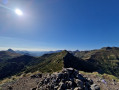
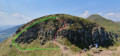
(S) From the Col de Cabre, take the balcony path that skirts the Puy de Peyre Arse to the south (you may spot chamois here, especially early in the morning). You will then rejoin the ridges. Further on, you’ll reach the famous Brèche de Rolland (the one in the Cantal).

(1) This is a slightly technical section, then continue along the ridge.

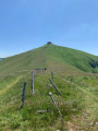
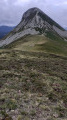
(2) Continuing north-west, tackle the steep ascent of Puy Mary, from where you’ll enjoy a magnificent panorama.

(3) Then descend via the tourist route (a very busy concrete path) to the Pas de Peyrol (take the opportunity to stop off at the inn for a pachade or a blueberry tart).

(4) Go round the inn on the left, then leave the Puy de la Tourte on your right, following theGR®400markings. You will then reach the knoll of the Blatte.

(5) Continue to the next junction.

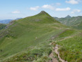
(6): A path branches off into the valley on the right towards Le Claux, but you should take the path that goes straight on to the small plateau at the foot of the Suc Gros. The path climbs to the Pas Rouge, which lives up to its name and is visible from a distance. From there, a magnificent panorama unfolds as you look back, and you can see a large part of the route.

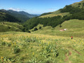
(7) Descend this small pass and cross the Luchard plateau, skirting the Rocher de l’Aygue on the right, following theGR®400markings on the small wooden posts in the mountain pastures. You’ll pass close to two burons.

(8) Then begin the descent into the valley, following a wide track.

(9) Leave the track after a few hairpin bends to take a narrow path (markedGR®400). After the ruined buron at La Devèze, the path descends steeply (it’s hard on the knees) before joining a wider, less steep track.

(10) Follow this track to reach the hamlet of Le Coin and then, after crossing a stream via a small bridge, arrive at Le Cher Soubro.

(11). From there, take the RD12 on the right towards Le Falgoux (E).

The circular route is now complete, but we strongly recommend rounding off your walk with a lovely meal at the Hôtel des Voyageurs, where you can sample the local specialities whilst enjoying a warm welcome from Bernard Mourguy and his wife, an excellent cook.

Waypoints

  1. S : mi 0 - alt. 5,013 ft - Col de Cabre (Cantal)
  2. 1 : mi 1.72 - alt. 5,397 ft - Brèche de Roland (Cantal)
  3. 2 : mi 2.1 - alt. 5,282 ft - Junction
  4. 3 : mi 2.41 - alt. 5,823 ft - Puy Mary
  5. 4 : mi 2.82 - alt. 5,210 ft - Pas de Peyrol
  6. 5 : mi 4.42 - alt. 5,121 ft - Suc de la Blatte
  7. 6 : mi 5.28 - alt. 4,944 ft - Junction
  8. 7 : mi 5.94 - alt. 5,023 ft - Pas Rouge
  9. 8 : mi 7.39 - alt. 4,764 ft - Downhill track
  10. 9 : mi 7.85 - alt. 4,419 ft - Start of the path on the right
  11. 10 : mi 8.68 - alt. 3,547 ft - Crossroads
  12. 11 : mi 9.15 - alt. 3,068 ft - Le Cher Soubro – D12 road
  13. E : mi 9.53 - alt. 3,041 ft - Le Falgoux

Notes

If you want to avoid the steep climb up to Puy Mary, the concrete descent and the crowds of tourists, you can go round Puy Mary via a little-used path which, at point (2), branches off to the right until it joins the road, which you then follow to the left up to the Pas de Peyrol.

Always be cautious and plan ahead when you're outdoors. Visorando and the author of this route cannot be held responsible for any accidents occurring on this route.

The GR® and PR® markings are the intellectual property of the Fédération Française de Randonnée Pédestre.

Reviews and comments

5 / 5
Based on 1 review

Reliability of the description
5 / 5
Ease of following the route
5 / 5
Route interest
5 / 5
Depassage
Depassage

Overall rating : 5 / 5

Date of your route : Aug 12, 2025
Reliability of the description : ★★★★★ Very good
Ease of following the route : ★★★★★ Very good
Route interest : ★★★★★ Very good
Very busy route : Yes

Last stage, no shade. Be careful in hot weather! We had a picnic close to the red rock to get a little shade.
We refilled our water bottles at the Puy Mary chalet (1 litre allowed), then at a spring before Luchard. There were lots of people at Puy Mary, which is to be expected! Otherwise, the route was fairly quiet.
We made it through the Rolland breach with our heavy bags, which is possible even if you're not very comfortable. In any case, you can go around it on the left; the GR trail has been rerouted from the foot of the breach to avoid it if you want.
Be careful after the Pas de Peyrol not to miss the path that goes around the Puy de la Tourte on the left. We followed the GR markings and ended up at the top of this Puy. Nothing serious, but with the heat, we could have done without it!
The descent to Falgoux is tedious in its second part, but hey, the circuit was so good that we didn't mind an hour of painful descent on our knees!
Conclusion: three magnificent days, lots of blueberries, superb views, no stress about the route, thank you!

Machine-translated

Other walks in the area

For more walks, use our search engine .

The GPS track and description are the property of this route's author. Please do not copy them without permission.