Montagne Sainte-Marguerite – in the Cévennes of the Ardèche

A circular 2-day tour in the Cévennes of the Ardèche.
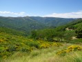
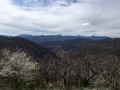
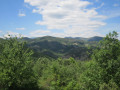
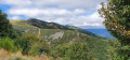
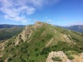
About ten kilometres north-west of Aubenas, Montagne Sainte-Marguerite rises to 976 metres. Its summit, bristling with radio masts, is a landmark that cannot be missed in the region. Whilst the summit itself, apart from the breathtaking views, is of little interest, its slopes are truly beautiful.
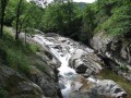
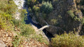
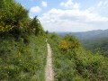
Holm oaks, chestnut trees, deep valleys, inviting rivers, nestled hamlets, listed churches, castles undergoing restoration, Roman roads – a wealth of natural and built heritage waiting to be discovered.

Details

517391
Creation:
Last update:
Last review:
  • Walking
    Activity: Walking
  • ↔
    Distance: 23.19 mi
  • ◔
    Average duration: 2 days 
  • ▲
    Difficulty: Difficult

  • ⚐
    Back to start: Yes
  • ↗
    Ascent: + 6,132 ft
  • ↘
    Descent: - 6,152 ft

  • ▲
    Highest point: 3,222 ft
  • ▼
    Lowest point: 997 ft

Photos

Stages of the route

This route needs several days, find the details below:

  1. S
  2. E

Notes

- Rocky paths; make sure you wear sturdy footwear.

- Drinking water and provisions available in all the villages you pass through, particularly Mayras, Saint-Pierre de Colombier and Aizac on the first day.
On the second day, you’ll pass through fewer villages; plan accordingly.

- As the climb up to the Col de Moucheyre is quite steep, it’s best to have lunch at the top, so don’t set off too late.

- (E) Aizac: end of the first stage and start of the second. There’s a restaurant, bar and small grocery shop in the village. Accommodation available at the “Le Volcan d’Aizac” lodge and B&B – 04 75 38 77 81 – breakfast, picnics, etc.

Worth a visit

(S) Neyrac-les-Bains spa resort

(3) Mayras: a charming medieval village.

(5) From sericulture (silkworm rearing) to weaving: the Moulinage Ecomuseum

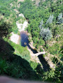
Swimming in rivers, particularly at (11).

(E) Col d’Aizac: a pretty, peaceful village surrounded by nature… at the foot of the Volcan d’Aizac!
You can go on a themed walk exploring the history of the Aizac Volcano. A short hike of 1 to 2 hours takes you to the summit, with information boards along the route.You can contact the “Le Volcan d’Aizac” lodge and guesthouse; Eric will be happy to provide you with information and lend you documents and guidebooks on this 80,000-year-old volcano, which is, sadly, now extinct!

(23) Niègles Church and village

Ventadour Castle

Between (24) and (25) Hautségur Castle

Always be cautious and plan ahead when you're outdoors. Visorando and the author of this route cannot be held responsible for any accidents occurring on this route.

Reviews and comments

4.4 / 5
Based on 3 reviews

Reliability of the description
4 / 5
Ease of following the route
4.7 / 5
Route interest
4.7 / 5
User 14542368

Hello, where exactly is it possible to camp in Aizac? I don’t think there’s really anywhere suitable.

Thanks!

Machine-translated

User 20765296

Overall rating : 4.7 / 5

Date of your route : Apr 25, 2026
Reliability of the description : ★★★★☆ Good
Ease of following the route : ★★★★★ Very good
Route interest : ★★★★★ Very good
Very busy route : No

A two-day hike at the end of April; the paths are peaceful and the scenery is stunning.
On the first day, between points 7 and 8, I had to take the A-road as access to the path was blocked due to roadworks. The first day ended with a camp at point 1 of the next day’s route; a water source is available at the fountain in Place d’Aizac. On the second day, you’ll find another water source by the toilets at the chapel at point 5.
A perfect hike for a peaceful weekend.

Machine-translated

DanySkayz
DanySkayz

Overall rating : 5 / 5

Date of your route : May 27, 2023
Reliability of the description : ★★★★★ Very good
Ease of following the route : ★★★★★ Very good
Route interest : ★★★★★ Very good
Very busy route : No

A two-day hike starting from Neyrac-les-Bains. The scenery is very varied, alternating between coniferous forests, stone villages, streams everywhere, oak forests and medieval castles.
We camped in Aizac, where you’ll find a bar, the Kezako, for a well-deserved beer on the terrace.
Overall, the hike is challenging, particularly certain sections of narrow, rocky descents.
There are plenty of public water sources where you can top up your water supplies regularly. This means you don’t have to carry too much weight in your rucksack.
This hike is ideal for a complete two-day break away from civilisation.
Follow the white/yellow markings.

Machine-translated

Pégase07530
Pégase07530

Hello!
You’re mistaken – this walk starts (and ends) in Mayras, or more precisely in the hamlet of Neyrac-les-Bains. Perhaps you’re confusing it with this one: https://www.visorando.com/randonnee-circul...
But it doesn’t matter, and it’s really not a big deal!
Enjoy your walks!
Eric

Machine-translated

shakaom
shakaom

Hello, we did indeed complete the 37 km hike described in the ‘Montagne Sainte Marguerite’ guide. On the map, it does start and end in Chirols, doesn’t it? I was just pointing out what we didn’t enjoy so much – please don’t take it personally...

Machine-translated

Pégase07530
Pégase07530
• Edited:

Hello “shakaom” and thank you for following this route!
We’re in the mid-mountain range, so there aren’t any dizzying peaks… nevertheless, I’ve identified at least fifteen high points with the lovely views that go with them!
To give a more objective review of a route, you’d really need to complete the whole thing! You told me yourself that you started (and finished) it in Chirols… that cuts it short by about a third! What a shame…
Eric

Machine-translated

gazok54
gazok54 ★

Thank you, shakaom, for this feedback from the field.
As for the route map provided with the PDF, it is on the same scale as the standard IGN map.

Machine-translated

shakaom
shakaom

Overall rating : 3.7 / 5

Date of your route : May 19, 2018
Reliability of the description : ★★★☆☆ Average
Ease of following the route : ★★★★☆ Good
Route interest : ★★★★☆ Good

We were delighted with this two-day circular route; we passed through some magnificent, traditional hamlets, alongside little streams, castles, cobbled paths and superb stone walls. The paths are very, very pleasant, charming and varied, set against a backdrop of lovely scenery.
We’re two seasoned walkers, but even without any major peaks, these two days are still quite tiring, with lots of little valleys – so the physical challenge adds to the visual delight.
That said, to be a bit picky, we did spot a few shortcomings:
Despite the descriptions, you really do need to buy a proper IGN-scale map (our mistake – we’d simply printed the one from the website), as we spent our time constantly pulling out the map, hesitating and dithering over which path to take. The walk isn’t straightforward without a good sense of direction, as it branches off constantly – which can be a bit annoying when you’re trying to keep moving.
There are also a few too many tarmac paths or sections on roads, and finally, one or two peaks or ridges are missing; indeed, some of the forest sections are rather long, and it would have been nice to take a detour to a few peaks, as ultimately, over the two days, there are hardly any real vantage points.
Despite the shortcomings mentioned above (which is just our opinion), we were generally very happy with this weekend in the Ardèche and with this hike.

Machine-translated

Other walks in the area

For more walks, use our search engine .

The GPS track and description are the property of this route's author. Please do not copy them without permission.