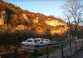
From Cénevières Castle to Calvignac

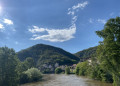
A walk starting from Cénevières Castle and leading to the village of Calvignac, where there is a lovely viewpoint and a community-run bar with a stunning view over the River Lot. For the most part, the route follows a wide path along the crest, followed by a descent along a narrow, fairly steep path. Please note that this is a one-way route: you will therefore need to arrange for a car to be waiting in Calvignac, or possibly walk back.

Details

105340166
Creation:
Last update:
Last review:
  • Walking
    Activity: Walking
  • ↔
    Distance: 2.14 mi
  • ◔
    Average duration: 1h 20 
  • ▲
    Difficulty: Moderate

  • ⚐
    Back to start: No
  • ↗
    Ascent: + 443 ft
  • ↘
    Descent: - 440 ft

  • ▲
    Highest point: 906 ft
  • ▼
    Lowest point: 469 ft

Photos

Description of the walk

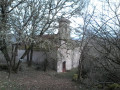
Park at the foot of Cénevières Castle.

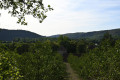
(S) With your back to the château and at the bend just before the entrance, by the stone cross, take the path leading uphill to the left. Follow it along the ridge.

(1) Pass by Pech de Labade and continue to the junction at La Balmette.

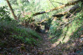
(2) Take a very narrow, inconspicuous path which descends to the left. Be careful: there are no obvious visual landmarks to help you find it and the entrance is quite inconspicuous. Follow this path down to the field below.

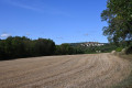
(3) Turn right onto the main track heading towards Calvignac, running alongside the fields and the edge of the woods. You’ll come out onto a quiet country lane; turn left onto it to reach the junction a few dozen metres further on.

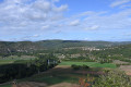
(4) Head up to the right towards Calvignac to reach the town hall of this pretty village with its incredible view: a visit is highly recommended (S/E).

Waypoints

  1. S : mi 0 - alt. 591 ft - Château de Cénevières
  2. 1 : mi 0.61 - alt. 896 ft - Pech de Labade - Lot (rivière)
  3. 2 : mi 1.06 - alt. 899 ft - La Balmette, path on the left
  4. 3 : mi 1.33 - alt. 469 ft - Woodland edge and field
  5. 4 : mi 1.86 - alt. 476 ft - Road junction
  6. E : mi 2.14 - alt. 617 ft - Calvignac Town Hall

Notes

Parking available at the château. No major difficulties or special equipment required. The path on the way down can be slippery in wet weather.

Worth a visit

Other walks in the area

For more walks, use our search engine .

The GPS track and description are the property of this route's author. Please do not copy them without permission.