Country:

 City:
City:


Park in the car park at a place called Casse, at the top of Rue Centrale in Larnagol.
(S/E) Take the path leading up towards the causse (north-west). Follow the Cas stream (on your right); it is dry in summer. Further on, pass the source of the Cas. Follow the path uphill to the Mas de Rousset.
(1) Follow the tarmac road for 300 metres until you reach a wider tarmac road.
(2) Turn left towards the Mas de Cariteau. The tarmac road then turns into a track. Follow this track, ignoring the paths to the right and left.
(3) When you reach a three-way junction in the path, take the path furthest to the right. Walk alongside a dry stone wall on your left. Continue along this path until you reach a hairpin bend to the right.
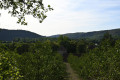
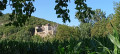
(4) Turn left onto the path (barely marked) opposite this hairpin bend and follow it for about twenty metres. Be careful, it’s steep. You can see the village of Calvignac in the distance to the left. Retrace your steps back to the hairpin bend and continue along the path. Opposite, there’s a view over the plain and, in the distance, Cénevières Castle. Continue along this path until you reach another hairpin bend.
(5) Turn left to join a small tarmac road that runs through the hamlet of Lascombes. Join the Departmental Road 662, cross it and follow the path opposite for 100 metres.
(6) Turn left onto the path across the Prémiac plain. About 800 metres further on, on the left, look out for the Mas de Piché (blue shutters) and, behind this farmhouse, the cliff and, at the top, the spot from where you had a view of Calvignac. Continue along this path, ignoring the turnings to the right and left, until you reach the D662.
(7) Follow the road to the village of Larnagol, where you walk up Rue Centrale to the top (S/E).



 Visorando Member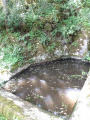

 Moderate