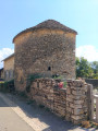
From Myon to the Gour de Conche, going up via the Monniot

A forest walk combining tracks, forest paths and dirt tracks, taking in the Gour de Conches, its waterfall and its spring.

Details

20878680
Creation:
Last update:
Last review:
  • Walking
    Activity: Walking
  • ↔
    Distance: 9.28 mi
  • ◔
    Average duration: 5h 10 
  • ▲
    Difficulty: Moderate

  • ⚐
    Back to start: Yes
  • ↗
    Ascent: + 988 ft
  • ↘
    Descent: - 988 ft

  • ▲
    Highest point: 1,601 ft
  • ▼
    Lowest point: 1,066 ft

Description of the walk

To get to the start, follow the D15 which links Myon to Doulaize. On leaving Myon, head towards the recycling centre and park in the football ground car park.

(S/E) With your back to the car park, turn left then head down the street to the right until you reach the junction.

(1) Turn left, walk past a pigsty and join a road.

(2) At the wayside cross, turn left (do not cross the bridge) and continue along theGR® de Pays: Tour du Monniot until you reach a junction where you leave the trail.

(3) Turn right and leave theGR® de Pays ‘Tour du Monniot’.

(4) Continue along the path on the right (signposted for mountain bikes).

(5) At the crossroads of paths, go straight on until you reach a clearing.

(6) Take the road on the right to descend to the Gour de Conche to see the waterfall, the Gour and the spring (before the bridge, takethe oldGR® on the left; this is about a hundred metres away).

(7) Return along the same route, turn right onto the grassy path and climb the steep slope (take care not to slip if it is wet).
Turn left onto the forest track and follow it to the clearing.

(6) Head right towards the hunting lodge. Walk past it and continue straight on along the grassy path, ignoring the paths to the right and left.

(8) Turn left and continue straight on, heading due north, to rejoin theGR® de Pays: Tour du Monniot.

(9) Turn right (GR® signpost) and head into a field.

(10) Walk along the edge of the field and turn left until you reach a road.

(11) Follow the tarmac road on the right until you reach a crossroads.

(12) At the junction, take the grassy track through the fir trees and continue straight on towards the north-east.

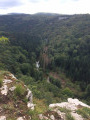
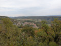
(13) Head up the faint path on the left through the pine trees: a fairly steep climb (take care of slipping if wet) to reach the viewpoint via theGR® du Pays: Tour du Monniot. Walk past the viewpoint and tackle the very steep and slippery descent.

(14) Leave theGR® du Pays via a grassy path on the left and rejoin the route you took on the way there.

(1) Turn left and, following the route in reverse, head back to the football pitch car park (S/E).


Waypoints

  1. S/E : mi 0 - alt. 1,191 ft - Football ground car park
  2. 1 : mi 0.19 - alt. 1,132 ft - Crossroads at the end of the circular loop
  3. 2 : mi 0.52 - alt. 1,066 ft - Junction at the wayside cross
  4. 3 : mi 2.01 - alt. 1,306 ft - Fork in the road (end of the GR)
  5. 4 : mi 2.28 - alt. 1,358 ft - Mountain bike signposting
  6. 5 : mi 2.59 - alt. 1,411 ft - Path junction
  7. 6 : mi 3.13 - alt. 1,427 ft - Clearing
  8. 7 : mi 3.72 - alt. 1,358 ft - Gour and the spring
  9. 8 : mi 4.83 - alt. 1,509 ft - Junction
  10. 9 : mi 5.76 - alt. 1,496 ft - Signpost… Tour du Monniot
  11. 10 : mi 6.33 - alt. 1,394 ft - Field
  12. 11 : mi 6.48 - alt. 1,378 ft - Route
  13. 12 : mi 7.05 - alt. 1,539 ft - path through the woods
  14. 13 : mi 7.97 - alt. 1,424 ft - Junction
  15. 14 : mi 8.86 - alt. 1,125 ft - Junction (end of the GRP)
  16. S/E : mi 9.28 - alt. 1,191 ft - Football ground car park

Notes

Wear good walking shoes: there are quite steep ascents and descents.

Worth a visit

Signposted section: Tour du Monniot (GRP®)
Gour de Conche, its spring and waterfall (formerGR®)
Viewpoint

Always be cautious and plan ahead when you're outdoors. Visorando and the author of this route cannot be held responsible for any accidents occurring on this route.

The GR® and PR® markings are the intellectual property of the Fédération Française de Randonnée Pédestre.

Reviews and comments

3.6 / 5
Based on 4 reviews

Reliability of the description
3.3 / 5
Ease of following the route
3.5 / 5
Route interest
4 / 5
cnu25
cnu25

Hello Sylvie … I’m sorry about that unpleasant encounter … but I hope to see you again on other courses

Machine-translated

Sylvie Duboz
Sylvie Duboz

Overall rating : 4 / 5

Date of your route : Jul 21, 2024
Reliability of the description : ★★★★☆ Good
Ease of following the route : ★★★★☆ Good
Route interest : ★★★★☆ Good
Very busy route : No

I don’t have particularly fond memories of this walk… Right at the start, I passed a farm with a very aggressive, untethered dog that came at me on the road. I felt very alone as I was on my own and there was no one else around.
Otherwise, the Gour de Conche waterfall was lovely, and it was a refreshing walk through the woods.

Machine-translated

cnu25
cnu25

Thanks, cuzcodom, for that comment...

Machine-translated

cuzcodom
cuzcodom

Overall rating : 4 / 5

Date of your route : May 15, 2022
Reliability of the description : ★★★★☆ Good
Ease of following the route : ★★★★★ Very good
Route interest : ★★★☆☆ Average
Very busy route : No

A lovely route through woodland, perfect for a warm day....
It’s difficult to describe, so a map app and GPS are essential.
For example, at point 9, don’t take the first path on the right, but carry on a little further until you find an ancient path with large, moss-covered rocks running along the right-hand side. If there are no rocks, then you’ve gone the wrong way...
Note: by mid-May, the waterfall is already practically dry...

Machine-translated

cnu25
cnu25

Hello,
I’m sorry to hear that this walk disappointed you… other people have completed it without too much difficulty.
Just a quick question: when you set off on the walk, do you activate the ‘Start this walk’ function on the Visorando website? Because if you stray from the route, your phone will ring.

Machine-translated

cnu25
cnu25

Hello, thank you for your comment. It’s true that the path marked ‘13’ is rather hard to spot, as I mentioned, because it’s at the end of the track and continues uphill to the left, running alongside the cliffs. Going through the fir trees seems to me to be a good alternative.

Machine-translated

pon39
pon39

Overall rating : 4 / 5

Date of your route : Apr 28, 2022
Reliability of the description : ★★★★☆ Good
Ease of following the route : ★★★★☆ Good
Route interest : ★★★★☆ Good
Very busy route : No

Access to the stadium car park is blocked by large stones; I parked my car on the gravel at the exit of the recycling centre. It’s a lovely spot on route 6, at Gour de Conche. We couldn’t find route 13, so we headed up at random through the fir trees to rejoin the GR de Pays further up.

Machine-translated

gougouilles
gougouilles

Overall rating : 2.3 / 5

Date of your route : Apr 18, 2022
Reliability of the description : ★☆☆☆☆ Very disappointing
Ease of following the route : ★☆☆☆☆ Very disappointing
Route interest : ★★★★★ Very good
Very busy route : No

Don’t do this! Not enough details....
A major oversight right from the start: at point 3, at a right-angle bend, you must turn left, otherwise you’ll end up on a road! We were very lucky to make it to the spring!
On the second section, from point 9 onwards, it was a disaster: we found ourselves in the woods with paths everywhere! We got lost and wandered round the woods before finally finding the road again at point 11.
And at point 13, we weren’t sure which way to get back onto the GR... We never saw the viewpoint and ended up returning to the village via a road!
What a shame!

Machine-translated

Other walks in the area

For more walks, use our search engine .

The GPS track and description are the property of this route's author. Please do not copy them without permission.