The Botte d’Alaise

A walk along tarmac roads and forest tracks to explore the viewpoints over the River Lison and the Gallic ruins.
Forest path no longer in use (9); see the notice dated 2 September 2023 for an alternative route

Details

21483345
Creation:
Last update:
Last review:
  • Walking
    Activity: Walking
  • ↔
    Distance: 8.81 mi
  • ◔
    Average duration: 4h 55 
  • ▲
    Difficulty: Moderate

  • ⚐
    Back to start: Yes
  • ↗
    Ascent: + 961 ft
  • ↘
    Descent: - 932 ft

  • ▲
    Highest point: 2,041 ft
  • ▼
    Lowest point: 1,056 ft

Description of the walk

Park in the car park near the wayside cross and the ‘Chêne de la Liberté’ (Freedom Oak) in Alaise.

(S/E) Head due north along the Chemin des Feuilles, which follows theGRP® route betweenLoue and its red and yellow markings. Cross the Lison to reach a right-angled junction at the D476.

(1) Turn right onto the D476 and theGRP® to reach a new bridge over the Lison.

(2) Leave theGRP® here, cross the Lison and begin a gentle climb to reach a junction at the edge of the woodland.

(3) Turn left, walk along the edge of the meadow and take the forest track on the left at the three trees in the meadow. You’ll reach another crossroads.

(4) Continue straight on, uphill along the Chemin de la Gauloise. After a hairpin bend to the right, you’ll reach a crossroads with four perpendicular paths.

(5) Turn left; further on, take a short detour to the left to reach a viewpoint. Back on the path, continue to the left. You will then walk past some Gallic ruins. You will then emerge onto a wider road.

(6) Take the forest track straight ahead to reach the D139.

(7) Turn left onto it, pass the Lison Valley viewpoint and then reach Saraz.

(8) Turn right onto the Route de Salins-les-Bains. Follow this tarmac road until you reach a forest track.

(9) Please note: this forest track was closed in September 2023. Suggestion from a walker:
“At (9) turn left towards the ‘Chemin du Gravier’ shown on the IGN map, follow this track running parallel to the route, and head due north at the junction via the ‘Chemin de l’Escaffette’ to rejoin (10) and the forest track for the return journey.”
(Previous route: Leave the road and take the forest track. At the top, turn left and, a few metres further on, turn right to join a well-defined track and follow the red markings on the trees. You will then come to a forest track branching off to the right, which is quite badly damaged by forestry machinery; take this track and follow it until you reach theGRP® junction.)

(10) Turn right onto theGRP® – this is the Chemin de Lescaffette. Continue along this path until you reach the Champs Cultils junction.

(11) Keep to the right on theGRP®, leave the forest and, through the meadows, return to the Calvary car park (S/E).


Waypoints

  1. S/E : mi 0 - alt. 1,532 ft - Calvary car park
  2. 1 : mi 1.22 - alt. 1,060 ft - D476 and GRP
  3. 2 : mi 1.81 - alt. 1,076 ft - Bridge over the - Lison (rivière)
  4. 3 : mi 2.31 - alt. 1,227 ft - D139
  5. 4 : mi 2.6 - alt. 1,253 ft - Wooded crossroads
  6. 5 : mi 3.26 - alt. 1,486 ft - Four-way junction
  7. 6 : mi 3.81 - alt. 1,575 ft - Trail junction
  8. 7 : mi 4.18 - alt. 1,706 ft - D139
  9. 8 : mi 5.01 - alt. 1,683 ft - Saraz
  10. 9 : mi 5.71 - alt. 1,886 ft - Forest track
  11. 10 : mi 6.4 - alt. 1,985 ft - GRP junction
  12. 11 : mi 7.92 - alt. 1,693 ft - Cultils Fields
  13. S/E : mi 8.81 - alt. 1,532 ft - Calvary car park

Notes

Much of the route is signposted withGRP® markers in red and yellow.

Worth a visit

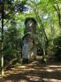
Between (5) and (6) Gallic ruins.
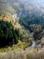
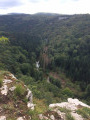
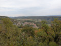
Between (7) and (8): Viewpoint over the River Lison.
Chiprey Mill.
View of the foothills of the Jura.

Reviews and comments

3.8 / 5
Based on 4 reviews

Reliability of the description
3.8 / 5
Ease of following the route
3.3 / 5
Route interest
4.3 / 5
cnu25
cnu25

Hello @Tirry............thank you very much for your comment... nature must have reclaimed its place... have a lovely day

Machine-translated

Tirry
Tirry

Overall rating : 4 / 5

Date of your route : Sep 01, 2026
Reliability of the description : ★★★★☆ Good
Ease of following the route : ★★★★☆ Good
Route interest : ★★★★☆ Good
Very busy route : No

You should avoid the stretch between points 9 and 10… It’s impassable.
We continued along the tarmac road after Saraz and, at the end, joined a dirt track on the right which took us back to the starting point. Allow an extra 2 km.

Machine-translated

Elibr
Elibr

Overall rating : 3.3 / 5

Date of your route : Sep 01, 2023
Reliability of the description : ★★★★☆ Good
Ease of following the route : ★★☆☆☆ Disappointing
Route interest : ★★★★☆ Good
Very busy route : No

I agree with Mae25, and you should avoid following the direction indicated after point 9 to get to point 10, as you risk spending a while wandering through the forest amongst the brambles because the path has disappeared. Otherwise, it’s a very pleasant walk.

Machine-translated

Mae25
Mae25

Overall rating : 3.3 / 5

Date of your route : Sep 02, 2023
Reliability of the description : ★★★☆☆ Average
Ease of following the route : ★★★☆☆ Average
Route interest : ★★★★☆ Good
Very busy route : No

4 stars for the route’s appeal: a bit too much road – though thankfully almost deserted – but long stretches through the forest, which were very pleasant in the summer heat. However, the route between points 9 and 10 needs to be revised or removed! There is quite simply no path left; we wasted three-quarters of an hour searching for it amongst the brambles, branches and fallen trees. The path, which we found thanks to the GPS, is completely destroyed, no doubt by forestry machinery: we made our way through the undergrowth, trying not to fall into holes, and were forced to go round large ruts, which were practically puddles. Suggestion: turn left at point 9, towards the ‘chemin du gravier’ shown on the IGN map; follow this path, which runs parallel to the route, and head due north to the junction via the ‘chemin de l’Escaffette’ to reach point 10 and the forest road for the return journey.

Machine-translated

cnu25
cnu25

Thank you, richardd, for your comment... Have a lovely day

Machine-translated

richardd
richardd

Overall rating : 4.3 / 5

Date of your route : Jun 05, 2022
Reliability of the description : ★★★★☆ Good
Ease of following the route : ★★★★☆ Good
Route interest : ★★★★★ Very good
Very busy route : No

a lovely walk amidst unspoilt wilderness

Machine-translated

Other walks in the area

For more walks, use our search engine .

The GPS track and description are the property of this route's author. Please do not copy them without permission.