Country:
 City:


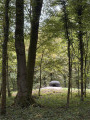
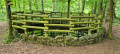
(S/E) At the start, the route passes the dome-shaped landform known as ‘Beim Galgen’. It then reaches the Kaisergarten, a planting consisting of three rows, each with three horse chestnut trees, which was laid out in 1897 to mark the 100th birthday of Emperor Wilhelm I.
In the Neunkircher Heck woodland area, there is a field of burial mounds dating from the Hallstatt period. Of the original 40 or so burial mounds, only traces remain today. Historic trenches from 1944 have further altered the landscape.
On the French border, boundary stones dating from 1830 serve as a reminder of the historic demarcation. Here, the route follows the so-called ‘smugglers’ path’, which was formerly used for the illegal exchange of goods between France and Germany. Further along the route lies a reconstructed Celtic farmstead comprising two buildings, a fence and a garden of herbs and medicinal plants.
Across open countryside, past rapeseed fields and orchard meadows, the route leads to a ‘Mardelle’ – a water-filled depression with no outlet. Its formation has not yet been conclusively explained by science. The route ends at a Celtic tree calendar, which explains the cultural and historical significance of various tree species. (S/E)
 Association / Club / Walk leader
 Moderate

 Visorando Member