


Refine your search for walks in Dranse (rivière)
Dranse (rivière) walks


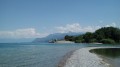
 The Dranse Delta Nature Reserve
 Visorando Member
 1.62 mi
 +30 ft
 -30 ft
 0h 45
 Easy
 Departure from Thonon-les-Bains (Haute-Savoie)
Formed by the confluence of the Dranse d'Abondance, the Dranse de Morzine and the Brevon, the Dranse flows into Lake Geneva at the border between the municipalities of Thonon-les-Bains and Publier. A nature reserve has been created around the small delta it forms, which is home to many birds and a diverse range of flora. This short walk takes you through the reserve to the mouth of the Dranse.
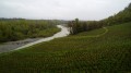
The Vineyards of Marin
 3.56 mi
+538 ft
-538 ft
2h 05
 Moderate
Departure from Haute-Savoie
The Marin vineyard is one of three vineyards on the French shore of Lake Geneva. This hike takes you through the vineyards, along the Dranse river and up to higher ground to enjoy beautiful panoramic views of Lake Geneva.
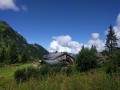
Lac de Plagnes via the Col de L'Aup Couti
 7.27 mi
+2,267 ft
-2,293 ft
5h 20
Moderate
Departure from Abondance (Haute-Savoie)
This hike will take you to the heights with belvederes and sublime views. You will encounter nature in all its diversity, with mountain pastures and the possibility of seeing a flock of sheep and their shepherd. The first part from the start to the lake remains wild, but the ascent is busier and more "touristy".
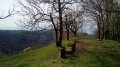
A balcony-like path above the Dranse, starting from Féternes Vieux
 2.50 mi
+436 ft
-433 ft
1h 30
Easy
Departure from Féternes (Haute-Savoie)
A short hike, mainly through woodland, offering a beautiful view of the Dranse valley and the Jura Mountains. Several other points of interest enhance the route: a chapel, an imposing lime tree, the remains of a tuff quarry, a cup-marked stone and a wayside shrine.
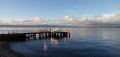
On the shores of Lake Geneva between Amphion and the Dranse Delta
 2.72 mi
+7 ft
-7 ft
1h 15
Easy
Departure from Publier (Haute-Savoie)
A short walk along the shores of Lake Geneva, with lovely views of the Swiss shore. The route passes through several public parks with beautiful, majestic trees and a small reed bed. Swimming is possible in season (July–September).
Walks near Dranse (rivière)
From Bernex to Les Chalets de Bise
8.24 mi
+4,633 ft
-2,795 ft
7h 50
 Very difficult
Departure from Bernex (Haute-Savoie)
After a climb through the forest to wake up our muscles, we leave the mountain pastures of the Bas-Chablais Pre-Alps behind us. The route runs alongside several lakes and offers panoramic views stretching from the Jura mountains to the Mont Blanc massif before plunging down below the Cornettes de Bise.
From Lugrin to Meillerie via the hamlet of Les Combes
 4.50 mi
+1,115 ft
-1,112 ft
3h 00
Moderate
Departure from Lugrin (Haute-Savoie)
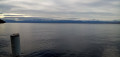
A linear hike, which requires careful planning, connecting two landing stages on Lake Geneva at a higher altitude. An often shaded route that nevertheless offers beautiful views of the lake. Oratories, chapels and churches are also along the way.
Graydon from the cable car
 Tourist office4.58 mi
+171 ft
-2,018 ft
2h 15
Moderate
Departure from Saint-Jean-d'Aulps (Haute-Savoie)
Reach the Graydon mountain pasture and its chapel by first taking the Roc d'Enfer cable car. You will then find yourself in a peaceful environment, surrounded by gentians and grazing cows, with Mont Blanc as a backdrop... The Graydon mountain pasture stretches out at the foot of the majestic Roc d'Enfer, where cows and goats graze peacefully on the lush grass around the small chapel surrounded by a magnificent valley.
From Bise to Lake Fontaine via Ubine
5.35 mi
+1,742 ft
-2,293 ft
4h 00
Moderate
Departure from La Chapelle-d'Abondance (Haute-Savoie)
If you want to discover the mountains in all their forms, both mineral and human, take this challenging route.
You are in a protected area! See the regulations in the practical information section.
From the Chalets de Bise to the Trébentaz Refuge
 8.20 mi
+3,924 ft
-2,740 ft
7h 10
 Difficult
Departure from La Chapelle-d'Abondance (Haute-Savoie)
This second stage continues the traverse of the Chablais. The route winds through the beautiful Abondance valley amidst magnificent, tranquil scenery. From the Chalet de Bise, there is a steep climb up to the Pas de la Bosse. From the pass, the path descends to the chalets of Chevenne, then follows the Sechet stream, continuing the descent along the right bank to the Chapelle d’Abondance. It runs alongside the Thoules stream and then the Dranse, which it leaves at the hamlet of Le Moulin, before climbing towards Sur Bayard to the Chalet des Crottes. From there, it is best to leave the main GR®5 route and, via a western path, follow the detour leading to the Refuge de Trébentaz, as the Refuge de la Haute Bise – shown on the IGN map – no longer offers accommodation.
From Lac des Plagnes to Lac de Tavaneuse
 5.73 mi
+2,507 ft
-2,677 ft
4h 50
Difficult
Departure from Abondance (Haute-Savoie)
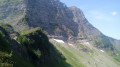
A linear hike from a lake accessible by car to a mountain lake in a wild setting, then back down into the valley. A very beautiful traverse at the foot of the impressive north faces of Pointe de la Chavache and Pointe d'Entre Deux Pertuis.
La Chapelle d'Abondance - Refuge de Chesery
13.80 mi
+3,907 ft
-745 ft
9h 45
Difficult
Departure from La Chapelle-d'Abondance (Haute-Savoie)
Itinéraire de la traversée des Alpes. De La Chapelle d’Abondance passer par le Haut Giffre pour un intermède suisse. Cette étape domine la Haute Vallée de la Dranse d'Abondance, passe par le domaine skiable des Portes du Soleil.
Vous êtes sur une zone protégée. Voir la réglementation dans les informations pratiques.
From the Trébentaz Refuge to the Golèse Refuge
 17.44 mi
+4,196 ft
-4,911 ft
11h 40
Difficult
Departure from La Chapelle-d'Abondance (Haute-Savoie)
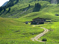
This third stage of the GTA takes you from the Chablais massif to the Giffre massif. It is very long but offers superb views of Les Dents Blanches and Les Dents du Midi in Switzerland. From the Trébentaz Refuge, the GR®5 detour crosses the Mattes ridge and rejoins the main GR®5 route. It descends towards the Pron mountain pasture, then skirts the Coincon ridge towards Lenlevay, descending into a wetland area and climbing back up to the Col de Bassachaux. It runs along the southern flank of the Crête des Rochassons and passes the Col de Chésery (1992 m) to enter Switzerland. It passes the Refuge de Chéseay, Lac Vert and climbs to Portes de l'Hiver, then descends to Chaux-Palin and continues along the hillside to La Pierre. After a short climb to the Col de Coux, it crosses back into France to cross the Torrent de Chardonnière and join the Col de Golèse and its refuge.
From Saint-Gingolph to the Chalets de Bise
 7.66 mi
+5,013 ft
-1,348 ft
7h 55
Difficult
Departure from Saint-Gingolph (Haute-Savoie)
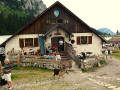
This first stage of the Grande Traversée des Alpes (GTA), from Lake Geneva to the Mediterranean, takes place in the Chablais massif. The path climbs up the Novel valley on the left bank of the Morge, below the hamlet of La Meurtaz, then follows the D30 road, which it overlooks after the hamlet of Jordy. On leaving Novel, the path winds its way above the hairpin bends of the D30 to La Planche. There, it leaves the main valley route to climb due south towards the chalets of Neuteu and on to the Col de Bise, before descending to the Chalets de Bise.
GTA, Great Alpine Crossing via the GR®5 and GR®55. From Lake Geneva to Nice.
 342.76 mi
+99,633 ft
-100,915 ft
21 days
Very difficult
Departure from Saint-Gingolph (Haute-Savoie)
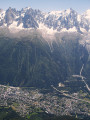
The Grande Traversée des Alpes (GTA) mainly follows the GR®5, with a few possible variations such as the crossing of the Haute Vanoise via the GR®55 and the Via Alpina, which this route takes instead of the GR®5 route via the Col de l’Iseran. It crosses the French Alps from north to south, from Saint-Gingolph to Nice. The guide includes web links to the many accommodation options along the route or nearby: mountain huts, lodges, campsites, cabins and shelters, excluding hotels. Although this guidebook details the GTA as a three-week trek, it can be adapted to suit your own pace, with stages of varying lengths, either completed in one go or in sections over several years. This journey, fuelled by the joy of freedom in unspoilt natural surroundings, will remain a superb and unforgettable experience, offering, moreover, the opportunity to meet many people with whom you can share this same passion for the mountains.