Gros Têt, Petit Têt and the lakes of the Plateau d’Emparis via the Col Saint-Georges

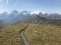
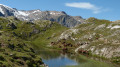
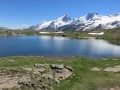
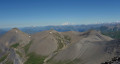
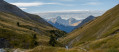
Between two well-trodden routes (Pic du Mas de la Grave and Plateau d’Emparis), the Gros Têt and Petit Têt are accessible off-trail via grassy slopes, offering a rare vantage point over the plateau and the Vallon de la Buffe, surrounded by numerous well-known peaks and glaciers, including the Glaciers de la Meije, the Pic Blanc, the Aiguilles d’Arves, the Pic des Trois Evêchés, and others.
Message from the moderators: You are in a sensitive natural area (Natura 2000) which is subject to specific regulations (see practical information).

Details

3922609
Creation:
Last update:
Last review:
  • Walking
    Activity: Walking
  • ↔
    Distance: 8.59 mi
  • ◔
    Average duration: 5h 35 
  • ▲
    Difficulty: Moderate

  • ⚐
    Back to start: Yes
  • ↗
    Ascent: + 1,890 ft
  • ↘
    Descent: - 1,886 ft

  • ▲
    Highest point: 8,570 ft
  • ▼
    Lowest point: 7,182 ft

Description of the walk

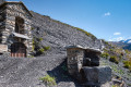
Access: once past the Chambon Dam, turn left towards Mizoën then Besse. In Besse, drive through the village and continue to the hamlet known as Le Gay. Opposite the campsite, take the track to Col Saint-Georges. Please note: this route should be avoided by vehicles with low ground clearance, as they may struggle on the bends.

(S/E) From the Col Saint-Georges car park, turn left towards the ruins of the Chalet Josserand, then continue right along the road.

(1) At the first junction, leave the track leading to the Refuge du Rif Tort on your left and continue down the track on the right. The road ends and gives way to a footpath that follows the Rif Tort and leaves it just before you reach its source.

(2) From this point, the route heads off the beaten track along the ridge overlooking the Vallon de la Buffe; you can soon make out the Chalet de la Grande Buffe below. This ridge marks the border with the Hautes-Alpes. Continue along the ridge, passing close to the source of the Rif Tort. The summit of the Gros Têt is easily reached.

(3) From there, head south down towards the Vallée de la Romanche until you reach the Petit Têt.

(4) Complete the ridge walk by heading towards the Plateau d’Emparis, whose lakes are already visible.

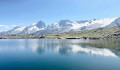
(5) Cross theGR®50-54path without following it and continue straight on towards the plateau to reach the first lake, Lac Lérié.

(6) Continue along the first lake towards the second, Lac Noir.

(7) After going round the plateau and skirting Lac Noir, head back towards the Col Saint-Georges car park, heading north-west.

(8) At the junction, you can turn left to see the first of the Cristalilns Lakes. The return route, however, heads off to the right and continues down the plateau. Once you’ve passed the rock-filled section, the path joins theGR®50-54at the fords.

(9) Follow the GR® trails to the left to reach the car park directly (S/E).

Waypoints

  1. S/E : mi 0 - alt. 7,375 ft - Col Saint-Georges (2245)
  2. 1 : mi 0.25 - alt. 7,365 ft - Junction at the Refuge du Rif Tort
  3. 2 : mi 2.17 - alt. 7,461 ft - Off-trail start
  4. 3 : mi 3.61 - alt. 8,570 ft - Le Gros Têt ou Cime du Rachas (2613m)
  5. 4 : mi 4.36 - alt. 8,310 ft - Le Petit Têt (2535m)
  6. 5 : mi 5.05 - alt. 7,733 ft - GR54 junction
  7. 6 : mi 5.91 - alt. 7,808 ft - Lac Lérié (2450m)
  8. 7 : mi 6.33 - alt. 7,995 ft - Lac Noir (2435m)
  9. 8 : mi 7 - alt. 7,743 ft - Lacs Cristallins junction
  10. 9 : mi 7.67 - alt. 7,185 ft - Junction with the °°GR®°°, on the left
  11. S/E : mi 8.59 - alt. 7,375 ft - Col Saint-Georges (2245)

Notes

To protect the local flora and fauna, swimming is prohibited, fires are prohibited, all rubbish must be collected (including biodegradable waste) and dogs must be kept on a lead.

There are no water points or designated picnic areas, not even at the start car park, but a chemical toilet has recently been installed there.

Hiking boots are strongly recommended; whilst the gradient is not very steep, the grass can be slippery.

As this route is off the beaten track, it should not be undertaken in foggy conditions.

Worth a visit

It is possible to start the return journey from the (5) via the Col du Souchet, but the plateau, just as much as the summits, really adds something special to this route.

Things to look out for along the way include marmots and edelweiss, both of which are very common.

Always be cautious and plan ahead when you're outdoors. Visorando and the author of this route cannot be held responsible for any accidents occurring on this route.

The GR® and PR® markings are the intellectual property of the Fédération Française de Randonnée Pédestre.

Reviews and comments

4.7 / 5
Based on 2 reviews

Reliability of the description
4.5 / 5
Ease of following the route
4.5 / 5
Route interest
5 / 5
Didgtt01
Didgtt01

Overall rating : 4.3 / 5

Date of your route : Aug 06, 2024
Reliability of the description : ★★★★☆ Good
Ease of following the route : ★★★★☆ Good
Route interest : ★★★★★ Very good
Very busy route : No

A lovely route to explore the plateau.
There are no particular difficulties, either in terms of the terrain or the route.

Machine-translated

renatore
renatore

Overall rating : 5 / 5

Date of your route : Jul 31, 2023
Reliability of the description : ★★★★★ Very good
Ease of following the route : ★★★★★ Very good
Route interest : ★★★★★ Very good
Very busy route : Yes

A lovely hike with spectacular scenery: La Meije and its glaciers, beautiful lakes, varied trails, and we were lucky enough to see about thirty vultures feasting on a sheep’s carcass – it was impressive. It wasn’t difficult at all; a great day out.

Machine-translated

Other walks in the area

For more walks, use our search engine .

The GPS track and description are the property of this route's author. Please do not copy them without permission.