Country:

 City:


Car park at the tourist tram station next to the Tourist Information Centre.
Collignon garage car park outside opening hours.
(S/E) From the roundabout, take the N841 towards Barvaux/Durbuy for 300 m. Take the path on the right towards “glacière, arboretum”.
(1) Ignore the path on the right crossing the River Aisne (which you’ll take on the return journey) and carry on straight ahead past the ice house. Join a tarmac road and follow it to the right for 50 m, then turn right again onto Rue du Val d’Aisne, following the Red Diamond markings (which you’ll follow all the way to the Eveux bridge).
(2) Cross the River Aisne and pass the Moulin de Fisenne, then carry on until you reach a fork in the road.
(3) Leave the tarmac road after house number 3, take thefirst path on the right and head into the woods. Ignore the next two paths on the right and continue north-east until you reach a T-junction.
(4) Turn right up a short hill, then left, still following the Red Diamond markings, and cross the Bois de Nallogne. Descend gently to the bridge over the Aisne.
(5) Just before the bridge, leave the Red Diamond markings, which head up to the right, and cross the River Aisne and then the N876 with care. Head up the road opposite, between the houses, along Rue des Jardins, which leads into the woods.
(6) Follow theGR® along a south-westerly stony path, then turn north-west.
(7) Turn right and continue along theGR® to the Brocard refuge, situated on a ridge (car park).
(8) Take the second path on the right. Ignore a path on the right and carry on to the next junction.
(9) Take the next right to join a stony track and follow it to the right for a good hundred metres.
(10) Turn slightly right ahead of you through the conifers. At the next junction, carry on straight ahead along a narrow, sunken path that descends through coppiced woodland to join a small tarmac road.
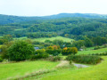
(11) Take this road on the right to head down to the next village. Make the most of the descent to admire the magnificent views. At the entrance to the village, continue down the road to join the N876.
(12) Turn left onto it and cross the bridge over the Aisne.
(13) Turn right onto Rue du Stockay to cross the bridge over the Estinale.
(14) At the chapel, take the small road that climbs to the right and continues as a track past a farm.
(15) After this, ignore the path leading off to the left into the meadows. Remember to look back from time to time to enjoy the views. Carry on to the village of Oster.
(16) Follow the road to the right for about a hundred metres.
(17) Take the path on the right between two hedges, then at the top, turn left to rejoin the Red Diamond markings, which you should follow. Then turn right onto the stony path that descends towards the woodland through the pine trees.
(18) Ignore the path leading straight down and turn left. Ignore the path leading uphill to the left.
(19) At the next junction, leave the Red Diamond markings and continue straight ahead. Walk alongside a small meadow on your right and ignore the path going uphill to the left.
(20) At the Y-junction, turn left, then ignore the path leading down to the right and continue on more or less level ground before descending slightly towards the River Aisne, which you will cross via a concrete footbridge. Continue straight ahead across the meadow alongside a ditch, which you will need to cross to rejoin the road you took at the start.
(1) Turn left to reach the tourist tram station (S/E).

 Visorando Member
 Difficult

 Easy