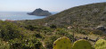
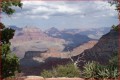
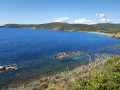
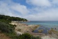
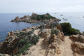
Dolmen de Briande and Cap Taillat from Escalet

This walk between Escalet and Cap Taillat is a classic in the Ramatuelle area. We did it again to see Cap Taillat five years after the terrible fire that devastated it in July 2017.

Details

20594748
Creation:
Last update:
Last review:
  • Walking
    Activity: Walking
  • ↔
    Distance: 4.91 mi
  • ◔
    Average duration: 2h 35 
  • ▲
    Difficulty: Moderate

  • ⚐
    Back to start: Yes
  • ↗
    Ascent: + 361 ft
  • ↘
    Descent: - 371 ft

  • ▲
    Highest point: 190 ft
  • ▼
    Lowest point: 3 ft

Photos

Description of the walk

From the D93, which runs from Saint-Tropez to La Croix-Valmer via the Col de Collebasse, at Ramatuelle, take the "L'Escalet" sign and follow the small road straight ahead to the village. The large car park was under construction when we visited, but there are plenty of parking options along Boulevard de la Praya and Avenue Cartaya. We parked on the beach side of this avenue.

(S/E) Head south along the avenue to the barrier after the small car park at Pointe du Canadel. Go through the barrier and look for the sign indicating the entrance to the coastal path.

(1) Enter the path by crossing the reeds.
On the left, it heads back to Escalet via the Pointe du Canadel coastline and on the right, it heads towards Cap Taillat.
Turn right, cross two footbridges between the rocks and you will come to a sign offering a choice between the coastal path, which is not recommended in rough weather, and the higher path.

(2) Take the higher path on the right, returning via the coastal path. Follow it until you reach Chemin de la Douane, overlooking the long customs house.

(3) Turn right onto Chemin de la Douane and climb up to the pass, where you will find the remains of the Briande dolmen on your right.

(4) After descending from the dolmen site, cross the track and take the path that follows it below and descends parallel to it, passing in front of the customs officers' house and joining the path that follows the beach.

(5) Take this path on the right and follow the beach, which is covered with posidonia seagrass and driftwood.

(6) Cross the start of the isthmus and continue to the right, crossing a rocky threshold towards the pretty Briande beach.

(7) After enjoying the charm of this beach (ideal for a picnic), return to the isthmus.

(6) Walk along the isthmus towards the Cap Taillat peninsula and find a hillside path on the right that gradually climbs to the top.

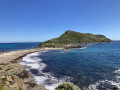
(8) From the summit, where there is a small building bearing the inscription "Guérite napoléonienne" (Napoleonic sentry box), you can enjoy a superb view of the entire coast between Cap Lardier and Cap Camarat. Retrace your steps back to the customs house.

(5) Take the coastal path that runs along the shore, mostly crossing the rocks. This path is very picturesque, but it is not recommended in rough seas combined with strong winds, as you are often exposed to sea spray and even splashes.

(2) Join the short shared section that crosses the two footbridges.

(1) Take the right-hand branch of the coastal path that leads over the rocks at Pointe du Canadel. This section is more technical and even more challenging, but most hikers can manage it with extra care. Follow it towards the small harbour.

(9) Just before you reach it, turn left to join Boulevard de la Praya and its car park.
Turn left, continue along Avenue Carraya and return to the car park (S/E).


Waypoints

  1. S/E : mi 0 - alt. 85 ft - Parking on Avenue de Carraya
  2. 1 : mi 0.21 - alt. 23 ft - Entrance to the coastal path
  3. 2 : mi 0.24 - alt. 26 ft - Fork in the coastal path and the higher path
  4. 3 : mi 0.71 - alt. 62 ft - Access to the Chemin de la Douane
  5. 4 : mi 1.01 - alt. 171 ft - Dolmen de la Briande
  6. 5 : mi 1.37 - alt. 20 ft - Start of the coastal path
  7. 6 : mi 1.55 - alt. 13 ft - Isthmus
  8. 7 : mi 1.9 - alt. 7 ft - Briande Beach
  9. 8 : mi 2.69 - alt. 187 ft - Summit of Cap Taillat
  10. 9 : mi 4.55 - alt. 13 ft - Small harbour
  11. S/E : mi 4.91 - alt. 85 ft - Parking on Avenue de Carraya

Notes

Walk completed in March 2022.

Please note that on the descent to the village by car, the road has many bends and the right-hand side of the road is particularly dangerous: to avoid falling into the ditch, plan to stop before passing another vehicle.

The walk is not difficult on the way there and on Cap Taillat itself. The return journey, closer to the sea, is more technical, especially on the section from Pointe du Canadel (between point (2) and Escalet beach).

Worth a visit

Cap Taillat and its surroundings were ravaged in July 2017 by a terrible fire, which completely changed the appearance of the area, once heavily wooded, with a beautiful pine forest on the cape. Five years on, nature has reclaimed its rights, but the place still retains a desolate character, reminding us, if necessary, that the Mediterranean environment is fragile and precious.

The long building at the bottom of the Briande valley is the "Maison des Douanes" (Customs House), built under Napoleon I to house the families of customs officers responsible for combating smuggling. When we visited in 2009, the building was in ruins. It has been restored by the Conservatoire du Littoral and is currently used for numerous cultural and/or environmental activities.

All that remains of the Briande dolmen are two standing granite slabs. It is the southernmost megalith in the department.

Reviews and comments

4.6 / 5
Based on 8 reviews

Reliability of the description
4.5 / 5
Ease of following the route
4.4 / 5
Route interest
4.9 / 5
emma41
emma41

Overall rating : 4.3 / 5

Date of your route : Mar 30, 2026
Reliability of the description : ★★★★☆ Good
Ease of following the route : ★★★★☆ Good
Route interest : ★★★★★ Very good
Very busy route : No

A lovely walk in the sunshine with a stunning view from Cap Taillat.
There is no longer a visible path in front of the dolmen.
We took the same route back.
Similarly, we did not take the coastal path.
Thanks to the author for posting this.

Machine-translated

bbanoun
bbanoun
• Edited:

Overall rating : 4.5 / 5

Date of your route : Mar 16, 2026
Reliability of the description : ★★★★☆ Good
Ease of following the route : Not used / Not applicable
Route interest : ★★★★★ Very good
Very busy route : No

On 12 March 2026, the upper section of the path is closed due to a landslide, so you must take the coastal path below. |

Machine-translated

Pesent1
Pesent1

Overall rating : 4.3 / 5

Date of your route : Dec 15, 2024
Reliability of the description : ★★★★☆ Good
Ease of following the route : ★★★★☆ Good
Route interest : ★★★★★ Very good
Very busy route : No

A beautiful hike along a magnificent coastline.
There is not much left of the dolmen, but the detour is not very long. However, the path that descends to the customs office between points 4 and 5 has almost disappeared, so it is better to return in the opposite direction.
The coastal path on the way back is also not easy to find or follow. It is, of course, possible to return via the same path you took on the way there, which is very pleasant, especially as the views appear from a different angle.

Machine-translated

Lartoche68
Lartoche68

Overall rating : 5 / 5

Date of your route : Mar 04, 2024
Reliability of the description : ★★★★★ Very good
Ease of following the route : ★★★★★ Very good
Route interest : ★★★★★ Very good
Very busy route : Yes

There weren't many people on the way there on 4 March, but there were plenty of lovers of beautiful scenery on the way back, whether on the coastal path or the high-altitude trail.
The hike is definitely worth the detour, the scenery is superb, it's a feast for the eyes!
Be sure to wear good shoes, as you'll be walking on rocks for much of the way.
Be careful, as some sections are slippery due to sea spray and waves.
Suitable for families, I have fond memories and beautiful images of this trip.

Machine-translated

phidet
phidet

Overall rating : 5 / 5

Date of your route : Jan 15, 2023
Reliability of the description : ★★★★★ Very good
Ease of following the route : ★★★★★ Very good
Route interest : ★★★★★ Very good
Very busy route : Yes

A beautiful succession of viewpoints. The detour via the dolmen is interesting.
The short climb up to Cap Taillat is the highlight of the hike.

Machine-translated

stjo
stjo
• Edited:

@Elodie-C I agree with you about the lack of picturesque charm of the Briande dolmen. If you would like to see a much better preserved one, I recommend taking a walk to the Gaoutabry dolmen, just north of La Londe-les-Maures.

Machine-translated

Elodie-C
Elodie-C

Overall rating : 4.7 / 5

Date of your route : Oct 25, 2022
Reliability of the description : ★★★★★ Very good
Ease of following the route : ★★★★☆ Good
Route interest : ★★★★★ Very good
Very busy route : No

A very beautiful walk along the coast, where you can admire the beautiful colours of the sea in this area and the small coves. We did it with our daughters, aged 7 and 11.
Unless you're passionate about archaeology, the dolmen isn't really worth the detour, as all you can see are two medium-sized stones stuck in the ground...
Be careful, the coastal path gets a little lost between points 5 and 2 when returning from 5. There has been a fire in the area...
In summer, remember to bring water and a hat!

Machine-translated

sst
sst

Overall rating : 4 / 5

Date of your route : May 25, 2022
Reliability of the description : ★★★★☆ Good
Ease of following the route : ★★★★☆ Good
Route interest : ★★★★☆ Good
Very busy route : No

At this time of year, the route is relatively wild. Very few people. Some trails are closed due to landslides, but the hike can be done without any problems.
Bring something to drink, wear sturdy shoes and a hat or cap.

Machine-translated

jk0683
jk0683

Overall rating : 5 / 5

Date of your route : Apr 16, 2022
Reliability of the description : ★★★★★ Very good
Ease of following the route : ★★★★★ Very good
Route interest : ★★★★★ Very good
Very busy route : Yes

A lovely, enjoyable walk with beautiful scenery. Not recommended in hot weather as there is no shade.

Machine-translated

Other walks in the area

For more walks, use our search engine .

The GPS track and description are the property of this route's author. Please do not copy them without permission.