


Refine your search for walks in Pas de la Bosse
Pas de la Bosse walks


 Cornettes de Bise from Bise
 Visorando Member

 6.40 mi
 +3,888 ft
 -3,862 ft
 6 hrs
 Very difficult
 Departure from La Chapelle-d'Abondance (Haute-Savoie)
One of the most beautiful hikes in the Chablais! A long and demanding route, where you walk in sumptuous surroundings. From the summit, the highest in the region along with the neighbouring Mont de Grange (2,432 m), there is a superb panorama of Lake Geneva, the Chablais peaks, the Swiss Alps and the Mont Blanc massif.
N.B. Route within a protected natural area: see recommendations in the practical information section.
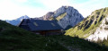
Chalets de Mens and Pointe de la Bosse tower
 4.10 mi
+2,113 ft
-2,113 ft
3h 45
 Moderate
Departure from La Chapelle-d'Abondance (Haute-Savoie)
A loop in a beautiful alpine setting at the foot of two majestic peaks, Mont Chauffé on the way up and the Cornettes de Bise on the way down.
N.B. Route within a protected natural area: see recommendations in the practical information.
From Bise to Lake Fontaine via Ubine
5.35 mi
+1,742 ft
-2,293 ft
4h 00
Moderate
Departure from La Chapelle-d'Abondance (Haute-Savoie)
If you want to discover the mountains in all their forms, both mineral and human, take this challenging route.
You are in a protected area! See the regulations in the practical information section.
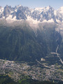
GTA, Great Alpine Crossing via the GR®5 and GR®55. From Lake Geneva to Nice.
 342.76 mi
+99,633 ft
-100,915 ft
21 days
Very difficult
Departure from Saint-Gingolph (Haute-Savoie)
The Grande Traversée des Alpes (GTA) mainly follows the GR®5, with a few possible variations such as the crossing of the Haute Vanoise via the GR®55 and the Via Alpina, which this route takes instead of the GR®5 route via the Col de l’Iseran. It crosses the French Alps from north to south, from Saint-Gingolph to Nice. The guide includes web links to the many accommodation options along the route or nearby: mountain huts, lodges, campsites, cabins and shelters, excluding hotels. Although this guidebook details the GTA as a three-week trek, it can be adapted to suit your own pace, with stages of varying lengths, either completed in one go or in sections over several years. This journey, fuelled by the joy of freedom in unspoilt natural surroundings, will remain a superb and unforgettable experience, offering, moreover, the opportunity to meet many people with whom you can share this same passion for the mountains.
From the Chalets de Bise to the Trébentaz Refuge
 8.20 mi
+3,924 ft
-2,740 ft
7h 10
 Difficult
Departure from La Chapelle-d'Abondance (Haute-Savoie)
This second stage continues the traverse of the Chablais. The route winds through the beautiful Abondance valley amidst magnificent, tranquil scenery. From the Chalet de Bise, there is a steep climb up to the Pas de la Bosse. From the pass, the path descends to the chalets of Chevenne, then follows the Sechet stream, continuing the descent along the right bank to the Chapelle d’Abondance. It runs alongside the Thoules stream and then the Dranse, which it leaves at the hamlet of Le Moulin, before climbing towards Sur Bayard to the Chalet des Crottes. From there, it is best to leave the main GR®5 route and, via a western path, follow the detour leading to the Refuge de Trébentaz, as the Refuge de la Haute Bise – shown on the IGN map – no longer offers accommodation.
A circular route from the Abondance Valley to the Dent d’Oche
18.48 mi
+8,638 ft
-8,622 ft
2 days
Very difficult
Departure from Abondance (Haute-Savoie)
A two-day trek with two long stages and significant elevation gain. The route starts at the foot of the impressive Mont Chauffé, passes by the Chalets de Bise and Lac de Darbon before ascending the Dent d’Oche, which offers a superb panoramic view of Lake Geneva. The return route takes you via Lac de la Cse d’Oche, Lac Fontaine and the Chalets d’Ubine. In summer, you’ll come across Abondance cows, goats and ibex.
You are in a protected area! Please see the regulations in the practical information section.
Saint Gingolph - La Chapelle d'Abondance
10.74 mi
+6,010 ft
-3,934 ft
10h 10
Difficult
Departure from Saint-Gingolph (Haute-Savoie)
Itinéraire de la traversée des Alpes. Etape des rives du lac Léman au Val d'Abondance. Franchir les montagnes du Chablais par une longue grimpette de 1850m en traversant les alpages pour passer le Col de Bise puis redescendre à la station de ski de la Chapelle d'Abondance. Cet itinéraire offre de très beaux panoramas sur le plus grand lac d'Europe et sur le sommet des Cornettes de Bise.