Country:

 City:


Start on the Wimereux sea wall.
(S) Facing the sea, head right along the sea wall. At the end of the sea wall, cross the small bridge.
(1) At the end of the promenade, do not head towards the stony path leading to the seafront but go up the stairs. Continue to Rue de la Rochette, then turn left onto Rue Édouard Zier. Take the first left onto Rue de l’Avancée. At the next junction, turn left onto Rue Duguay Trouin.
(2) At the right-hand corner, take theGR® 120 footpath on the left, which heads towards the football pitch and goes round it.
(3) As you leave the football pitch, carry on straight ahead, ignoring the successive paths on your right. Follow the coastline to Pointe aux Oies.
(4) At Pointe aux Oies, carry on straight ahead. The path runs between the coast and the D940 departmental road.
You’ll come to a small road and its car park. Head towards the D940.
(5) Cross the road towards the Dunes de la Slack. Follow the only path through the dunes.
(6) Join the departmental road at the River La Slack at the entrance to Ambleteuse, go under the road and turn left. Leave the main road immediately by taking thefirst right. Turn right again towards a small bridge spanning the river.
(7) At the junction, turn left onto Rue de l’Écluse. Ignore the dead-end road on the right and continue along Rue de l’Écluse. At the next ‘Y’-shaped junction, turn left, staying on Rue de l’Écluse until you come to the start of a path on the left.
(8) Take the small path on the left at a right angle, then take thefirst right onto Rue du Laboratoire. Continue to the junction with Rue du Fort. Turn left and walk all the way up the street to the embankment.
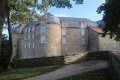
(9) You’ll arrive at Fort d’Ambleteuse, then walk the entire length of the Ambleteuse sea wall.
(10) At the end of the sea wall, walk along the beach to Audresselles.
(11) At high tide, leave the beach and head back up Rue de la Mer, then turn left onto Rue Édouard Quenu. Take Rue des Hauts Claives, then turn right onto Rue du Nid de Corbet, then left onto Rue des Goélands, which leads to the D940, Rue Pierre De Wissant.
(12) At the departmental road, turn left and follow it along.
(13) Take thesecond left onto theGR®120path towards Pointe du Nid de Corbet. Continue straight on until you reach the hamlet of Cran Mademoiselle.
(14) Stay on the path branching off to the right and follow the coastline. Carry on straight ahead to Cran Poulet.
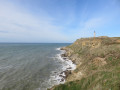
(15) Cross the small road and carry on straight ahead. The path veers to the right before curving slightly to the left. Follow this winding path to Cran aux Œufs. Continuing along the coast, pass Pointe du Riden, Cran Barbier, Cran des Silliers and Cran de Quette, before reaching the Cap Gris Nez viewpoint.
(16) At the Route du Belvédère, turn right.
(17) Cross the Route du Cap, which leads to the observatory (on your left), and take the path directly ahead.
(18) Turn left to access the various viewing points on a round trip.
(18) On your return, continue to the left and join Rue du Fort. Turn right onto this road.
(19) Turn left immediately onto Chemin des Douaniers. Continue to Rue de la Plage.
(20) Head down Rue de la Plage to the left towards the seafront for a viewpoint (restaurant). Retrace your steps.
(20) Turn left and rejoin theGR®120, staying on the main path. Ignore the path on the left leading to the beach and continue straight on towards the hamlet of La Baraque Fricot. A little further on, ignore the path on the left leading to the beach once again, turn right and head for the car park area.
(21) Turn right, again ignoring the path on the left towards the beach, then take thefirst left between the houses and the car park. Follow the track (Route du Châtelet) to the Dunes du Châtelet.
(22) At the end of the track, take the footpath straight ahead. A little further on, theGR®120veers left towards the beach. Then leave the beach via the footpath and head for the roundabout on Rue des Oyats.
(23) Stay on the path which leads to the sea wall at Rue des Mouettes. Walk the entire length of the seafront. Pass by a restaurant.
(24) Head to the end of Rue Arlette Davids, which leads to Wissant beach. Continue along the beach until you reach the hamlet of Strouanne and the junction with the street of the same name. Carry on straight ahead.
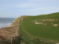
(25) Turn slightly right onto the path that overlooks the cliffs and leads to Le Cran d’Escalles.
(26) At Cran d’Escalles, the path crosses Rue de la Mer and continues opposite.
(27) Climb Cap Blanc Nez to reach the car park entrance.
(E) Turn sharply left to reach the viewpoint.
(28) Return along the same route to the car park (E).


 Visorando Member
 Easy
 Moderate
 Tourist office